Rumley Topo Map Texas
To zoom in, hover over the map of Rumley
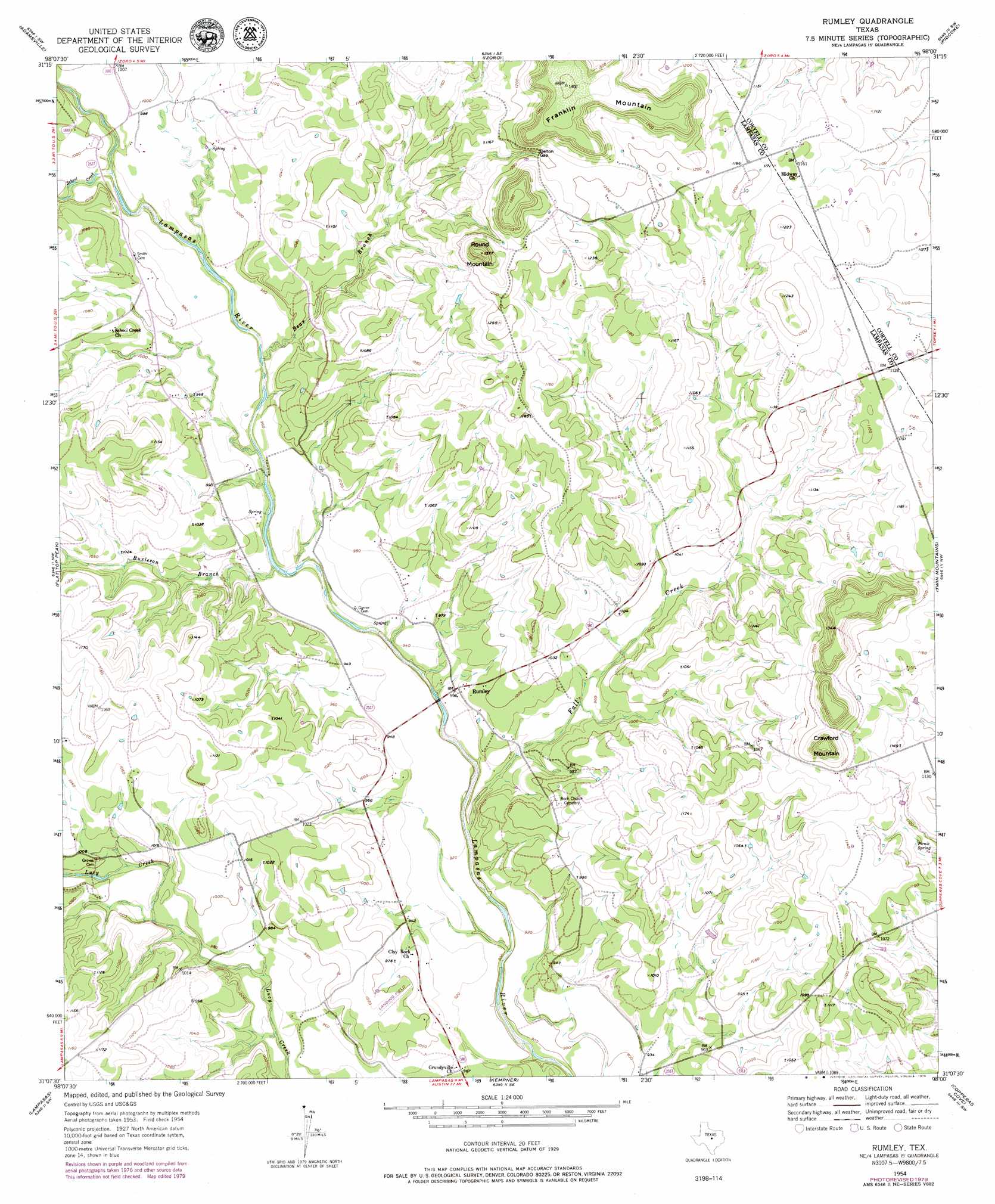
USGS Topo Quad 31098b1 - 1:24,000 scale
| Topo Map Name: | Rumley |
| USGS Topo Quad ID: | 31098b1 |
| Print Size: | ca. 21 1/4" wide x 27" high |
| Southeast Coordinates: | 31.125° N latitude / 98° W longitude |
| Map Center Coordinates: | 31.1875° N latitude / 98.0625° W longitude |
| U.S. State: | TX |
| Filename: | o31098b1.jpg |
| Download Map JPG Image: | Rumley topo map 1:24,000 scale |
| Map Type: | Topographic |
| Topo Series: | 7.5´ |
| Map Scale: | 1:24,000 |
| Source of Map Images: | United States Geological Survey (USGS) |
| Alternate Map Versions: |
Rumley TX 1954, updated 1957 Download PDF Buy paper map Rumley TX 1954, updated 1976 Download PDF Buy paper map Rumley TX 2010 Download PDF Buy paper map Rumley TX 2012 Download PDF Buy paper map Rumley TX 2016 Download PDF Buy paper map |
1:24,000 Topo Quads surrounding Rumley
Star |
Evant |
Pearl |
Purmela |
Gatesville West |
Castle Peak |
Adamsville |
Izoro |
Pidcoke |
Shell Mountains |
Ogles |
Flat Top Peak |
Rumley |
Twin Mountains |
Fort Hood |
Nix |
Lampasas |
Kempner |
Copperas Cove |
Mcmillan Mountains |
Naruna |
Lake Victor |
Bachelor Peak |
Briggs |
Ding Dong |
> Back to 31098a1 at 1:100,000 scale
> Back to 31098a1 at 1:250,000 scale
> Back to U.S. Topo Maps home
Rumley topo map: Gazetteer
Rumley: Airports
Marshall Ranch Airport elevation 286m 938′Rumley: Gaps
Belton Gap elevation 365m 1197′Rumley: Populated Places
Rumley elevation 293m 961′Rumley: Springs
Picnic Spring elevation 323m 1059′Rumley: Streams
Bear Branch elevation 293m 961′Burleson Branch elevation 282m 925′
Fall Creek elevation 276m 905′
School Creek elevation 292m 958′
Rumley: Summits
Crawford Mountain elevation 416m 1364′Franklin Mountain elevation 427m 1400′
Round Mountain elevation 404m 1325′
Rumley digital topo map on disk
Buy this Rumley topo map showing relief, roads, GPS coordinates and other geographical features, as a high-resolution digital map file on DVD: