Cinder Hill Topo Map Arizona
To zoom in, hover over the map of Cinder Hill
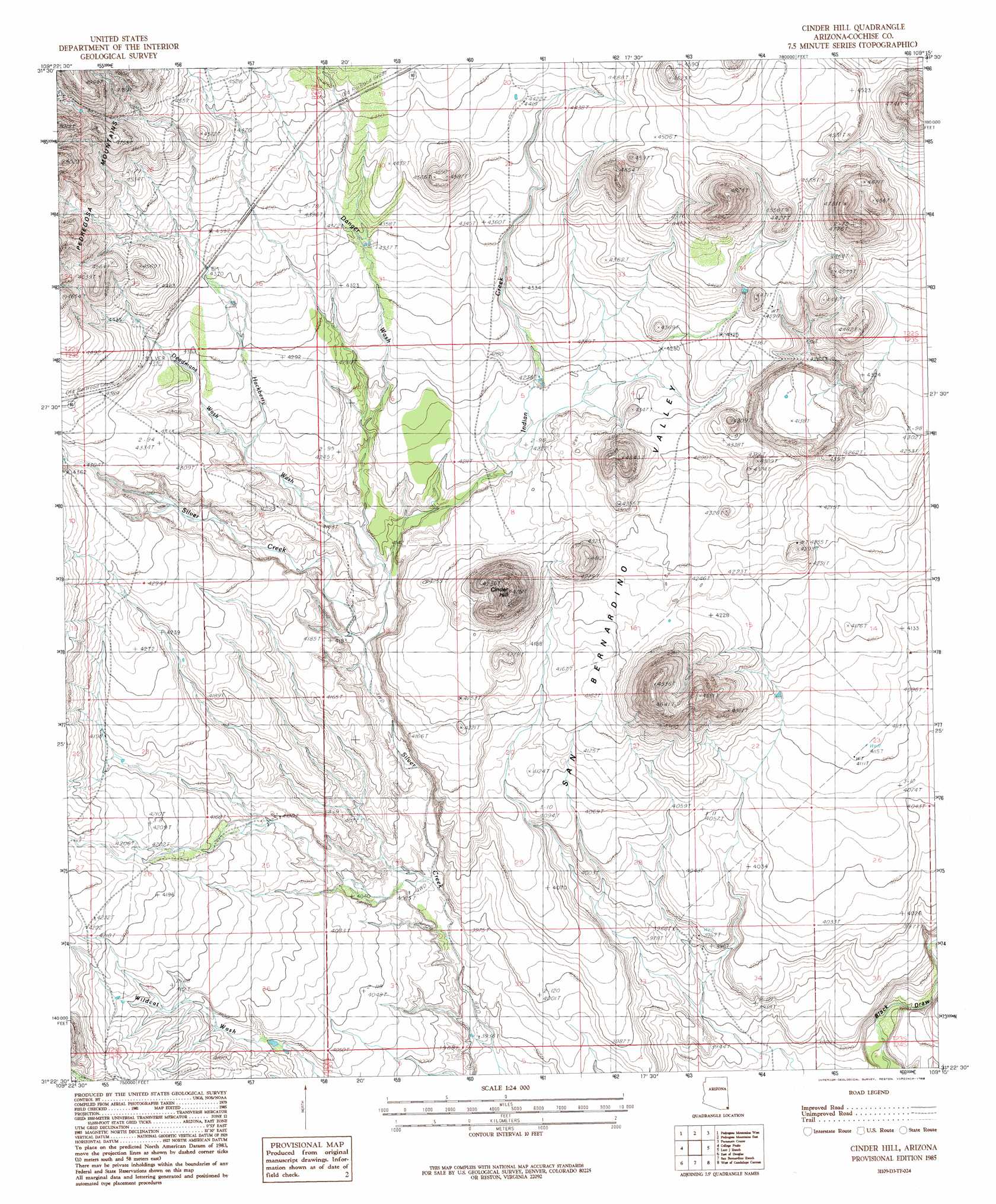
USGS Topo Quad 31109d3 - 1:24,000 scale
| Topo Map Name: | Cinder Hill |
| USGS Topo Quad ID: | 31109d3 |
| Print Size: | ca. 21 1/4" wide x 27" high |
| Southeast Coordinates: | 31.375° N latitude / 109.25° W longitude |
| Map Center Coordinates: | 31.4375° N latitude / 109.3125° W longitude |
| U.S. State: | AZ |
| Filename: | o31109d3.jpg |
| Download Map JPG Image: | Cinder Hill topo map 1:24,000 scale |
| Map Type: | Topographic |
| Topo Series: | 7.5´ |
| Map Scale: | 1:24,000 |
| Source of Map Images: | United States Geological Survey (USGS) |
| Alternate Map Versions: |
Cinder Hill AZ 1985, updated 1986 Download PDF Buy paper map Cinder Hill AZ 1996, updated 2003 Download PDF Buy paper map Cinder Hill AZ 2011 Download PDF Buy paper map Cinder Hill AZ 2014 Download PDF Buy paper map |
1:24,000 Topo Quads surrounding Cinder Hill
Swisshelm Mountain |
Bruno Peak |
Swede Peak |
Apache |
Skull Canyon |
Leslie Canyon |
Pedregosa Mountains West |
Pedregosa Mountains East |
Paramore Crater |
Skeleton Canyon |
Douglas Ne |
College Peaks |
Cinder Hill |
Lazy J Ranch |
Guadalupe Spring |
Douglas |
East Of Douglas |
San Bernardino Ranch |
West Of Guadalupe Canyon |
Guadalupe Canyon |
> Back to 31109a1 at 1:100,000 scale
> Back to 31108a1 at 1:250,000 scale
> Back to U.S. Topo Maps home
Cinder Hill topo map: Gazetteer
Cinder Hill: Reservoirs
Main Tank elevation 1293m 4242′Moore Tank elevation 1350m 4429′
Mormon Tank elevation 1339m 4393′
Silo Tank elevation 0m 0′
Teaque Tank elevation 1284m 4212′
Wells Tank elevation 1327m 4353′
Cinder Hill: Streams
Danger Wash elevation 1257m 4124′Deadmans Wash elevation 1288m 4225′
Hackberry Wash elevation 1256m 4120′
Indian Creek elevation 1247m 4091′
Cinder Hill: Summits
Cinder Hill elevation 1447m 4747′Cinder Hill digital topo map on disk
Buy this Cinder Hill topo map showing relief, roads, GPS coordinates and other geographical features, as a high-resolution digital map file on DVD: