Lewis Springs Topo Map Arizona
To zoom in, hover over the map of Lewis Springs
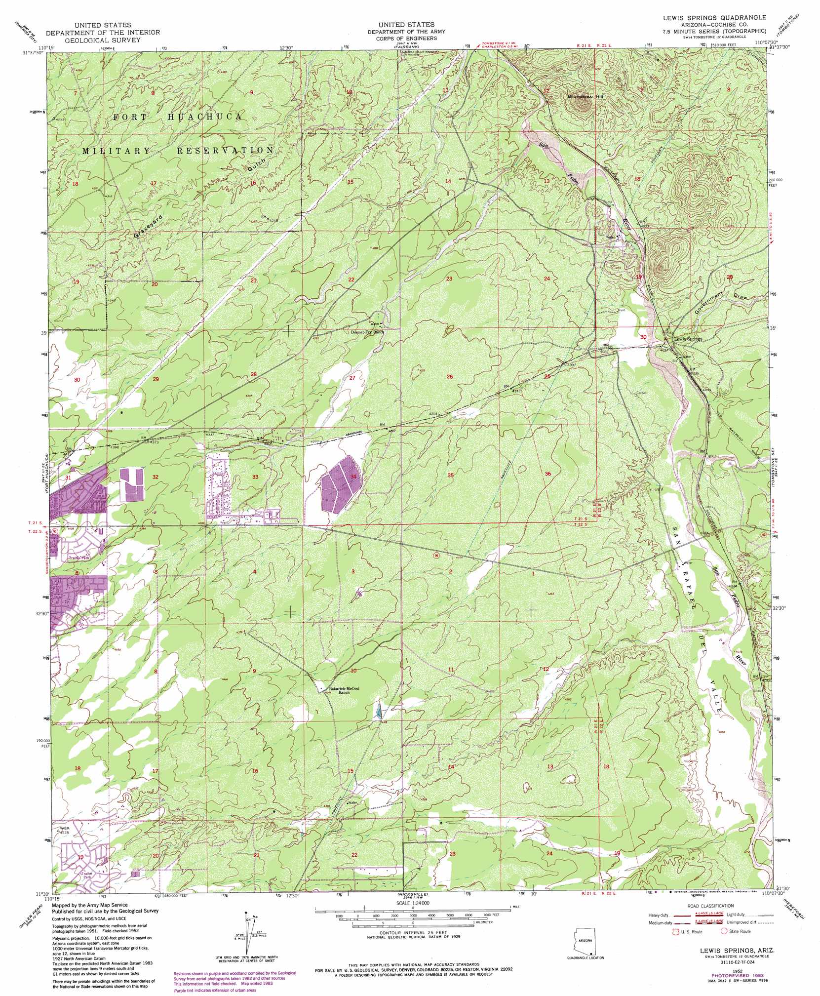
USGS Topo Quad 31110e2 - 1:24,000 scale
| Topo Map Name: | Lewis Springs |
| USGS Topo Quad ID: | 31110e2 |
| Print Size: | ca. 21 1/4" wide x 27" high |
| Southeast Coordinates: | 31.5° N latitude / 110.125° W longitude |
| Map Center Coordinates: | 31.5625° N latitude / 110.1875° W longitude |
| U.S. State: | AZ |
| Filename: | o31110e2.jpg |
| Download Map JPG Image: | Lewis Springs topo map 1:24,000 scale |
| Map Type: | Topographic |
| Topo Series: | 7.5´ |
| Map Scale: | 1:24,000 |
| Source of Map Images: | United States Geological Survey (USGS) |
| Alternate Map Versions: |
Lewis Springs AZ 1952, updated 1955 Download PDF Buy paper map Lewis Springs AZ 1952, updated 1966 Download PDF Buy paper map Lewis Springs AZ 1952, updated 1978 Download PDF Buy paper map Lewis Springs AZ 1952, updated 1984 Download PDF Buy paper map Lewis Springs AZ 1996, updated 2002 Download PDF Buy paper map Lewis Springs AZ 2011 Download PDF Buy paper map Lewis Springs AZ 2014 Download PDF Buy paper map |
1:24,000 Topo Quads surrounding Lewis Springs
Apache Peak |
Mcgrew Spring |
Land |
Haberstock Hill |
Black Diamond Peak |
Mustang Mountains |
Huachuca City |
Fairbank |
Tombstone |
Hay Mountain |
Pyeatt Ranch |
Fort Huachuca |
Lewis Springs |
Tombstone Se |
Potter Mountain |
Huachuca Peak |
Miller Peak |
Nicksville |
Hereford |
Bisbee |
Campini Mesa |
Montezuma Pass |
Bob Thompson Peak |
Stark |
Naco |
> Back to 31110e1 at 1:100,000 scale
> Back to 31110a1 at 1:250,000 scale
> Back to U.S. Topo Maps home
Lewis Springs topo map: Gazetteer
Lewis Springs: Parks
San Pedro Riparian National Conservation Area elevation 1251m 4104′Lewis Springs: Populated Places
Lewis Springs elevation 1234m 4048′Lewis Springs: Summits
Brunckow Hill elevation 1359m 4458′Lewis Springs: Valleys
Government Draw elevation 1227m 4025′Lewis Springs digital topo map on disk
Buy this Lewis Springs topo map showing relief, roads, GPS coordinates and other geographical features, as a high-resolution digital map file on DVD: