West Of Lukeville Topo Map Arizona
To zoom in, hover over the map of West Of Lukeville
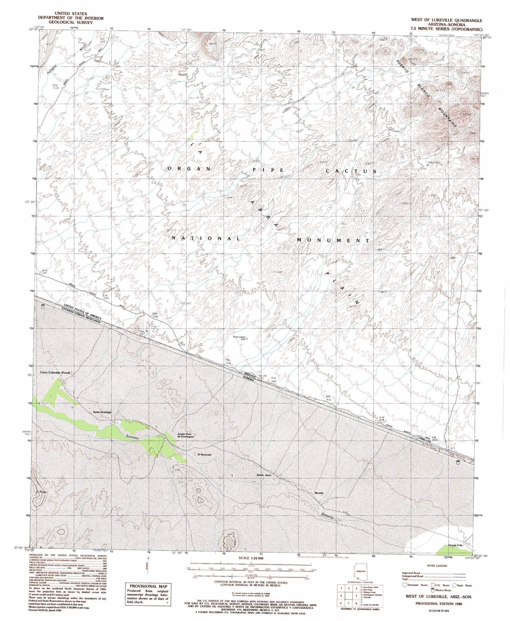
USGS Topo Quad 31112h8 - 1:24,000 scale
| Topo Map Name: | West Of Lukeville |
| USGS Topo Quad ID: | 31112h8 |
| Print Size: | ca. 21 1/4" wide x 27" high |
| Southeast Coordinates: | 31.875° N latitude / 112.875° W longitude |
| Map Center Coordinates: | 31.9375° N latitude / 112.9375° W longitude |
| U.S. State: | AZ |
| Filename: | o31112h8.jpg |
| Download Map JPG Image: | West Of Lukeville topo map 1:24,000 scale |
| Map Type: | Topographic |
| Topo Series: | 7.5´ |
| Map Scale: | 1:24,000 |
| Source of Map Images: | United States Geological Survey (USGS) |
| Alternate Map Versions: |
West of Lukeville AZ 1988, updated 1988 Download PDF Buy paper map West of Lukeville AZ 1996, updated 2000 Download PDF Buy paper map West of Lukeville AZ 2011 Download PDF Buy paper map West of Lukeville AZ 2014 Download PDF Buy paper map |
1:24,000 Topo Quads surrounding West Of Lukeville
North Of Agua Dulce Mountains |
Palo Verde Camp |
Bates Well |
Armenta Well |
Gunsight |
Agua Dulce Mountains |
Pozo Nuevo Well |
Kino Peak |
Tillotson Peak |
Mount Ajo |
West Of Quitobaquito Springs |
Quitobaquito Springs |
West Of Lukeville |
Lukeville |
Diaz Peak |
South Of Lukeville |
Blankenship Well |
|||
> Back to 31112e1 at 1:100,000 scale
> Back to 31112a1 at 1:250,000 scale
> Back to U.S. Topo Maps home
West Of Lukeville topo map: Gazetteer
West Of Lukeville: Mines
Milton Mine elevation 494m 1620′West Of Lukeville: Plains
La Abra Plain elevation 421m 1381′West Of Lukeville: Wells
Pozo Salado Well elevation 382m 1253′West Of Lukeville digital topo map on disk
Buy this West Of Lukeville topo map showing relief, roads, GPS coordinates and other geographical features, as a high-resolution digital map file on DVD: