Cienega School Topo Map New Mexico
To zoom in, hover over the map of Cienega School
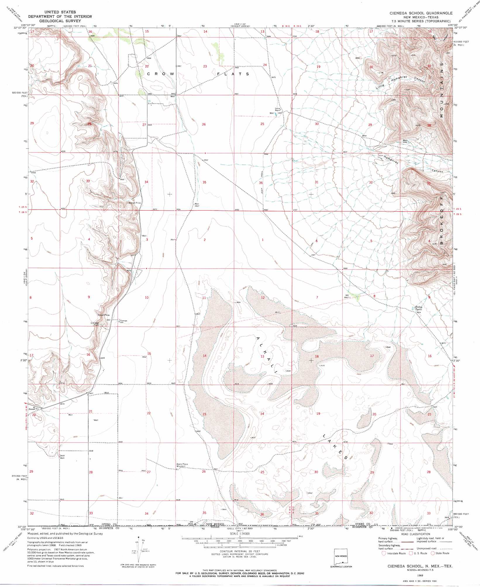
USGS Topo Quad 32105a1 - 1:24,000 scale
| Topo Map Name: | Cienega School |
| USGS Topo Quad ID: | 32105a1 |
| Print Size: | ca. 21 1/4" wide x 27" high |
| Southeast Coordinates: | 32° N latitude / 105° W longitude |
| Map Center Coordinates: | 32.0625° N latitude / 105.0625° W longitude |
| U.S. States: | NM, TX |
| Filename: | o32105a1.jpg |
| Download Map JPG Image: | Cienega School topo map 1:24,000 scale |
| Map Type: | Topographic |
| Topo Series: | 7.5´ |
| Map Scale: | 1:24,000 |
| Source of Map Images: | United States Geological Survey (USGS) |
| Alternate Map Versions: |
Cienega School NM 1969, updated 1973 Download PDF Buy paper map Cienega School NM 2010 Download PDF Buy paper map Cienega School NM 2013 Download PDF Buy paper map Cienega School NM 2017 Download PDF Buy paper map |
1:24,000 Topo Quads surrounding Cienega School
Cornucopia Ranch Se |
Hackberry Hill |
Gowdy Ranch |
Algerita Canyon |
Ares Peak |
Van Winkle Lake |
Lewis Canyon |
Sheep Draw |
La Paloma Canyon |
Pickett Hill |
Shiloh Hills Se |
Culp Draw |
Cienega School |
Panther Canyon |
El Paso Gap |
C And L Draw |
Dell City |
Linda Lake North |
P X Flat |
Guadalupe Peak |
Mickey Draw West |
Mickey Draw East |
Linda Lake South |
Patterson Hills |
Guadalupe Pass |
> Back to 32105a1 at 1:100,000 scale
> Back to 32104a1 at 1:250,000 scale
> Back to U.S. Topo Maps home
Cienega School topo map: Gazetteer
Cienega School: Arroyos
Humphery Canyon elevation 1128m 3700′Cienega School: Lakes
Alkali Lakes elevation 1108m 3635′Cienega School: Populated Places
Cienega (historical) elevation 1114m 3654′Cienega School: Reservoirs
Holley Tank elevation 1116m 3661′Cienega School: Valleys
Little Humphrey Canyon elevation 1159m 3802′Lower Humphrey Canyon elevation 1137m 3730′
West Dog Canyon elevation 1196m 3923′
Cienega School: Wells
10074 Water Well elevation 1113m 3651′Cienega School digital topo map on disk
Buy this Cienega School topo map showing relief, roads, GPS coordinates and other geographical features, as a high-resolution digital map file on DVD: