Big Horn Topo Map Arizona
To zoom in, hover over the map of Big Horn
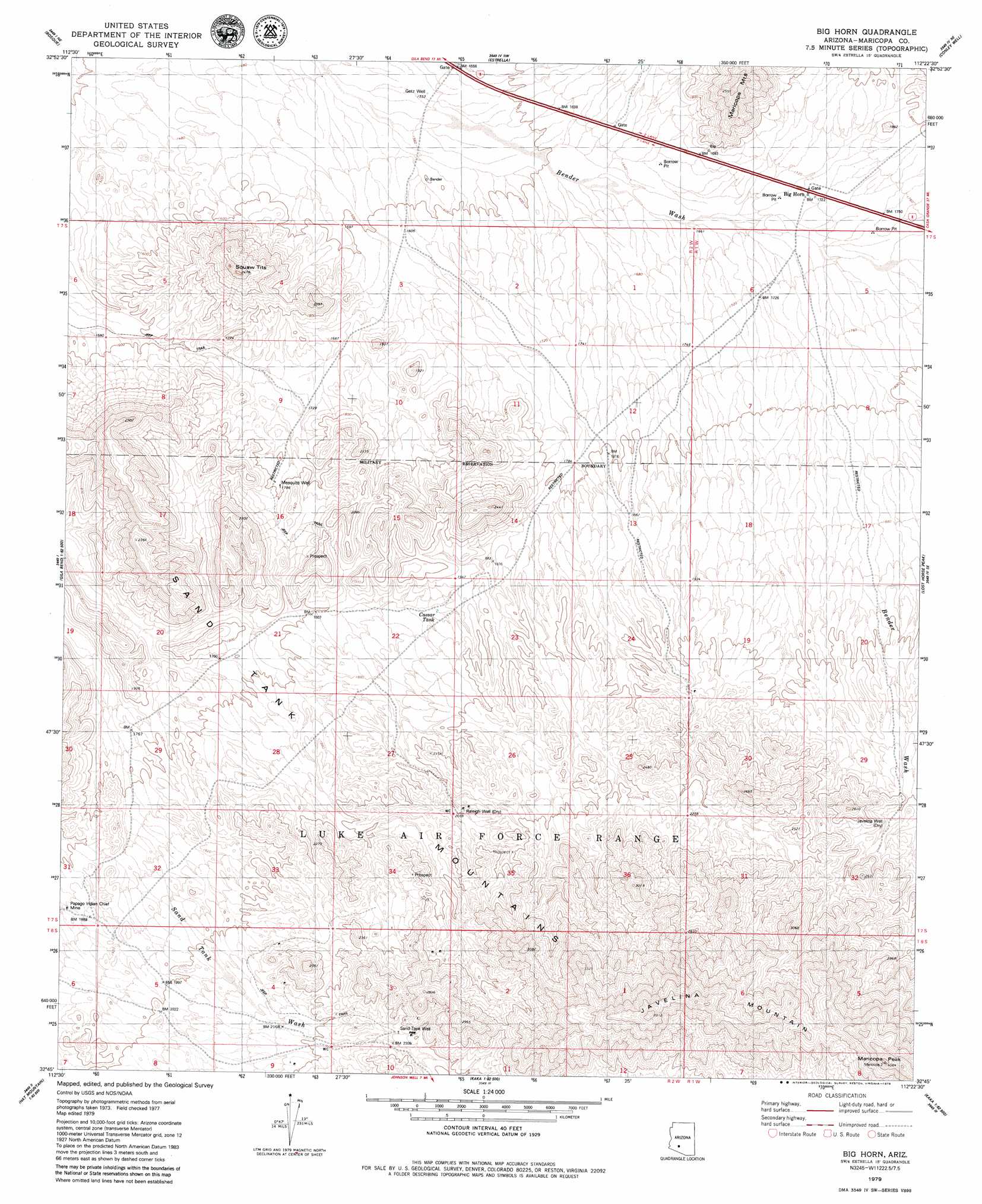
USGS Topo Quad 32112g4 - 1:24,000 scale
| Topo Map Name: | Big Horn |
| USGS Topo Quad ID: | 32112g4 |
| Print Size: | ca. 21 1/4" wide x 27" high |
| Southeast Coordinates: | 32.75° N latitude / 112.375° W longitude |
| Map Center Coordinates: | 32.8125° N latitude / 112.4375° W longitude |
| U.S. State: | AZ |
| Filename: | o32112g4.jpg |
| Download Map JPG Image: | Big Horn topo map 1:24,000 scale |
| Map Type: | Topographic |
| Topo Series: | 7.5´ |
| Map Scale: | 1:24,000 |
| Source of Map Images: | United States Geological Survey (USGS) |
| Alternate Map Versions: |
Big Horn AZ 1979, updated 1979 Download PDF Buy paper map Big Horn AZ 2011 Download PDF Buy paper map Big Horn AZ 2014 Download PDF Buy paper map |
1:24,000 Topo Quads surrounding Big Horn
Cotton Center |
Cotton Center Se |
Butterfield Pass |
Mobile |
Enid |
Gila Bend |
Bosque |
Estrella |
Conley Well |
Haley Hills |
South Of Gila Bend |
Blue Plateau |
Big Horn |
Lost Horse Peak |
Antelope Peak |
Hat Mountain |
Platt Well |
Kaka Nw |
Johnson Well |
Little Table Top |
Hat Mountain Sw |
Tom Thumb |
Moi Vaya |
Kaka |
Copperosity Hills |
> Back to 32112e1 at 1:100,000 scale
> Back to 32112a1 at 1:250,000 scale
> Back to U.S. Topo Maps home
Big Horn topo map: Gazetteer
Big Horn: Mines
Papago Indian Chief Mine elevation 562m 1843′Big Horn: Populated Places
Big Horn elevation 526m 1725′Big Horn: Reservoirs
Caesar Tank elevation 572m 1876′Big Horn: Summits
Javelina Mountain elevation 1171m 3841′Maricopa Peak elevation 1239m 4064′
Squaw Tits elevation 741m 2431′
Big Horn: Wells
Getz Well elevation 475m 1558′Javelina Well elevation 683m 2240′
Mesquite Well elevation 548m 1797′
Raleigh Well elevation 635m 2083′
Big Horn digital topo map on disk
Buy this Big Horn topo map showing relief, roads, GPS coordinates and other geographical features, as a high-resolution digital map file on DVD: