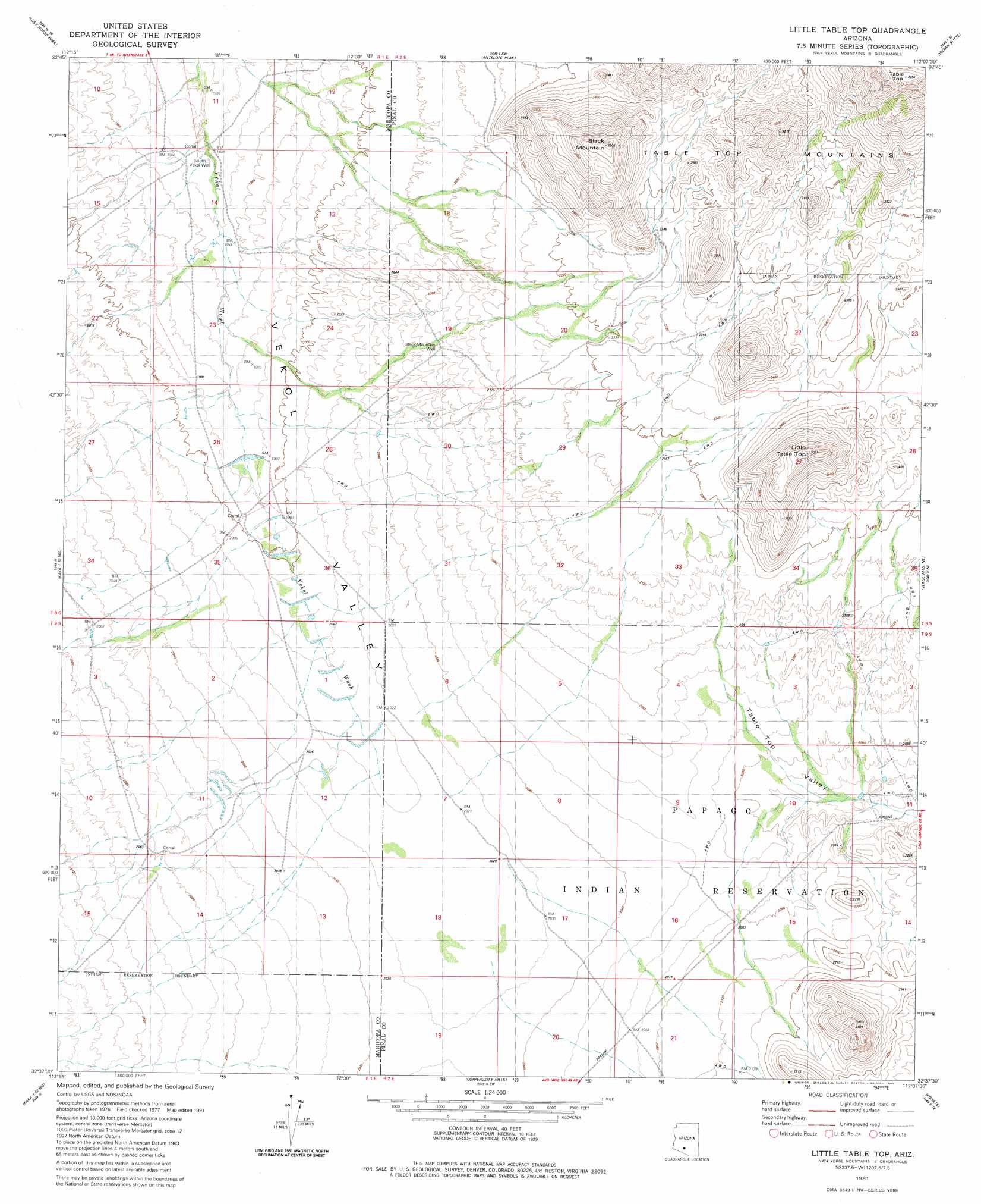
Little Table Top Topo Map Arizona
To zoom in, hover over the map of Little Table Top
USGS Topo Quad 32112f2 - 1:24,000 scale
| Topo Map Name: | Little Table Top |
| USGS Topo Quad ID: | 32112f2 |
| Print Size: | ca. 21 1/4" wide x 27" high |
| Southeast Coordinates: | 32.625° N latitude / 112.125° W longitude |
| Map Center Coordinates: | 32.6875° N latitude / 112.1875° W longitude |
| U.S. State: | AZ |
| Filename: | o32112f2.jpg |
| Download Map JPG Image: | Little Table Top topo map 1:24,000 scale |
| Map Type: | Topographic |
| Topo Series: | 7.5´ |
| Map Scale: | 1:24,000 |
| Source of Map Images: | United States Geological Survey (USGS) |
| Alternate Map Versions: |
Little Table Top AZ 1981, updated 1981 Download PDF Buy paper map Little Table Top AZ 2011 Download PDF Buy paper map Little Table Top AZ 2014 Download PDF Buy paper map |
1:24,000 Topo Quads surrounding Little Table Top
Estrella |
Conley Well |
Haley Hills |
Antelope Peak Ne |
Stanfield |
Big Horn |
Lost Horse Peak |
Antelope Peak |
Indian Butte |
Double Peak |
Kaka Nw |
Johnson Well |
Little Table Top |
Vekol Mountains Ne |
Vaiva Vo |
Moi Vaya |
Kaka |
Copperosity Hills |
Kohatk |
North Komelik |
Cimarron Peak |
West Of Ventana |
Ventana |
Drew Spring Well |
Santa Rosa Mountains Nw |
> Back to 32112e1 at 1:100,000 scale
> Back to 32112a1 at 1:250,000 scale
> Back to U.S. Topo Maps home
Little Table Top topo map: Gazetteer
Little Table Top: Summits
Black Mountain elevation 1002m 3287′Little Table Top elevation 937m 3074′
Little Table Top: Wells
Black Mountain Well elevation 637m 2089′South Vekol Well elevation 593m 1945′
Little Table Top digital topo map on disk
Buy this Little Table Top topo map showing relief, roads, GPS coordinates and other geographical features, as a high-resolution digital map file on DVD: