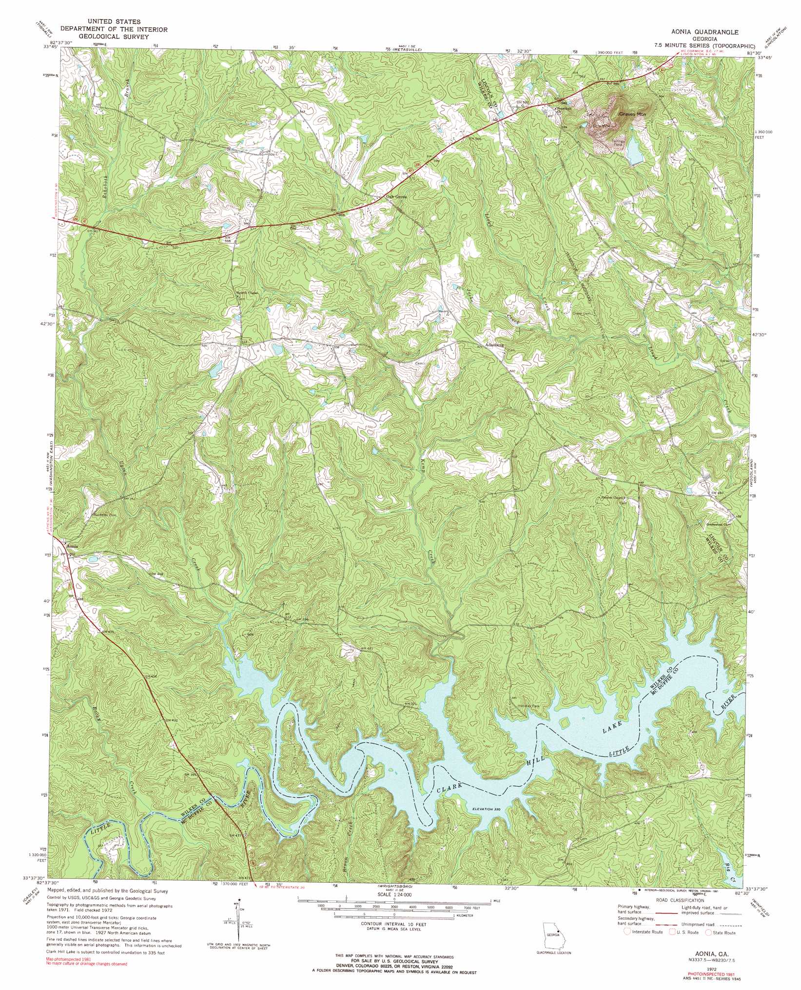
Aonia Topo Map Georgia
To zoom in, hover over the map of Aonia
USGS Topo Quad 33082f5 - 1:24,000 scale
| Topo Map Name: | Aonia |
| USGS Topo Quad ID: | 33082f5 |
| Print Size: | ca. 21 1/4" wide x 27" high |
| Southeast Coordinates: | 33.625° N latitude / 82.5° W longitude |
| Map Center Coordinates: | 33.6875° N latitude / 82.5625° W longitude |
| U.S. State: | GA |
| Filename: | o33082f5.jpg |
| Download Map JPG Image: | Aonia topo map 1:24,000 scale |
| Map Type: | Topographic |
| Topo Series: | 7.5´ |
| Map Scale: | 1:24,000 |
| Source of Map Images: | United States Geological Survey (USGS) |
| Alternate Map Versions: |
Aonia GA 1972, updated 1974 Download PDF Buy paper map Aonia GA 1972, updated 1991 Download PDF Buy paper map Aonia GA 2011 Download PDF Buy paper map Aonia GA 2014 Download PDF Buy paper map |
1:24,000 Topo Quads surrounding Aonia
Jacksons Crossroads |
Broad |
Chennault |
Willington |
Mccormick |
Celeste |
Tignall |
Metasville |
Lincolnton |
Plum Branch |
Washington West |
Washington East |
Aonia |
Woodlawn |
Leah |
Sharon |
Cadley |
Wrightsboro |
Winfield |
Appling |
Sparta Ne |
Warrenton |
Thomson West |
Thompson East |
Harlem |
> Back to 33082e1 at 1:100,000 scale
> Back to 33082a1 at 1:250,000 scale
> Back to U.S. Topo Maps home
Aonia topo map: Gazetteer
Aonia: Bends
Busseys Bend elevation 100m 328′Fish Dam Bend elevation 105m 344′
Griffins Bend elevation 100m 328′
Aonia: Bridges
Smith Bridge (historical) elevation 100m 328′Tom Watson Bridge elevation 100m 328′
Aonia: Crossings
Fish Dam Ford (historical) elevation 100m 328′Aonia: Dams
Hale Lake Dam elevation 153m 501′Aonia: Parks
Holliday Park elevation 116m 380′Aonia: Populated Places
Adasburg elevation 159m 521′Aonia elevation 155m 508′
Oak Grove elevation 165m 541′
Aonia: Reservoirs
Hale Lake elevation 153m 501′Aonia: Streams
Broom Creek elevation 100m 328′Jocko Creek elevation 127m 416′
Kemp Creek elevation 100m 328′
Rehoboth Branch elevation 113m 370′
Rocky Creek elevation 101m 331′
Upton Creek elevation 100m 328′
Aonia: Summits
Graves Mountain elevation 269m 882′Aonia digital topo map on disk
Buy this Aonia topo map showing relief, roads, GPS coordinates and other geographical features, as a high-resolution digital map file on DVD:
South Carolina, Western North Carolina & Northeastern Georgia
Buy digital topo maps: South Carolina, Western North Carolina & Northeastern Georgia