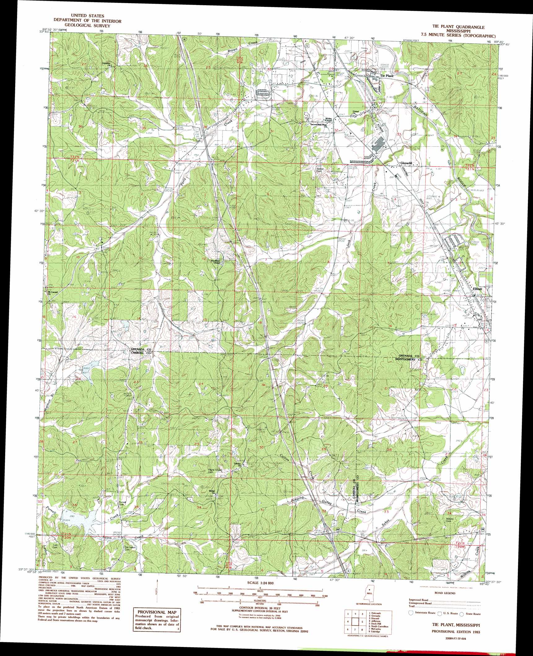
Tie Plant Topo Map Mississippi
To zoom in, hover over the map of Tie Plant
USGS Topo Quad 33089f7 - 1:24,000 scale
| Topo Map Name: | Tie Plant |
| USGS Topo Quad ID: | 33089f7 |
| Print Size: | ca. 21 1/4" wide x 27" high |
| Southeast Coordinates: | 33.625° N latitude / 89.75° W longitude |
| Map Center Coordinates: | 33.6875° N latitude / 89.8125° W longitude |
| U.S. State: | MS |
| Filename: | o33089f7.jpg |
| Download Map JPG Image: | Tie Plant topo map 1:24,000 scale |
| Map Type: | Topographic |
| Topo Series: | 7.5´ |
| Map Scale: | 1:24,000 |
| Source of Map Images: | United States Geological Survey (USGS) |
| Alternate Map Versions: |
Tie Plant MS 1983, updated 1983 Download PDF Buy paper map Tie Plant MS 2012 Download PDF Buy paper map Tie Plant MS 2015 Download PDF Buy paper map |
1:24,000 Topo Quads surrounding Tie Plant
Paynes |
Tillatoba |
Scobey |
Coffeeville |
Benwood |
Cascilla |
Holcomb |
Grenada |
Kincaid |
Gore Springs |
Avalon |
Jefferson |
Tie Plant |
Duck Hill |
Sweatman |
Browning |
North Carrollton |
Mccarley |
Eskridge |
Lodi |
Gravel Hill |
Coila |
Bailey Lake |
Winona |
Kilmichael |
> Back to 33089e1 at 1:100,000 scale
> Back to 33088a1 at 1:250,000 scale
> Back to U.S. Topo Maps home
Tie Plant topo map: Gazetteer
Tie Plant: Crossings
Interchange 195 elevation 103m 337′Tie Plant: Dams
Potacocawa Structure Y-31a-34 Dam elevation 96m 314′Potacocawa Watershed Y-31a-13 Dam elevation 79m 259′
Tie Plant: Populated Places
Glenwild elevation 64m 209′Tie Plant elevation 61m 200′
Tie Plant: Streams
Bolton Branch elevation 56m 183′Collins Gulley Creek elevation 73m 239′
Jack Creek elevation 54m 177′
Jumping Creek elevation 97m 318′
Salem Creek elevation 87m 285′
Tie Plant digital topo map on disk
Buy this Tie Plant topo map showing relief, roads, GPS coordinates and other geographical features, as a high-resolution digital map file on DVD: