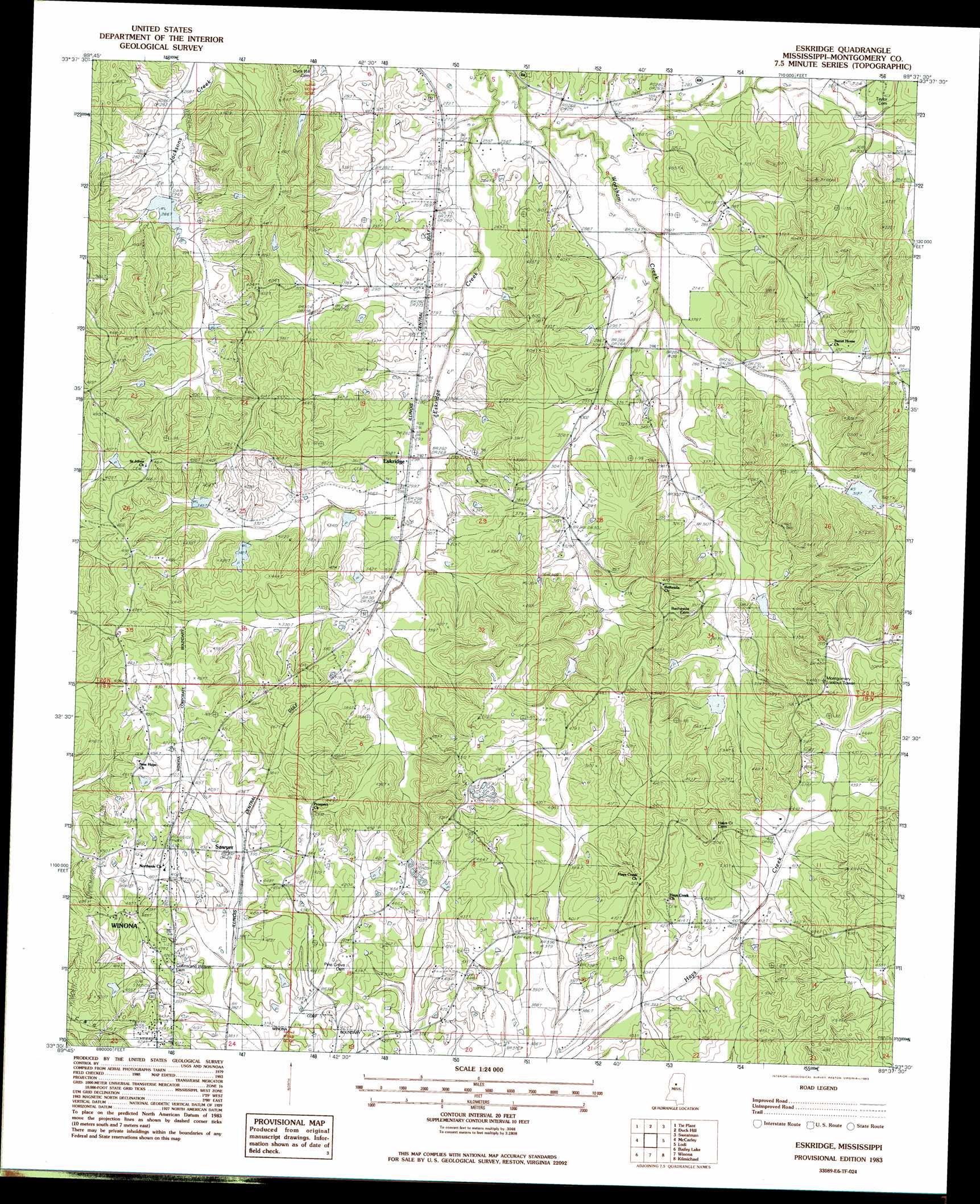
Eskridge Topo Map Mississippi
To zoom in, hover over the map of Eskridge
USGS Topo Quad 33089e6 - 1:24,000 scale
| Topo Map Name: | Eskridge |
| USGS Topo Quad ID: | 33089e6 |
| Print Size: | ca. 21 1/4" wide x 27" high |
| Southeast Coordinates: | 33.5° N latitude / 89.625° W longitude |
| Map Center Coordinates: | 33.5625° N latitude / 89.6875° W longitude |
| U.S. State: | MS |
| Filename: | o33089e6.jpg |
| Download Map JPG Image: | Eskridge topo map 1:24,000 scale |
| Map Type: | Topographic |
| Topo Series: | 7.5´ |
| Map Scale: | 1:24,000 |
| Source of Map Images: | United States Geological Survey (USGS) |
| Alternate Map Versions: |
Eskridge MS 1983, updated 1983 Download PDF Buy paper map Eskridge MS 2012 Download PDF Buy paper map Eskridge MS 2015 Download PDF Buy paper map |
1:24,000 Topo Quads surrounding Eskridge
Holcomb |
Grenada |
Kincaid |
Gore Springs |
Big Creek |
Jefferson |
Tie Plant |
Duck Hill |
Sweatman |
Cadaretta |
North Carrollton |
Mccarley |
Eskridge |
Lodi |
Little Sand Creek |
Coila |
Bailey Lake |
Winona |
Kilmichael |
Stewart |
Murdock Lake |
Peachahala Creek |
Vaiden |
Poplar Creek |
French Camp |
> Back to 33089e1 at 1:100,000 scale
> Back to 33088a1 at 1:250,000 scale
> Back to U.S. Topo Maps home
Eskridge topo map: Gazetteer
Eskridge: Dams
Blaylock Pond Dam elevation 125m 410′Bogue Watershed Y-30-31 Dam elevation 127m 416′
Bogue Watershed Y-30-34 Dam elevation 109m 357′
Bogue Watershed Y-30-94 Dam elevation 104m 341′
Bogue Watershed Y-30-95 Dam elevation 90m 295′
G E Mason Catfish Pond Dam elevation 120m 393′
G E Mason Catfish Ponds Dam elevation 120m 393′
Eskridge: Populated Places
Eskridge elevation 90m 295′Fox elevation 132m 433′
Sawyer elevation 140m 459′
Eskridge: Streams
Eskridge Creek elevation 75m 246′Eskridge digital topo map on disk
Buy this Eskridge topo map showing relief, roads, GPS coordinates and other geographical features, as a high-resolution digital map file on DVD: