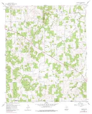
Gibtown Topo Map Texas
To zoom in, hover over the map of Gibtown
USGS Topo Quad 33097a8 - 1:24,000 scale
| Topo Map Name: | Gibtown |
| USGS Topo Quad ID: | 33097a8 |
| Print Size: | ca. 21 1/4" wide x 27" high |
| Southeast Coordinates: | 33° N latitude / 97.875° W longitude |
| Map Center Coordinates: | 33.0625° N latitude / 97.9375° W longitude |
| U.S. State: | TX |
| Filename: | o33097a8.jpg |
| Download Map JPG Image: | Gibtown topo map 1:24,000 scale |
| Map Type: | Topographic |
| Topo Series: | 7.5´ |
| Map Scale: | 1:24,000 |
| Source of Map Images: | United States Geological Survey (USGS) |
| Alternate Map Versions: |
Gibtown TX 1960, updated 1961 Download PDF Buy paper map Gibtown TX 1960, updated 1978 Download PDF Buy paper map Gibtown TX 2010 Download PDF Buy paper map Gibtown TX 2013 Download PDF Buy paper map Gibtown TX 2016 Download PDF Buy paper map |
1:24,000 Topo Quads surrounding Gibtown
> Back to 33097a1 at 1:100,000 scale
> Back to 33096a1 at 1:250,000 scale
> Back to U.S. Topo Maps home
Gibtown topo map: Gazetteer
Gibtown: Populated Places
Gibtown elevation 336m 1102′Joplin elevation 353m 1158′
Westbrook elevation 318m 1043′
Willow Point elevation 288m 944′
Gibtown: Streams
Elm Pool Creek elevation 314m 1030′Oxford Water Branch elevation 311m 1020′
Rock Hole Hollow Branch elevation 310m 1017′
Gibtown: Summits
Armstrong Mountain elevation 365m 1197′Wampler Hill elevation 377m 1236′
Gibtown digital topo map on disk
Buy this Gibtown topo map showing relief, roads, GPS coordinates and other geographical features, as a high-resolution digital map file on DVD:


