Fourmile Hill Topo Map Texas
To zoom in, hover over the map of Fourmile Hill
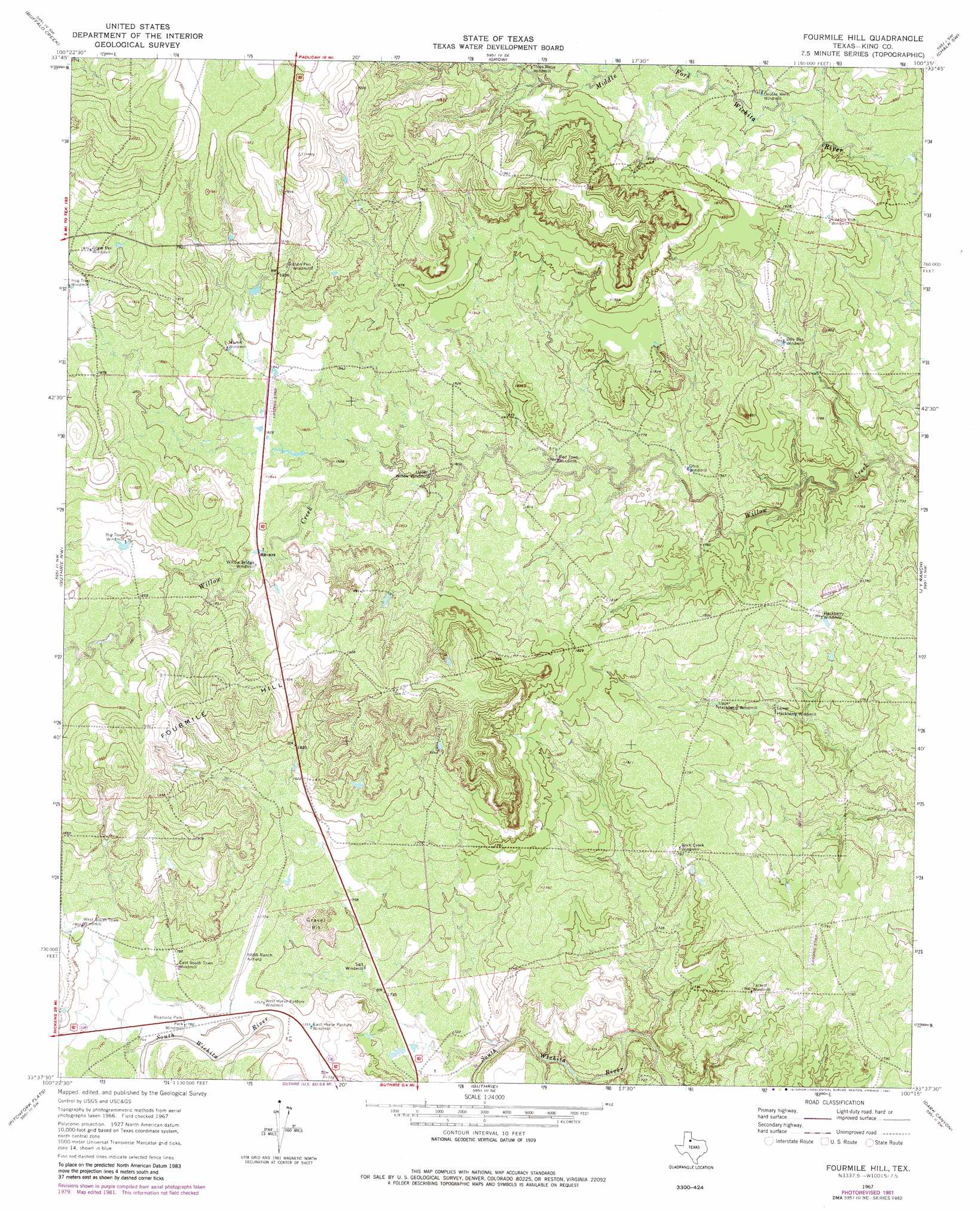
USGS Topo Quad 33100f3 - 1:24,000 scale
| Topo Map Name: | Fourmile Hill |
| USGS Topo Quad ID: | 33100f3 |
| Print Size: | ca. 21 1/4" wide x 27" high |
| Southeast Coordinates: | 33.625° N latitude / 100.25° W longitude |
| Map Center Coordinates: | 33.6875° N latitude / 100.3125° W longitude |
| U.S. State: | TX |
| Filename: | o33100f3.jpg |
| Download Map JPG Image: | Fourmile Hill topo map 1:24,000 scale |
| Map Type: | Topographic |
| Topo Series: | 7.5´ |
| Map Scale: | 1:24,000 |
| Source of Map Images: | United States Geological Survey (USGS) |
| Alternate Map Versions: |
Fourmile Hill TX 1967, updated 1970 Download PDF Buy paper map Fourmile Hill TX 1967, updated 1981 Download PDF Buy paper map Fourmile Hill TX 2010 Download PDF Buy paper map Fourmile Hill TX 2012 Download PDF Buy paper map Fourmile Hill TX 2016 Download PDF Buy paper map |
1:24,000 Topo Quads surrounding Fourmile Hill
China Canyon |
Grow Nw |
Ginsite |
Chalk |
Y Ranch |
Dumont |
Buffalo Creek |
Grow |
Chalk Sw |
Lowrance Mountain |
East Afton Ne |
Guthrie Nw |
Fourmile Hill |
J Y Ranch |
Ox Yoke Creek |
Pitchfork Ranch |
Pitchfork Flats |
Guthrie |
Dark Canyon |
Buzzard Peak |
Pursley House |
Southerland Canyon |
Bob Creek |
Kiowa Peak Nw |
Kiowa Peak Ne |
> Back to 33100e1 at 1:100,000 scale
> Back to 33100a1 at 1:250,000 scale
> Back to U.S. Topo Maps home
Fourmile Hill topo map: Gazetteer
Fourmile Hill: Airports
6666 Ranch Airport elevation 538m 1765′Fourmile Hill: Summits
Fourmile Hill elevation 593m 1945′Fourmile Hill digital topo map on disk
Buy this Fourmile Hill topo map showing relief, roads, GPS coordinates and other geographical features, as a high-resolution digital map file on DVD: