Y Ranch Topo Map Texas
To zoom in, hover over the map of Y Ranch
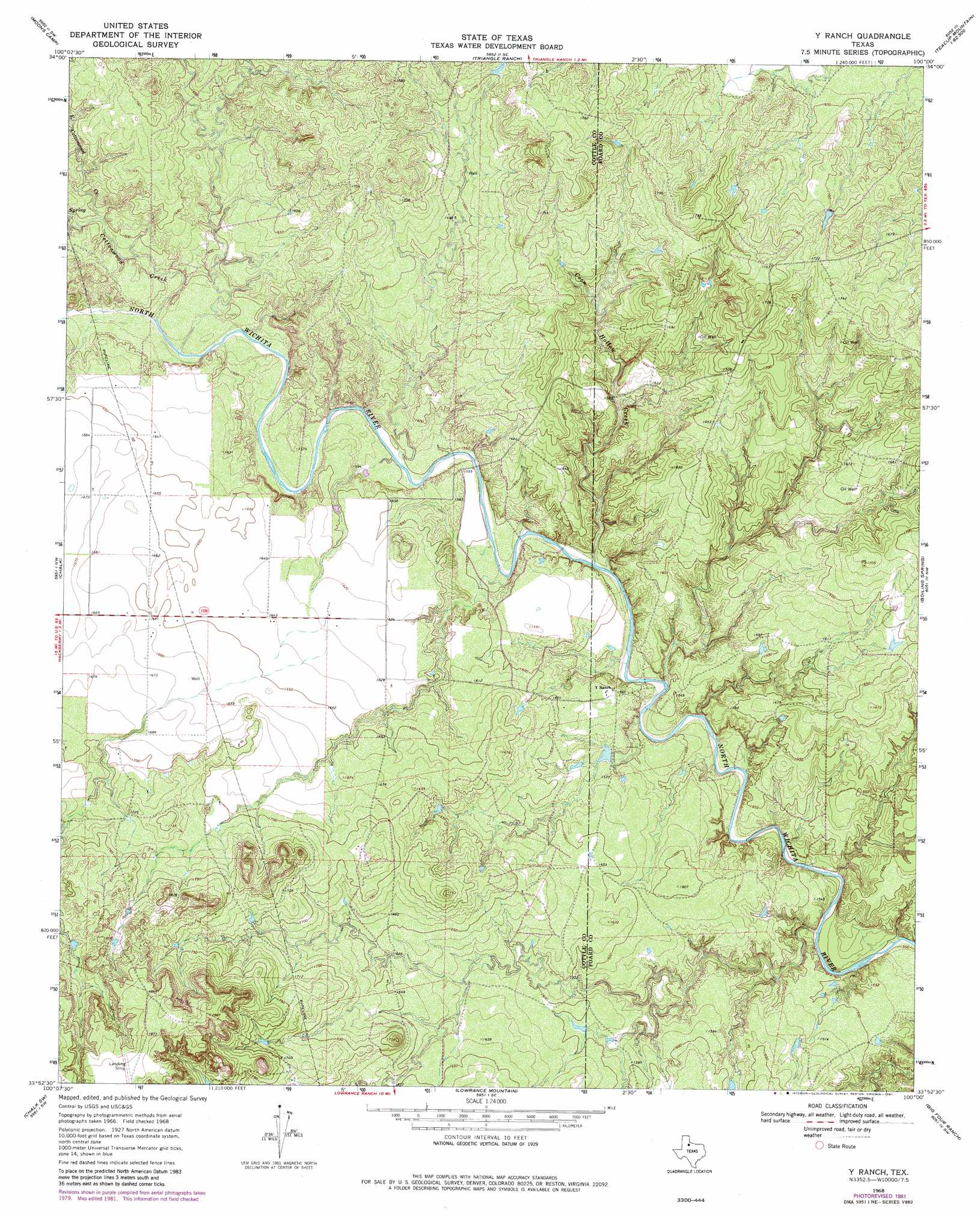
USGS Topo Quad 33100h1 - 1:24,000 scale
| Topo Map Name: | Y Ranch |
| USGS Topo Quad ID: | 33100h1 |
| Print Size: | ca. 21 1/4" wide x 27" high |
| Southeast Coordinates: | 33.875° N latitude / 100° W longitude |
| Map Center Coordinates: | 33.9375° N latitude / 100.0625° W longitude |
| U.S. State: | TX |
| Filename: | o33100h1.jpg |
| Download Map JPG Image: | Y Ranch topo map 1:24,000 scale |
| Map Type: | Topographic |
| Topo Series: | 7.5´ |
| Map Scale: | 1:24,000 |
| Source of Map Images: | United States Geological Survey (USGS) |
| Alternate Map Versions: |
Y Ranch TX 1968, updated 1970 Download PDF Buy paper map Y Ranch TX 1968, updated 1981 Download PDF Buy paper map Y Ranch TX 2010 Download PDF Buy paper map Y Ranch TX 2012 Download PDF Buy paper map Y Ranch TX 2016 Download PDF Buy paper map |
1:24,000 Topo Quads surrounding Y Ranch
Dunlap |
Swearingen |
Baker |
Cactus Creek |
Maybell Canyon |
Paducah |
Moons Camp |
Triangle Ranch |
Vivian |
Teacup Mountain |
Ginsite |
Chalk |
Y Ranch |
Boiling Spring |
Foard City |
Grow |
Chalk Sw |
Lowrance Mountain |
Big Four Ranch |
Truscott North |
Fourmile Hill |
J Y Ranch |
Ox Yoke Creek |
Maverick Flat |
Truscott South |
> Back to 33100e1 at 1:100,000 scale
> Back to 33100a1 at 1:250,000 scale
> Back to U.S. Topo Maps home
Y Ranch topo map: Gazetteer
Y Ranch: Streams
Coon Hollow Creek elevation 466m 1528′Cottonwood Creek elevation 478m 1568′
East Cottonwood Creek elevation 484m 1587′
Y Ranch digital topo map on disk
Buy this Y Ranch topo map showing relief, roads, GPS coordinates and other geographical features, as a high-resolution digital map file on DVD: