Grow Nw Topo Map Texas
To zoom in, hover over the map of Grow Nw
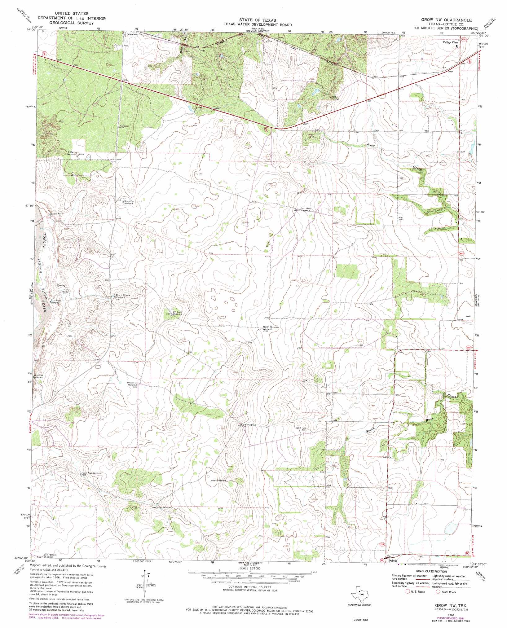
USGS Topo Quad 33100h4 - 1:24,000 scale
| Topo Map Name: | Grow Nw |
| USGS Topo Quad ID: | 33100h4 |
| Print Size: | ca. 21 1/4" wide x 27" high |
| Southeast Coordinates: | 33.875° N latitude / 100.375° W longitude |
| Map Center Coordinates: | 33.9375° N latitude / 100.4375° W longitude |
| U.S. State: | TX |
| Filename: | o33100h4.jpg |
| Download Map JPG Image: | Grow Nw topo map 1:24,000 scale |
| Map Type: | Topographic |
| Topo Series: | 7.5´ |
| Map Scale: | 1:24,000 |
| Source of Map Images: | United States Geological Survey (USGS) |
| Alternate Map Versions: |
Grow NW TX 1968, updated 1970 Download PDF Buy paper map Grow NW TX 1968, updated 1981 Download PDF Buy paper map Grow NW TX 2010 Download PDF Buy paper map Grow NW TX 2012 Download PDF Buy paper map Grow NW TX 2016 Download PDF Buy paper map |
1:24,000 Topo Quads surrounding Grow Nw
Turtle Hole Camp |
Fields Canyon |
Cee Vee |
Dunlap |
Swearingen |
Ballard Camp |
Tee Pee City |
Devils Canyon |
Paducah |
Moons Camp |
Russellville |
China Canyon |
Grow Nw |
Ginsite |
Chalk |
Sanders Hollow |
Dumont |
Buffalo Creek |
Grow |
Chalk Sw |
East Afton |
East Afton Ne |
Guthrie Nw |
Fourmile Hill |
J Y Ranch |
> Back to 33100e1 at 1:100,000 scale
> Back to 33100a1 at 1:250,000 scale
> Back to U.S. Topo Maps home
Grow Nw topo map: Gazetteer
Grow Nw: Populated Places
Delwin elevation 610m 2001′Valley View elevation 609m 1998′
Grow Nw digital topo map on disk
Buy this Grow Nw topo map showing relief, roads, GPS coordinates and other geographical features, as a high-resolution digital map file on DVD: