Rail Canyon Topo Map New Mexico
To zoom in, hover over the map of Rail Canyon
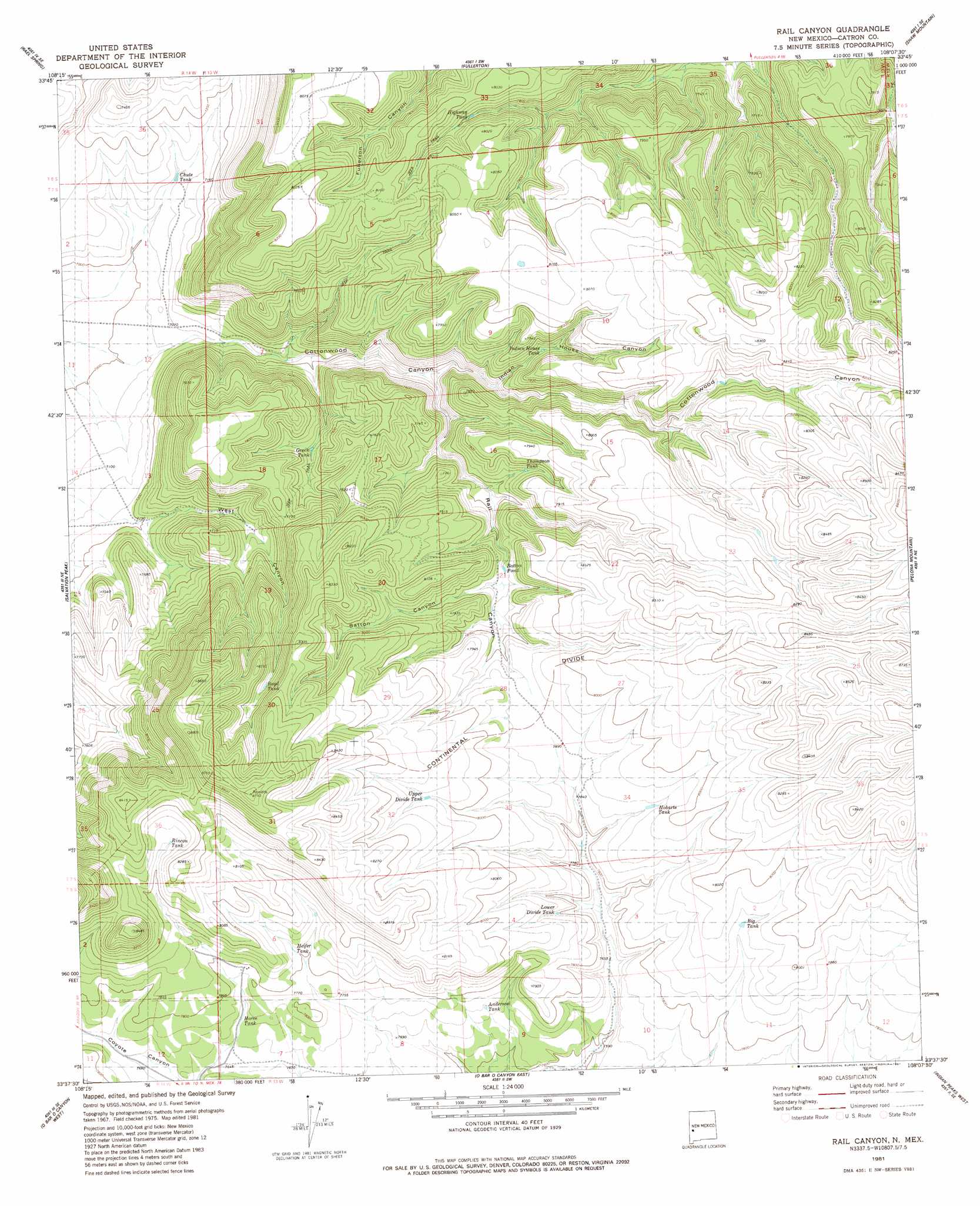
USGS Topo Quad 33108f2 - 1:24,000 scale
| Topo Map Name: | Rail Canyon |
| USGS Topo Quad ID: | 33108f2 |
| Print Size: | ca. 21 1/4" wide x 27" high |
| Southeast Coordinates: | 33.625° N latitude / 108.125° W longitude |
| Map Center Coordinates: | 33.6875° N latitude / 108.1875° W longitude |
| U.S. State: | NM |
| Filename: | o33108f2.jpg |
| Download Map JPG Image: | Rail Canyon topo map 1:24,000 scale |
| Map Type: | Topographic |
| Topo Series: | 7.5´ |
| Map Scale: | 1:24,000 |
| Source of Map Images: | United States Geological Survey (USGS) |
| Alternate Map Versions: |
Rail Canyon NM 1981, updated 1981 Download PDF Buy paper map Rail Canyon NM 2010 Download PDF Buy paper map Rail Canyon NM 2013 Download PDF Buy paper map Rail Canyon NM 2017 Download PDF Buy paper map |
1:24,000 Topo Quads surrounding Rail Canyon
Tullarosa Canyon |
Bell Peak |
Horse Mountain West |
Horse Mountain East |
Luera Mountains Nw |
John Kerr Peak |
Rael Spring |
Fullerton |
Shaw Mountain |
Luera Mountains West |
Collins Park |
Salvation Peak |
Rail Canyon |
Pelona Mountain |
Mojonera Canyon |
Pitchfork Canyon |
O Bar O Canyon West |
O Bar O Canyon East |
Indian Peaks West |
Indian Peaks East |
Loco Mountain |
Canyon Creek Mountains |
Black Mountain |
Spring Canyon |
Taylor Peak |
> Back to 33108e1 at 1:100,000 scale
> Back to 33108a1 at 1:250,000 scale
> Back to U.S. Topo Maps home
Rail Canyon topo map: Gazetteer
Rail Canyon: Lakes
Batton Pond elevation 2348m 7703′Rail Canyon: Reservoirs
Anderson Tank elevation 2352m 7716′Big Tank elevation 2410m 7906′
Chute Tank elevation 2158m 7080′
Green Tank elevation 2279m 7477′
Heifer Tank elevation 2382m 7814′
Highway Tank elevation 2369m 7772′
Hobarts Tank elevation 2408m 7900′
Horse Tank elevation 2352m 7716′
Indian House Tank elevation 2337m 7667′
Lower Divide Tank elevation 2385m 7824′
Rincon Tank elevation 2451m 8041′
Thompson Tank elevation 2342m 7683′
Upper Divide Tank elevation 2452m 8044′
Rail Canyon: Valleys
Batton Canyon elevation 2352m 7716′Coyote Canyon elevation 2318m 7604′
Indian House Canyon elevation 2273m 7457′
Rail Canyon elevation 2225m 7299′
West Canyon elevation 2192m 7191′
Rail Canyon digital topo map on disk
Buy this Rail Canyon topo map showing relief, roads, GPS coordinates and other geographical features, as a high-resolution digital map file on DVD: