Oatman Mountain Topo Map Arizona
To zoom in, hover over the map of Oatman Mountain
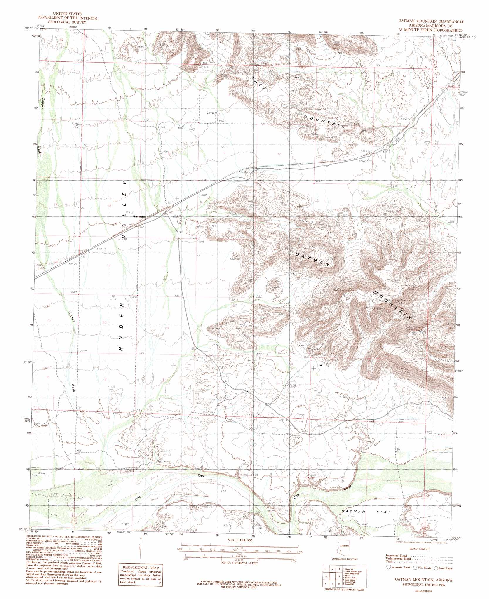
USGS Topo Quad 33113a2 - 1:24,000 scale
| Topo Map Name: | Oatman Mountain |
| USGS Topo Quad ID: | 33113a2 |
| Print Size: | ca. 21 1/4" wide x 27" high |
| Southeast Coordinates: | 33° N latitude / 113.125° W longitude |
| Map Center Coordinates: | 33.0625° N latitude / 113.1875° W longitude |
| U.S. State: | AZ |
| Filename: | o33113a2.jpg |
| Download Map JPG Image: | Oatman Mountain topo map 1:24,000 scale |
| Map Type: | Topographic |
| Topo Series: | 7.5´ |
| Map Scale: | 1:24,000 |
| Source of Map Images: | United States Geological Survey (USGS) |
| Alternate Map Versions: |
Oatman Mountain AZ 1986, updated 1986 Download PDF Buy paper map Oatman Mountain AZ 2011 Download PDF Buy paper map Oatman Mountain AZ 2014 Download PDF Buy paper map |
1:24,000 Topo Quads surrounding Oatman Mountain
Nottbusch Butte |
Columbus Peak |
Cortez Peak |
Fourth Of July Butte |
Gillespie |
Turtleback Mountain |
Hyder Ne |
Yellow Medicine Butte |
Quail Spring Wash |
Woolsey Peak |
Baragan Mountain |
Hyder |
Oatman Mountain |
Dendora Valley |
Citrus Valley West |
Aztec Nw |
Agua Caliente |
Sentinel Peak |
Sentinel Ne |
Theba |
Aztec Hills |
Aztec Se |
Sentinel |
Sentinel Se |
South Of Theba |
> Back to 33113a1 at 1:100,000 scale
> Back to 33112a1 at 1:250,000 scale
> Back to U.S. Topo Maps home
Oatman Mountain topo map: Gazetteer
Oatman Mountain: Flats
Oatman Flat elevation 153m 501′Oatman Mountain: Populated Places
Montezuma elevation 184m 603′Papago elevation 200m 656′
Oatman Mountain: Summits
Oatman Mountain elevation 526m 1725′Oatman Mountain: Wells
East Mill Well elevation 147m 482′Oatman Mountain digital topo map on disk
Buy this Oatman Mountain topo map showing relief, roads, GPS coordinates and other geographical features, as a high-resolution digital map file on DVD: