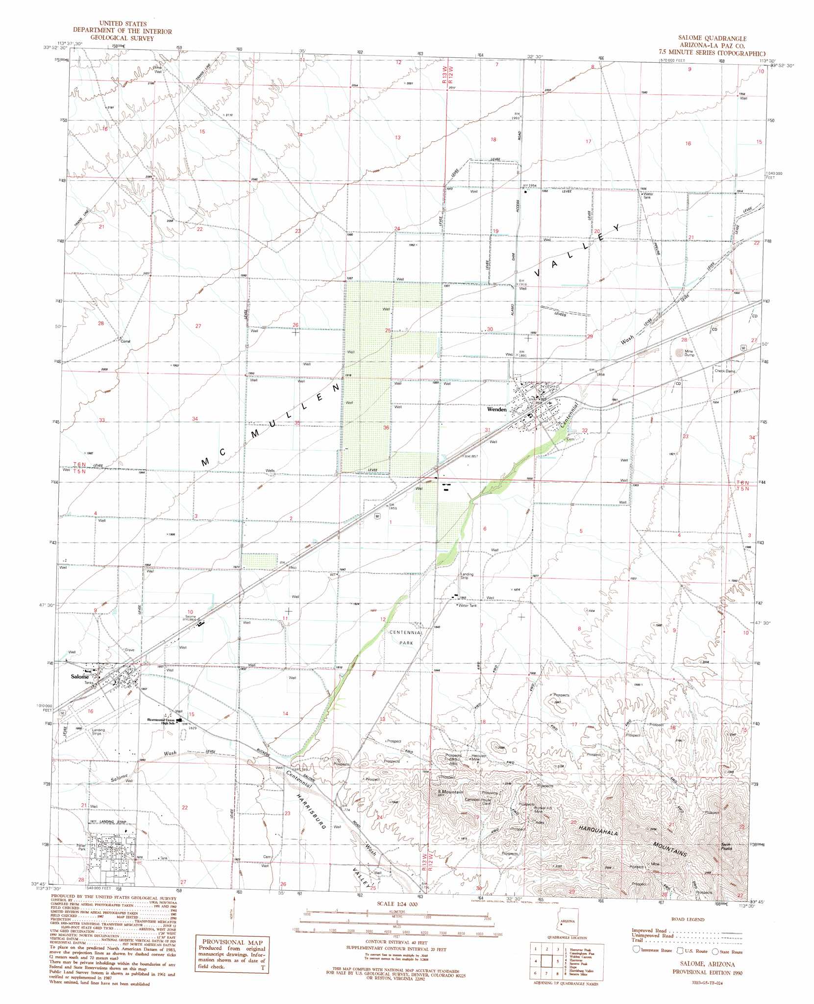
Salome Topo Map Arizona
To zoom in, hover over the map of Salome
USGS Topo Quad 33113g5 - 1:24,000 scale
| Topo Map Name: | Salome |
| USGS Topo Quad ID: | 33113g5 |
| Print Size: | ca. 21 1/4" wide x 27" high |
| Southeast Coordinates: | 33.75° N latitude / 113.5° W longitude |
| Map Center Coordinates: | 33.8125° N latitude / 113.5625° W longitude |
| U.S. State: | AZ |
| Filename: | o33113g5.jpg |
| Download Map JPG Image: | Salome topo map 1:24,000 scale |
| Map Type: | Topographic |
| Topo Series: | 7.5´ |
| Map Scale: | 1:24,000 |
| Source of Map Images: | United States Geological Survey (USGS) |
| Alternate Map Versions: |
Salome AZ 1990, updated 1990 Download PDF Buy paper map Salome AZ 2011 Download PDF Buy paper map Salome AZ 2014 Download PDF Buy paper map |
1:24,000 Topo Quads surrounding Salome
Butler Pass |
Butler Well |
Alamo Dam Se |
E C P Peak |
Smith Peak |
Bouse Hills East |
Harcuvar Peak |
Cunningham Pass |
Webber Canyon |
Gladden |
East Of Utting |
Harcuvar |
Salome |
Socorro Peak |
Harquahala Mountain |
Vicksburg |
Hope |
Harrisburg Valley |
Socorro Mine |
Weldon Hill |
New Water Well |
Hope Sw |
Hope Se |
Lone Mountain |
Courthouse Well |
> Back to 33113e1 at 1:100,000 scale
> Back to 33112a1 at 1:250,000 scale
> Back to U.S. Topo Maps home
Salome topo map: Gazetteer
Salome: Airports
Indian Hills Airpark elevation 571m 1873′Salome Airport elevation 571m 1873′
Wenden Airfield elevation 562m 1843′
Salome: Mines
Blue Star Claim elevation 598m 1961′Bunker Hill Mine elevation 655m 2148′
Campbell House Claim elevation 606m 1988′
Four Winds Mine elevation 603m 1978′
Hercules Mine elevation 597m 1958′
Salome: Parks
Centennial Park elevation 560m 1837′Salome: Pillars
Landmark Letter elevation 681m 2234′Salome: Populated Places
Salome elevation 0m 0′Wenden elevation 569m 1866′
Salome: Streams
Salome Wash elevation 0m 0′Salome: Summits
S Mountain elevation 681m 2234′South Mountain elevation 681m 2234′
Twin Peaks elevation 890m 2919′
Salome: Wells
Browns Well elevation 548m 1797′Mesquite Well elevation 566m 1856′
Petes Well elevation 560m 1837′
Salome digital topo map on disk
Buy this Salome topo map showing relief, roads, GPS coordinates and other geographical features, as a high-resolution digital map file on DVD: