Hale Center Topo Map Texas
To zoom in, hover over the map of Hale Center
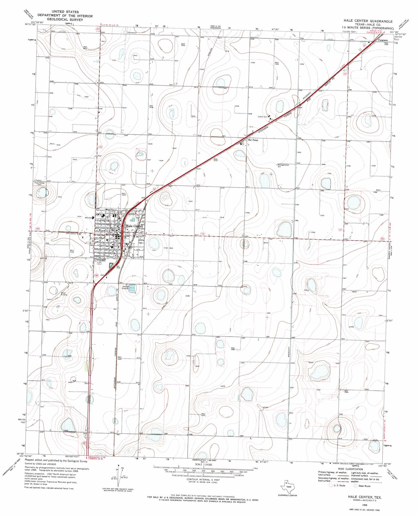
USGS Topo Quad 34101a7 - 1:24,000 scale
| Topo Map Name: | Hale Center |
| USGS Topo Quad ID: | 34101a7 |
| Print Size: | ca. 21 1/4" wide x 27" high |
| Southeast Coordinates: | 34° N latitude / 101.75° W longitude |
| Map Center Coordinates: | 34.0625° N latitude / 101.8125° W longitude |
| U.S. State: | TX |
| Filename: | o34101a7.jpg |
| Download Map JPG Image: | Hale Center topo map 1:24,000 scale |
| Map Type: | Topographic |
| Topo Series: | 7.5´ |
| Map Scale: | 1:24,000 |
| Source of Map Images: | United States Geological Survey (USGS) |
| Alternate Map Versions: |
Hale Center TX 1968, updated 1970 Download PDF Buy paper map Hale Center TX 2010 Download PDF Buy paper map Hale Center TX 2012 Download PDF Buy paper map Hale Center TX 2016 Download PDF Buy paper map |
1:24,000 Topo Quads surrounding Hale Center
Hilburn |
Edmonson |
Kress West |
Kress East |
Providence |
Olton Ne |
Halfway |
Wasson |
Plainview |
Aiken |
Corry |
Hale Center Sw |
Hale Center |
Happy Union |
Plainview Se |
Anton Ne |
Cotton Center |
Underwood |
Julia Lake |
Barwise |
Roundup |
Abernathy Sw |
Abernathy |
Heckville |
Petersburg |
> Back to 34101a1 at 1:100,000 scale
> Back to 34100a1 at 1:250,000 scale
> Back to U.S. Topo Maps home
Hale Center topo map: Gazetteer
Hale Center: Populated Places
Hale Center elevation 1042m 3418′Hale City (historical) elevation 1054m 3458′
Six Point elevation 1041m 3415′
Hale Center digital topo map on disk
Buy this Hale Center topo map showing relief, roads, GPS coordinates and other geographical features, as a high-resolution digital map file on DVD: