Blind Hills Topo Map California
To zoom in, hover over the map of Blind Hills
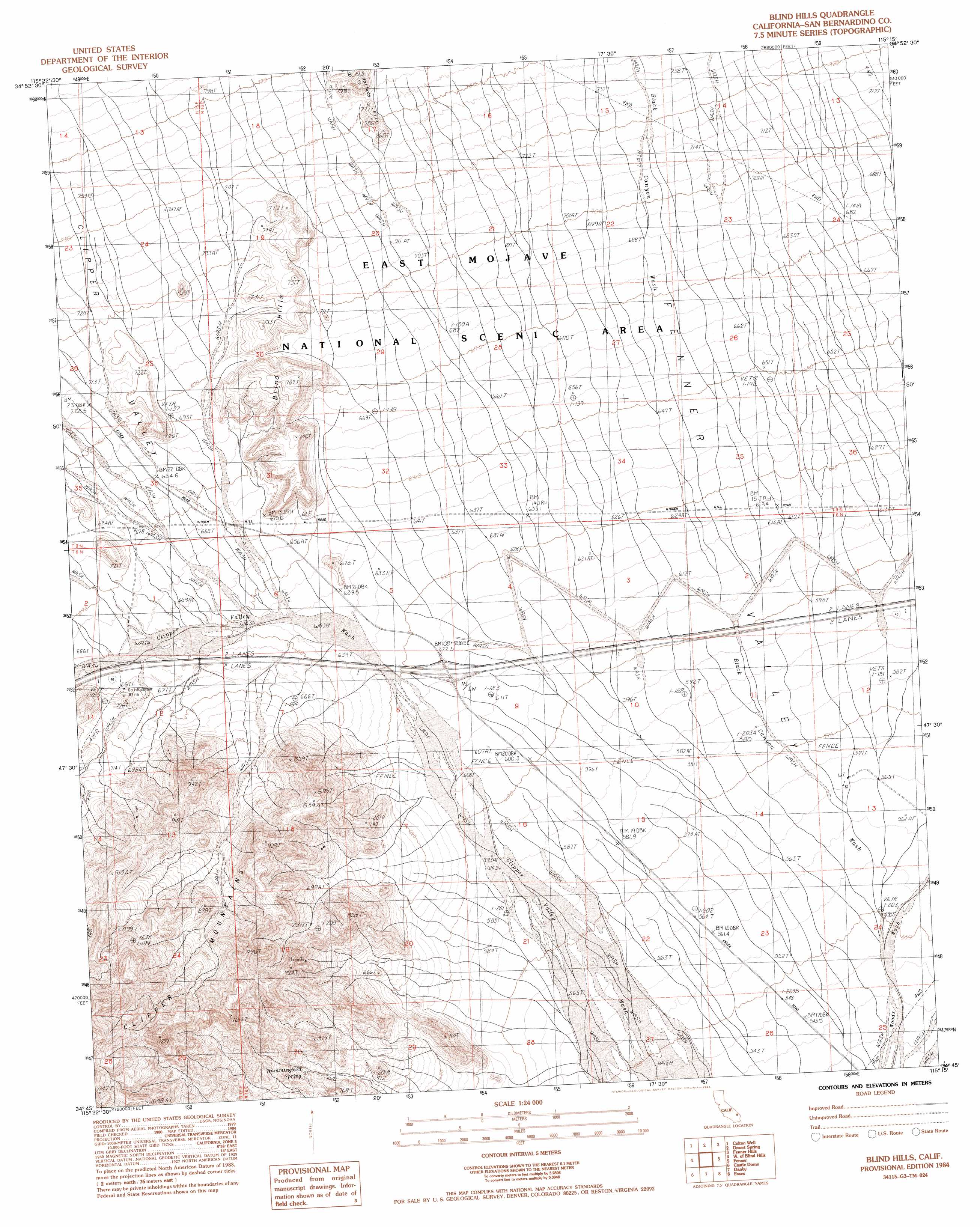
USGS Topo Quad 34115g3 - 1:24,000 scale
| Topo Map Name: | Blind Hills |
| USGS Topo Quad ID: | 34115g3 |
| Print Size: | ca. 21 1/4" wide x 27" high |
| Southeast Coordinates: | 34.75° N latitude / 115.25° W longitude |
| Map Center Coordinates: | 34.8125° N latitude / 115.3125° W longitude |
| U.S. State: | CA |
| Filename: | o34115g3.jpg |
| Download Map JPG Image: | Blind Hills topo map 1:24,000 scale |
| Map Type: | Topographic |
| Topo Series: | 7.5´ |
| Map Scale: | 1:24,000 |
| Source of Map Images: | United States Geological Survey (USGS) |
| Alternate Map Versions: |
Blind Hills CA 1984, updated 1984 Download PDF Buy paper map Blind Hills CA 2012 Download PDF Buy paper map Blind Hills CA 2015 Download PDF Buy paper map |
1:24,000 Topo Quads surrounding Blind Hills
Hayden |
Columbia Mountain |
Woods Mountains |
Hackberry Mountain |
Signal Hill |
Fountain Peak |
Colton Well |
Desert Spring |
Fenner Hills |
Goffs |
Van Winkle Spring |
West Of Blind Hills |
Blind Hills |
Fenner |
Fenner Spring |
Van Winkle Wash |
Castle Dome |
Danby |
Essex |
Little Piute Mountains |
Cadiz |
Cadiz Summit |
Skeleton Pass |
Old Woman Statue |
Painted Rock Wash |
> Back to 34115e1 at 1:100,000 scale
> Back to 34114a1 at 1:250,000 scale
> Back to U.S. Topo Maps home
Blind Hills topo map: Gazetteer
Blind Hills: Mines
Goldhammer Mine elevation 677m 2221′Blind Hills: Springs
Hummingbird Spring elevation 716m 2349′Blind Hills: Summits
Blind Hills elevation 754m 2473′Halfway Hill elevation 817m 2680′
Blind Hills digital topo map on disk
Buy this Blind Hills topo map showing relief, roads, GPS coordinates and other geographical features, as a high-resolution digital map file on DVD: