Trenton Topo Map North Carolina
To zoom in, hover over the map of Trenton
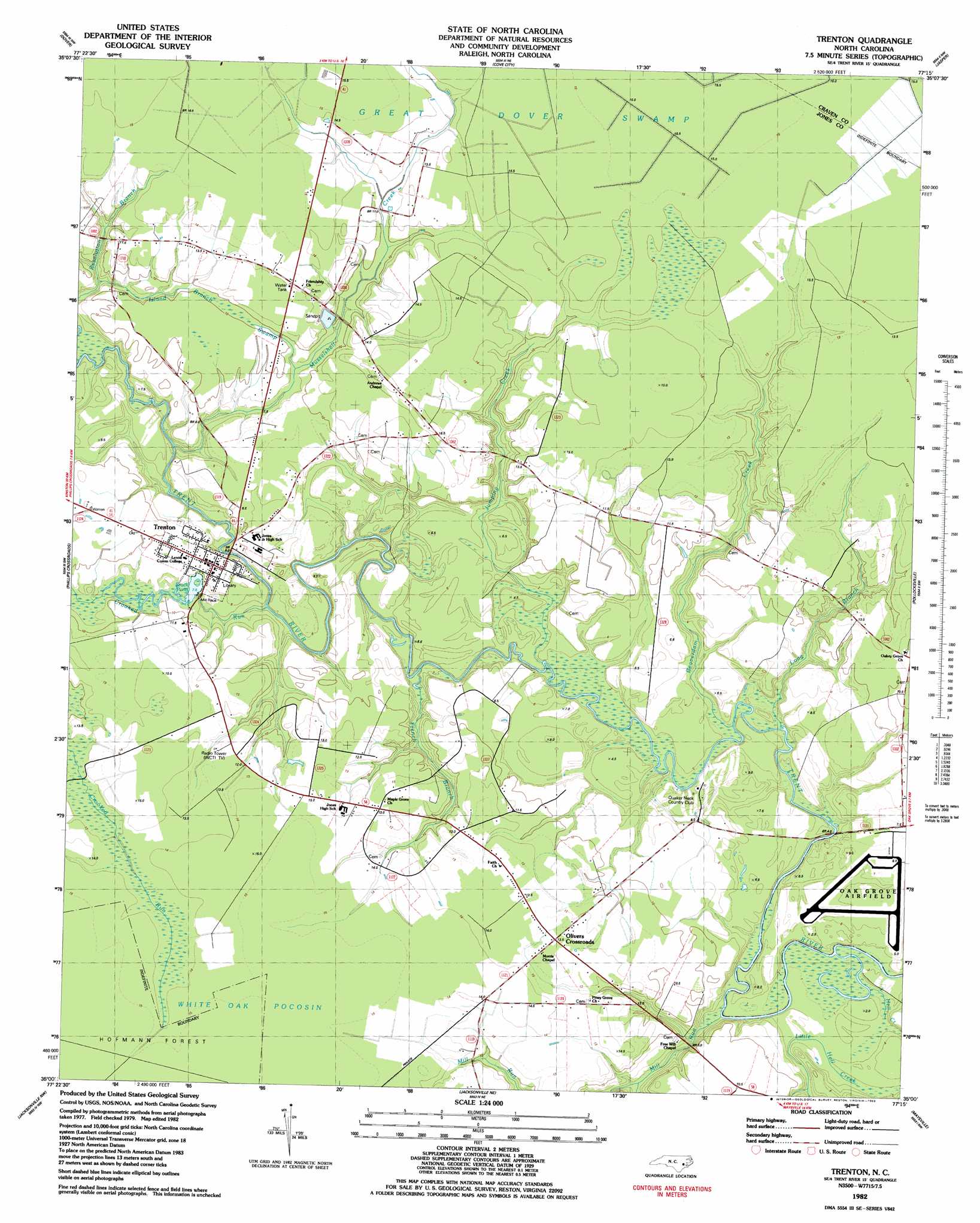
USGS Topo Quad 35077a3 - 1:24,000 scale
| Topo Map Name: | Trenton |
| USGS Topo Quad ID: | 35077a3 |
| Print Size: | ca. 21 1/4" wide x 27" high |
| Southeast Coordinates: | 35° N latitude / 77.25° W longitude |
| Map Center Coordinates: | 35.0625° N latitude / 77.3125° W longitude |
| U.S. State: | NC |
| Filename: | o35077a3.jpg |
| Download Map JPG Image: | Trenton topo map 1:24,000 scale |
| Map Type: | Topographic |
| Topo Series: | 7.5´ |
| Map Scale: | 1:24,000 |
| Source of Map Images: | United States Geological Survey (USGS) |
| Alternate Map Versions: |
Trenton NC 1982, updated 1983 Download PDF Buy paper map Trenton NC 2010 Download PDF Buy paper map Trenton NC 2013 Download PDF Buy paper map Trenton NC 2016 Download PDF Buy paper map |
1:24,000 Topo Quads surrounding Trenton
Kinston |
Grifton |
Fort Barnwell |
Vanceboro |
Ernul |
Rivermont |
Dover |
Cove City |
Jasper |
Askin |
Comfort |
Phillips Crossroads |
Trenton |
Pollocksville |
New Bern |
Richlands |
Jacksonville Nw |
Jacksonville Ne |
Maysville |
Catfish Lake |
Catherine Lake |
Jacksonville North |
Kellum |
Stella |
Hadnot Creek |
> Back to 35077a1 at 1:100,000 scale
> Back to 35076a1 at 1:250,000 scale
> Back to U.S. Topo Maps home
Trenton topo map: Gazetteer
Trenton: Areas
Pollocksville elevation 8m 26′Trenton: Bridges
Quaker Bridge elevation 7m 22′Trenton: Populated Places
Olivers elevation 12m 39′Olivers Crossroads elevation 14m 45′
Trenton elevation 4m 13′
Trenton: Reservoirs
Brock Pond elevation 6m 19′Trenton: Streams
Beaverdam Branch elevation 3m 9′Beaverdam Creek elevation 0m 0′
Crooked Run elevation 1m 3′
French Branch elevation 2m 6′
Jumping Creek elevation 1m 3′
Little Hell Creek elevation 0m 0′
Long Branch elevation 0m 0′
Mill Run elevation 2m 6′
Musselshell Creek elevation 8m 26′
Trenton: Swamps
Island Branch Swamp elevation 12m 39′Trenton digital topo map on disk
Buy this Trenton topo map showing relief, roads, GPS coordinates and other geographical features, as a high-resolution digital map file on DVD:
Atlantic Coast (NY, NJ, PA, DE, MD, VA, NC)
Buy digital topo maps: Atlantic Coast (NY, NJ, PA, DE, MD, VA, NC)
 map DVD")