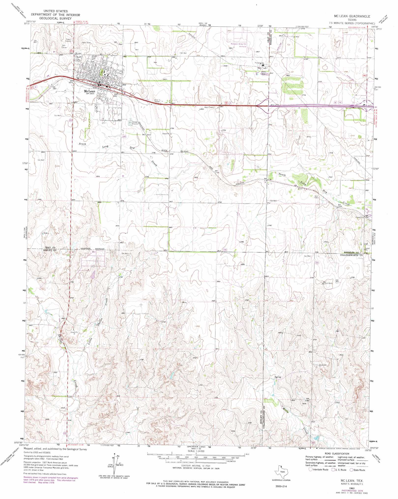
Mclean Topo Map Texas
To zoom in, hover over the map of Mclean
USGS Topo Quad 35100b5 - 1:24,000 scale
| Topo Map Name: | Mclean |
| USGS Topo Quad ID: | 35100b5 |
| Print Size: | ca. 21 1/4" wide x 27" high |
| Southeast Coordinates: | 35.125° N latitude / 100.5° W longitude |
| Map Center Coordinates: | 35.1875° N latitude / 100.5625° W longitude |
| U.S. State: | TX |
| Filename: | o35100b5.jpg |
| Download Map JPG Image: | Mclean topo map 1:24,000 scale |
| Map Type: | Topographic |
| Topo Series: | 7.5´ |
| Map Scale: | 1:24,000 |
| Source of Map Images: | United States Geological Survey (USGS) |
| Alternate Map Versions: |
McLean TX 1963, updated 1967 Download PDF Buy paper map McLean TX 1963, updated 1978 Download PDF Buy paper map McLean TX 2010 Download PDF Buy paper map McLean TX 2012 Download PDF Buy paper map McLean TX 2016 Download PDF Buy paper map |
1:24,000 Topo Quads surrounding Mclean
Lefors |
Pond Creek Nw |
Pond Creek |
Spring Creek |
Wheeler |
Taylor Ranch |
Hudgens Ranch |
Back |
Pakan |
Wheeler Se |
Rockledge |
Alanreed |
Mclean |
Ramsdell |
Shamrock West |
Griffin Ranch |
Troublesome Creek |
Spencer Lake |
Abra |
Dozier |
Lelia Lake |
Lelia Lake Creek |
Mcknight |
Quail |
Rolla Ne |
> Back to 35100a1 at 1:100,000 scale
> Back to 35100a1 at 1:250,000 scale
> Back to U.S. Topo Maps home
Mclean topo map: Gazetteer
Mclean: Airports
McLean/Gray County Airport elevation 863m 2831′Mclean: Populated Places
McLean elevation 872m 2860′Mclean: Streams
Little Skillet Creek elevation 783m 2568′Mclean digital topo map on disk
Buy this Mclean topo map showing relief, roads, GPS coordinates and other geographical features, as a high-resolution digital map file on DVD: