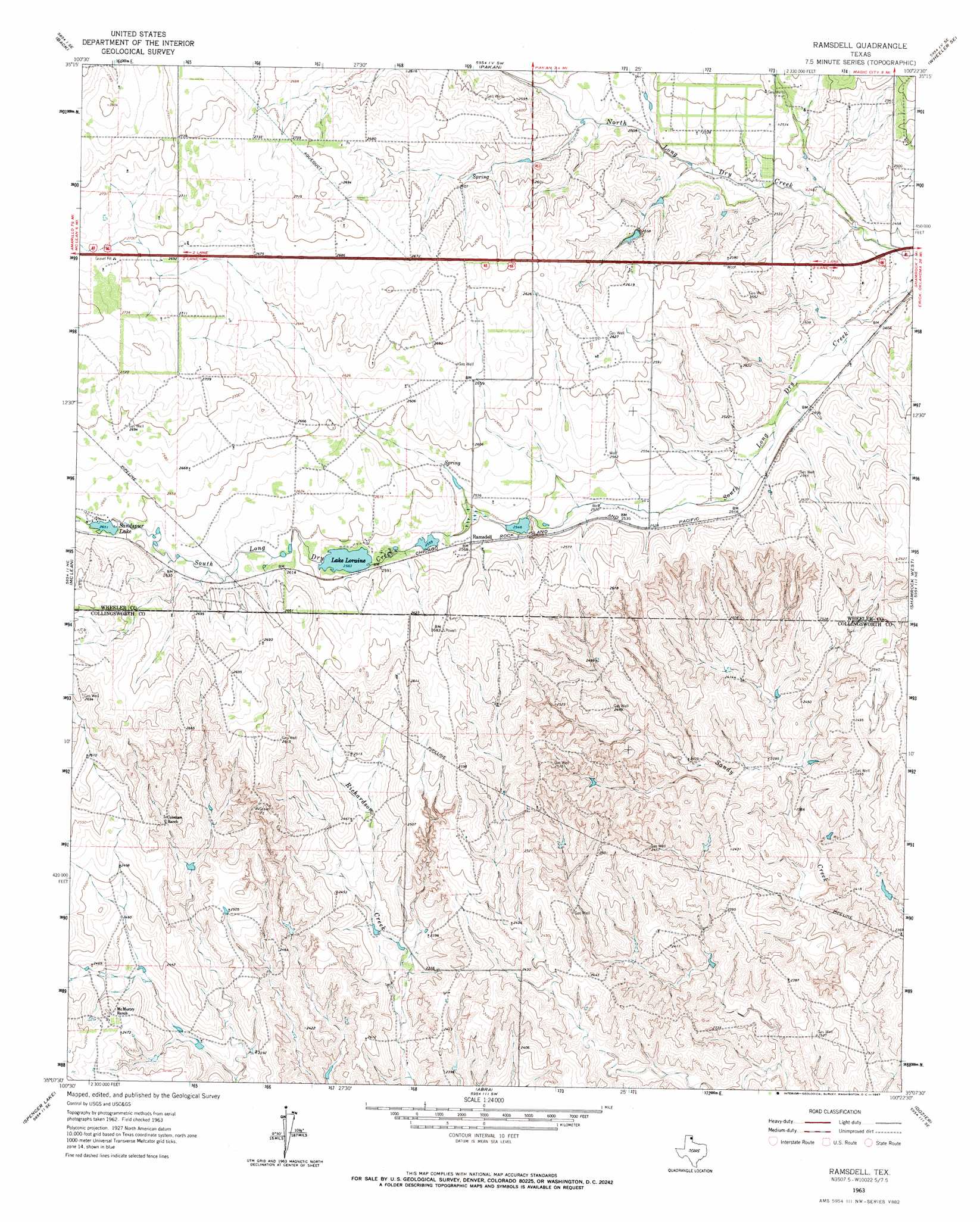
Ramsdell Topo Map Texas
To zoom in, hover over the map of Ramsdell
USGS Topo Quad 35100b4 - 1:24,000 scale
| Topo Map Name: | Ramsdell |
| USGS Topo Quad ID: | 35100b4 |
| Print Size: | ca. 21 1/4" wide x 27" high |
| Southeast Coordinates: | 35.125° N latitude / 100.375° W longitude |
| Map Center Coordinates: | 35.1875° N latitude / 100.4375° W longitude |
| U.S. State: | TX |
| Filename: | o35100b4.jpg |
| Download Map JPG Image: | Ramsdell topo map 1:24,000 scale |
| Map Type: | Topographic |
| Topo Series: | 7.5´ |
| Map Scale: | 1:24,000 |
| Source of Map Images: | United States Geological Survey (USGS) |
| Alternate Map Versions: |
Ramsdell TX 1963, updated 1967 Download PDF Buy paper map Ramsdell TX 2010 Download PDF Buy paper map Ramsdell TX 2012 Download PDF Buy paper map Ramsdell TX 2016 Download PDF Buy paper map |
1:24,000 Topo Quads surrounding Ramsdell
Pond Creek Nw |
Pond Creek |
Spring Creek |
Wheeler |
Kelton Nw |
Hudgens Ranch |
Back |
Pakan |
Wheeler Se |
Twitty |
Alanreed |
Mclean |
Ramsdell |
Shamrock West |
Shamrock East |
Troublesome Creek |
Spencer Lake |
Abra |
Dozier |
Lutie |
Lelia Lake Creek |
Mcknight |
Quail |
Rolla Ne |
Wellington Nw |
> Back to 35100a1 at 1:100,000 scale
> Back to 35100a1 at 1:250,000 scale
> Back to U.S. Topo Maps home
Ramsdell topo map: Gazetteer
Ramsdell: Dams
Lake Loraine Dam elevation 791m 2595′Sandspur Club Lake Dam elevation 808m 2650′
Ramsdell: Populated Places
Ramsdell elevation 782m 2565′Ramsdell: Reservoirs
Lake Loraine elevation 787m 2582′Sandspru Lake elevation 808m 2650′
Sandspur Club Lake elevation 808m 2650′
Ramsdell digital topo map on disk
Buy this Ramsdell topo map showing relief, roads, GPS coordinates and other geographical features, as a high-resolution digital map file on DVD: