Beautiful Valley Well Topo Map Arizona
To zoom in, hover over the map of Beautiful Valley Well
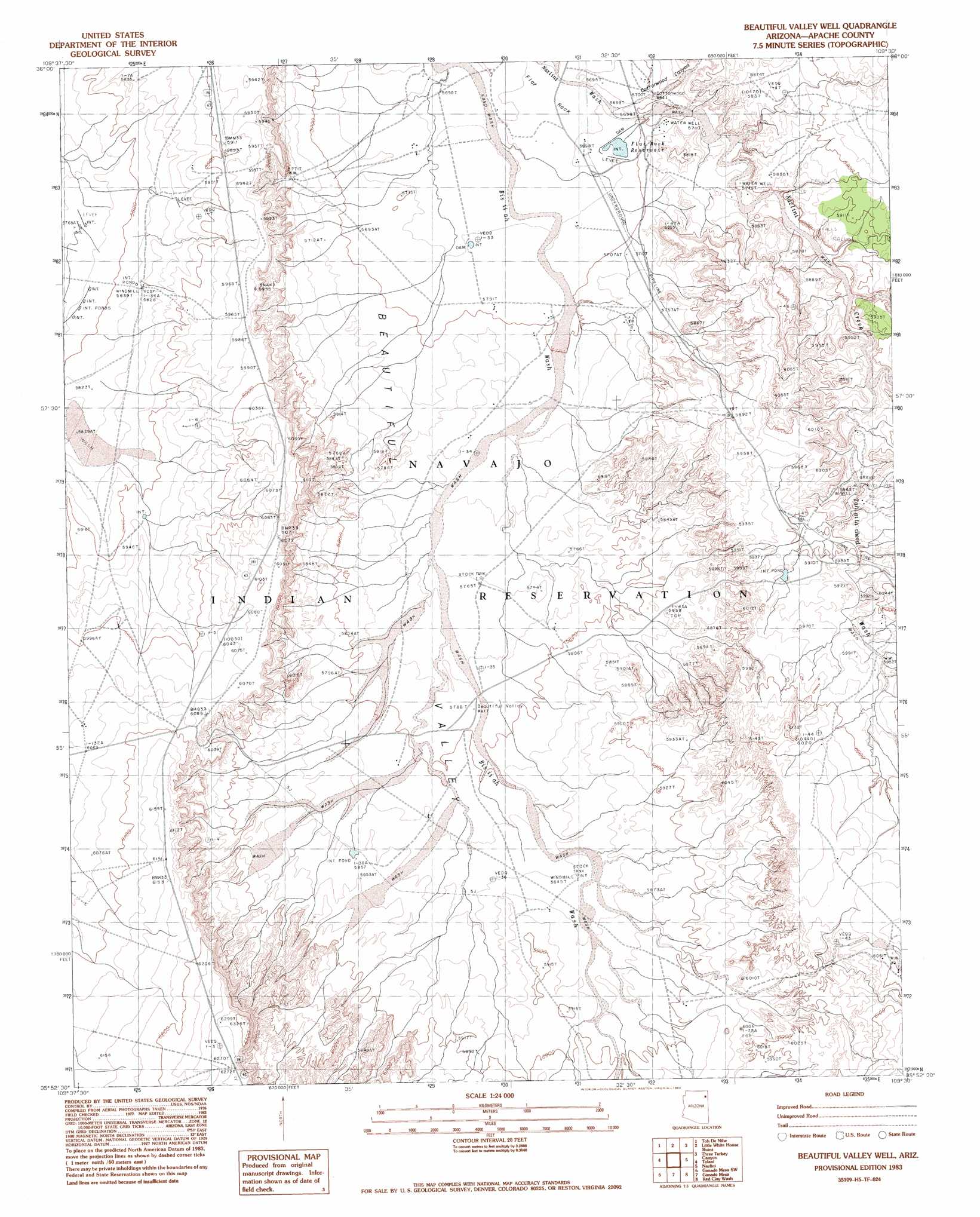
USGS Topo Quad 35109h5 - 1:24,000 scale
| Topo Map Name: | Beautiful Valley Well |
| USGS Topo Quad ID: | 35109h5 |
| Print Size: | ca. 21 1/4" wide x 27" high |
| Southeast Coordinates: | 35.875° N latitude / 109.5° W longitude |
| Map Center Coordinates: | 35.9375° N latitude / 109.5625° W longitude |
| U.S. State: | AZ |
| Filename: | o35109h5.jpg |
| Download Map JPG Image: | Beautiful Valley Well topo map 1:24,000 scale |
| Map Type: | Topographic |
| Topo Series: | 7.5´ |
| Map Scale: | 1:24,000 |
| Source of Map Images: | United States Geological Survey (USGS) |
| Alternate Map Versions: |
Ganado 1 NE AZ 1955, updated 1962 Download PDF Buy paper map Beautiful Valley Well AZ 1983, updated 1983 Download PDF Buy paper map Beautiful Valley Well AZ 2011 Download PDF Buy paper map Beautiful Valley Well AZ 2014 Download PDF Buy paper map |
1:24,000 Topo Quads surrounding Beautiful Valley Well
Lohali Point |
Ventana Mesa |
Chinle |
Del Merto |
Mummy Cave Ruins |
Salina |
Toh De Niihe |
Little White House Ruins |
Three Turkey Canyon |
Spider Rock |
Steamboat Rock Ne |
Tolani |
Beautiful Valley Well |
Nazlini |
White Rock Wash |
Steamboat Rock |
Ganado Mesa Sw |
Ganado Mesa |
Red Clay Wash |
Oak Creek Mountain |
Steamboat Canyon |
Cornfields |
Ganado |
Kinlichee |
East Of Kinlichee |
> Back to 35109e1 at 1:100,000 scale
> Back to 35108a1 at 1:250,000 scale
> Back to U.S. Topo Maps home
Beautiful Valley Well topo map: Gazetteer
Beautiful Valley Well: Areas
Petrified Forest elevation 1775m 5823′Beautiful Valley Well: Reservoirs
Flat Rock Reservoir elevation 1734m 5688′Beautiful Valley Well: Streams
Bis Ii Ah Wash elevation 1799m 5902′Nazlini Creek elevation 1732m 5682′
Beautiful Valley Well: Valleys
Cottonwood Canyon elevation 1738m 5702′Tah-aith-cheed Wash elevation 1767m 5797′
Beautiful Valley Well: Wells
Beautiful Valley Well elevation 1765m 5790′Cottonwood Well elevation 1738m 5702′
Beautiful Valley Well digital topo map on disk
Buy this Beautiful Valley Well topo map showing relief, roads, GPS coordinates and other geographical features, as a high-resolution digital map file on DVD: