South Butte Topo Map Arizona
To zoom in, hover over the map of South Butte
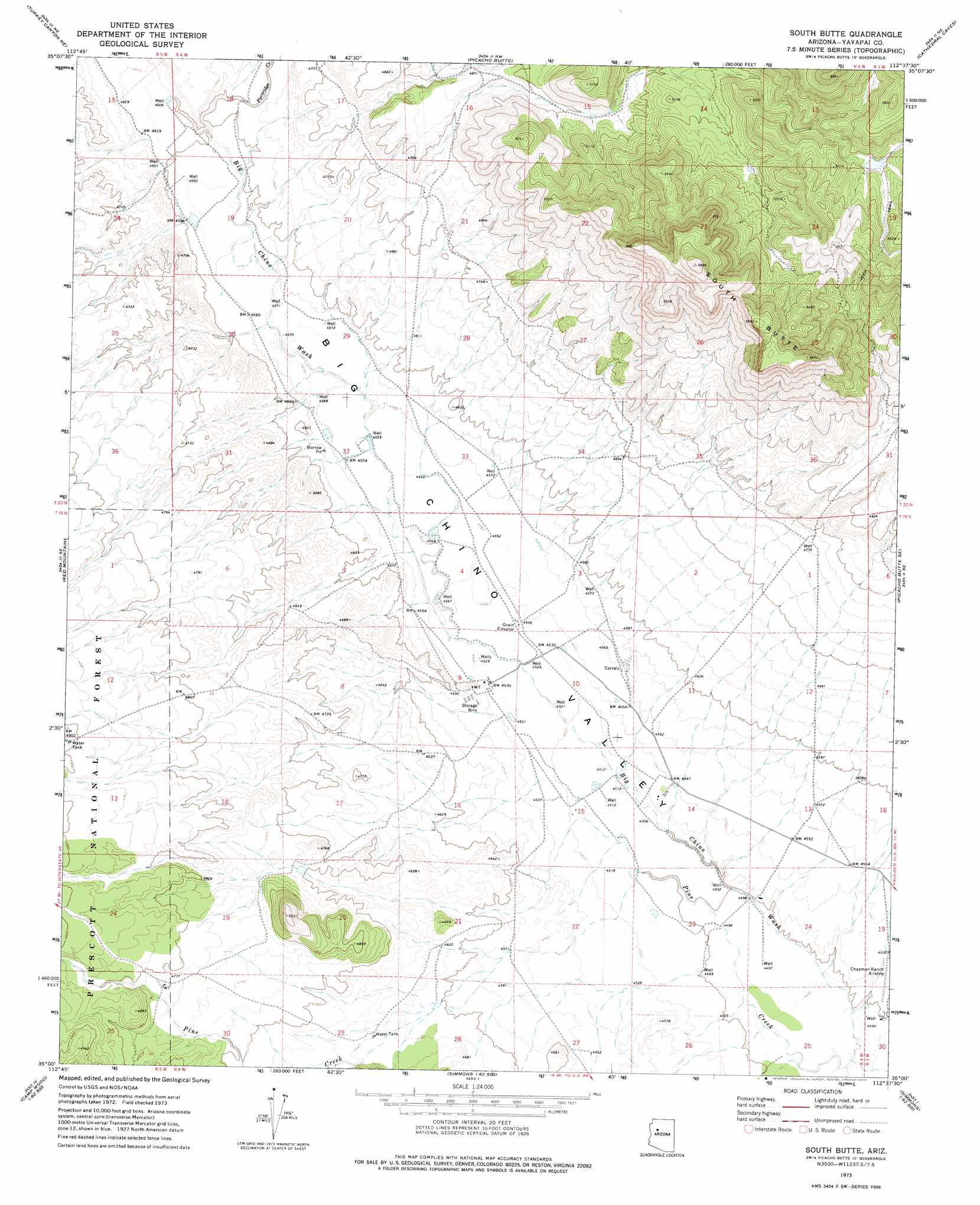
USGS Topo Quad 35112a6 - 1:24,000 scale
| Topo Map Name: | South Butte |
| USGS Topo Quad ID: | 35112a6 |
| Print Size: | ca. 21 1/4" wide x 27" high |
| Southeast Coordinates: | 35° N latitude / 112.625° W longitude |
| Map Center Coordinates: | 35.0625° N latitude / 112.6875° W longitude |
| U.S. State: | AZ |
| Filename: | o35112a6.jpg |
| Download Map JPG Image: | South Butte topo map 1:24,000 scale |
| Map Type: | Topographic |
| Topo Series: | 7.5´ |
| Map Scale: | 1:24,000 |
| Source of Map Images: | United States Geological Survey (USGS) |
| Alternate Map Versions: |
South Butte AZ 1973, updated 1976 Download PDF Buy paper map South Butte AZ 2012 Download PDF Buy paper map South Butte AZ 2014 Download PDF Buy paper map |
| FStopo: | US Forest Service topo South Butte is available: Download FStopo PDF Download FStopo TIF |
1:24,000 Topo Quads surrounding South Butte
Seligman West |
Seligman East |
Crookton |
Horse Trap Mesa |
Fitzgerald Hill |
Purcell Canyon |
Turkey Canyon Ne |
Picacho Butte |
Cathedral Caves |
Ash Fork |
Turkey Canyon |
Red Mountain |
South Butte |
Picacho Butte Se |
Meath Spring |
Juniper Mountains |
Indian Peak |
Limestone Peak |
Wineglass Ranch |
Paulden |
Camp Wood |
Seepage Mountain |
Simmons |
Sullivan Buttes |
Chino Valley North |
> Back to 35112a1 at 1:100,000 scale
> Back to 35112a1 at 1:250,000 scale
> Back to U.S. Topo Maps home
South Butte topo map: Gazetteer
South Butte: Airports
Chapman Ranch Airstrip elevation 1381m 4530′South Butte: Streams
Partridge Creek elevation 1400m 4593′South Butte: Summits
South Butte elevation 1826m 5990′South Butte digital topo map on disk
Buy this South Butte topo map showing relief, roads, GPS coordinates and other geographical features, as a high-resolution digital map file on DVD: