Limestone Peak Topo Map Arizona
To zoom in, hover over the map of Limestone Peak
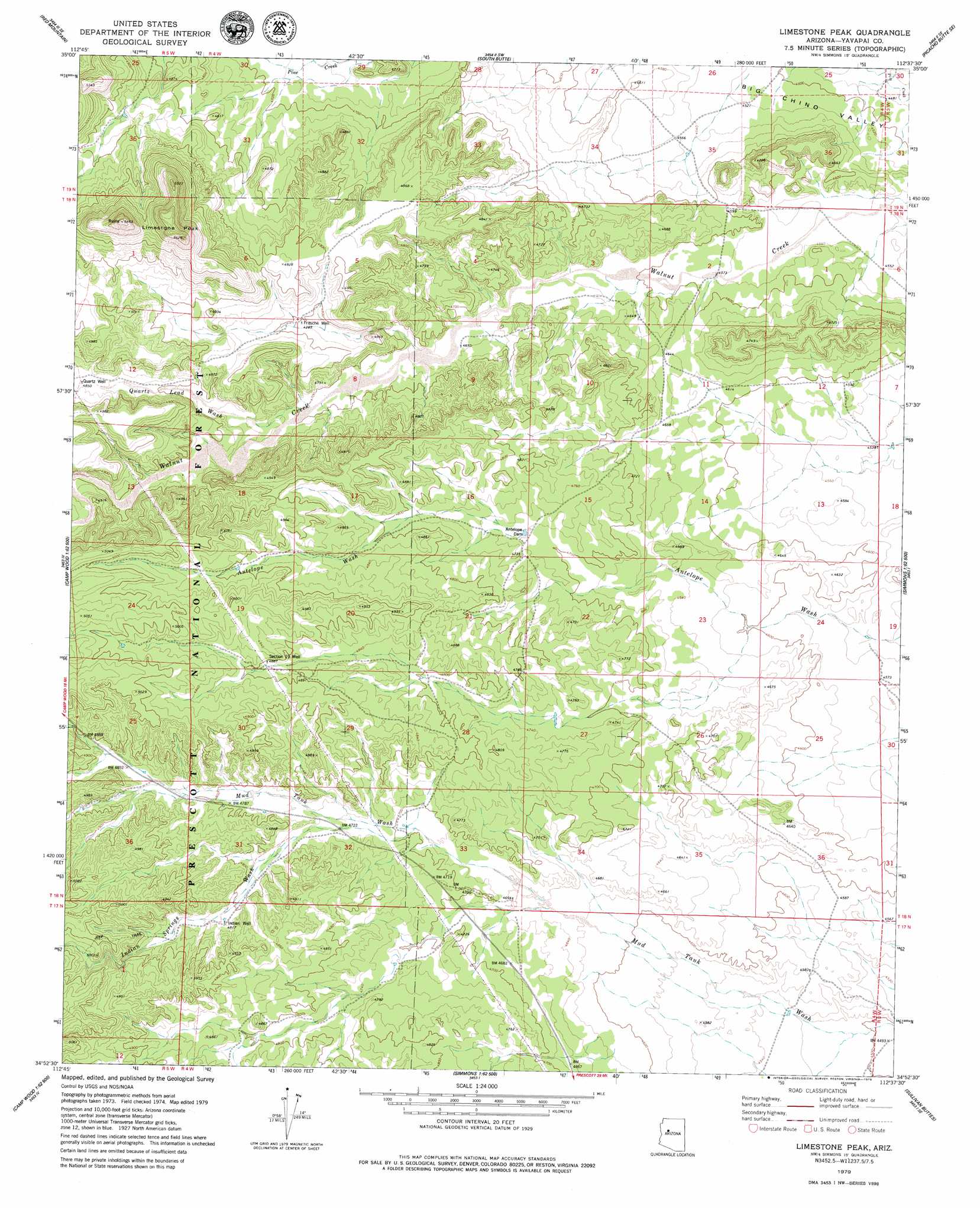
USGS Topo Quad 34112h6 - 1:24,000 scale
| Topo Map Name: | Limestone Peak |
| USGS Topo Quad ID: | 34112h6 |
| Print Size: | ca. 21 1/4" wide x 27" high |
| Southeast Coordinates: | 34.875° N latitude / 112.625° W longitude |
| Map Center Coordinates: | 34.9375° N latitude / 112.6875° W longitude |
| U.S. State: | AZ |
| Filename: | o34112h6.jpg |
| Download Map JPG Image: | Limestone Peak topo map 1:24,000 scale |
| Map Type: | Topographic |
| Topo Series: | 7.5´ |
| Map Scale: | 1:24,000 |
| Source of Map Images: | United States Geological Survey (USGS) |
| Alternate Map Versions: |
Limestone Peak AZ 1979, updated 1979 Download PDF Buy paper map Limestone Peak AZ 2012 Download PDF Buy paper map Limestone Peak AZ 2014 Download PDF Buy paper map |
| FStopo: | US Forest Service topo Limestone Peak is available: Download FStopo PDF Download FStopo TIF |
1:24,000 Topo Quads surrounding Limestone Peak
Purcell Canyon |
Turkey Canyon Ne |
Picacho Butte |
Cathedral Caves |
Ash Fork |
Turkey Canyon |
Red Mountain |
South Butte |
Picacho Butte Se |
Meath Spring |
Juniper Mountains |
Indian Peak |
Limestone Peak |
Wineglass Ranch |
Paulden |
Camp Wood |
Seepage Mountain |
Simmons |
Sullivan Buttes |
Chino Valley North |
Sheridan Mountain |
Smith Mesa |
Mount Josh |
Jerome Canyon |
Chino Valley South |
> Back to 34112e1 at 1:100,000 scale
> Back to 34112a1 at 1:250,000 scale
> Back to U.S. Topo Maps home
Limestone Peak topo map: Gazetteer
Limestone Peak: Areas
The Sinks elevation 1526m 5006′Limestone Peak: Dams
Antelope Dam elevation 1440m 4724′Limestone Peak: Reservoirs
Sampson Tank elevation 1512m 4960′Limestone Peak: Streams
Indian Springs Wash elevation 1432m 4698′Quartz Lead Wash elevation 1444m 4737′
Limestone Peak: Summits
Limestone Peak elevation 1649m 5410′Limestone Peak: Valleys
Aztec Pass elevation 1397m 4583′Limestone Peak: Wells
Fritsche Well elevation 1461m 4793′Indian Well elevation 1469m 4819′
Quartz Well elevation 1482m 4862′
Section Nineteen Well elevation 1491m 4891′
Limestone Peak digital topo map on disk
Buy this Limestone Peak topo map showing relief, roads, GPS coordinates and other geographical features, as a high-resolution digital map file on DVD: