Center Hill Topo Map North Carolina
To zoom in, hover over the map of Center Hill
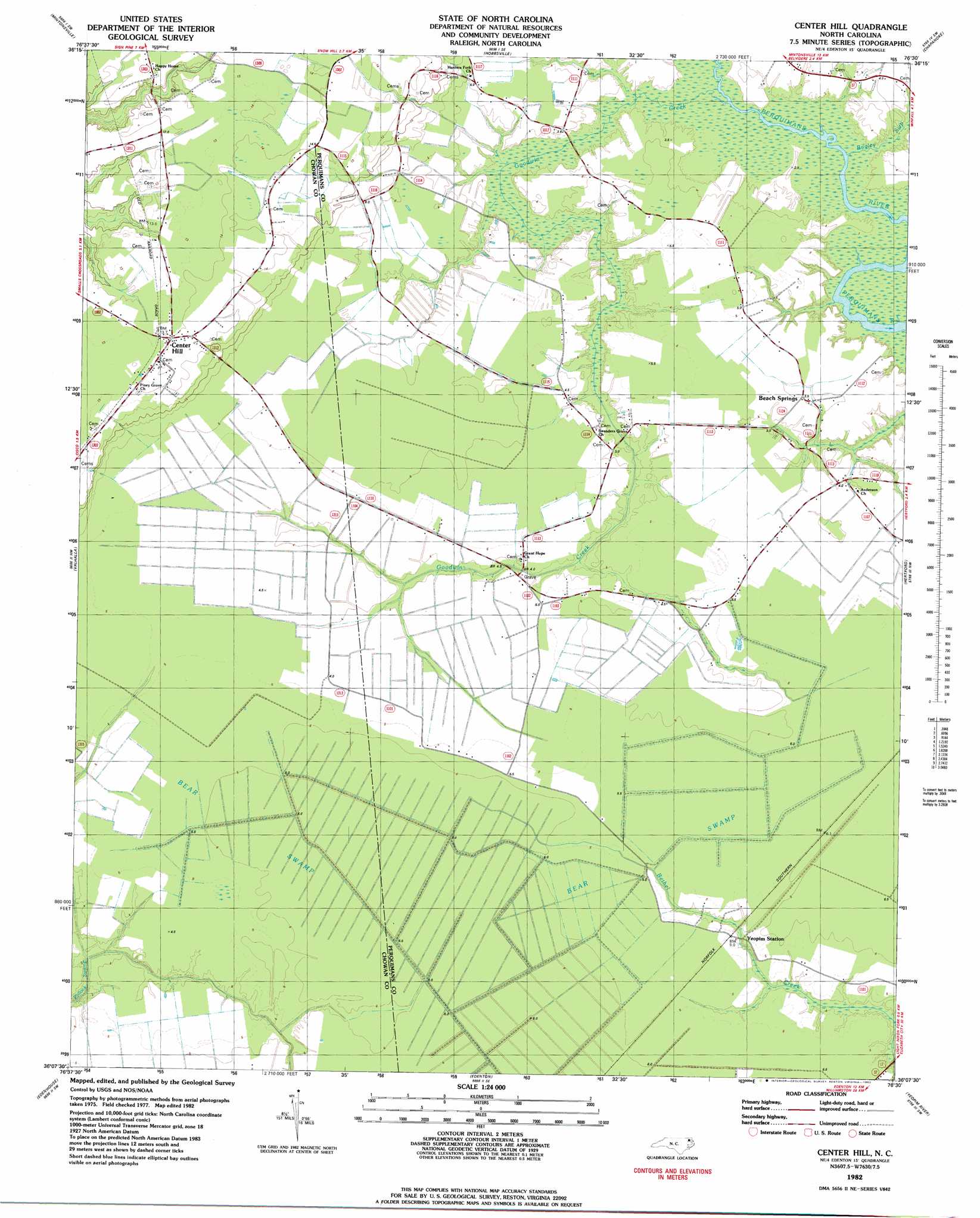
USGS Topo Quad 36076b5 - 1:24,000 scale
| Topo Map Name: | Center Hill |
| USGS Topo Quad ID: | 36076b5 |
| Print Size: | ca. 21 1/4" wide x 27" high |
| Southeast Coordinates: | 36.125° N latitude / 76.5° W longitude |
| Map Center Coordinates: | 36.1875° N latitude / 76.5625° W longitude |
| U.S. State: | NC |
| Filename: | o36076b5.jpg |
| Download Map JPG Image: | Center Hill topo map 1:24,000 scale |
| Map Type: | Topographic |
| Topo Series: | 7.5´ |
| Map Scale: | 1:24,000 |
| Source of Map Images: | United States Geological Survey (USGS) |
| Alternate Map Versions: |
Center Hill NC 1982, updated 1982 Download PDF Buy paper map Center Hill NC 1997, updated 2000 Download PDF Buy paper map Center Hill NC 2010 Download PDF Buy paper map Center Hill NC 2013 Download PDF Buy paper map Center Hill NC 2016 Download PDF Buy paper map |
1:24,000 Topo Quads surrounding Center Hill
Gatesville |
Merchants Millpond |
Sunbury |
Lynchs Corner |
South Mills |
Harrellsville |
Mintonsville |
Hobbsville |
Chapanoke |
Pasquotank |
Colerain |
Valhalla |
Center Hill |
Hertford |
Nixonton |
Merry Hill |
Edenhouse |
Edenton |
Yeopim River |
Harvey Neck |
Woodard |
Westover |
Roper North |
Leonards Point |
Columbia West |
> Back to 36076a1 at 1:100,000 scale
> Back to 36076a1 at 1:250,000 scale
> Back to U.S. Topo Maps home
Center Hill topo map: Gazetteer
Center Hill: Populated Places
Beach Springs elevation 3m 9′Center Hill elevation 14m 45′
Yeopim Station elevation 3m 9′
Center Hill: Post Offices
Tyner Post Office elevation 14m 45′Center Hill: Reservoirs
Goodings Millpond elevation 0m 0′Center Hill: Streams
Bagley Swamp elevation 0m 0′Goodwin Creek elevation 0m 0′
Center Hill: Swamps
Bear Swamp elevation 5m 16′Bear Swamp elevation 5m 16′
Center Hill digital topo map on disk
Buy this Center Hill topo map showing relief, roads, GPS coordinates and other geographical features, as a high-resolution digital map file on DVD:
Atlantic Coast (NY, NJ, PA, DE, MD, VA, NC)
Buy digital topo maps: Atlantic Coast (NY, NJ, PA, DE, MD, VA, NC)
 map DVD")