Choteau Nw Topo Map Oklahoma
To zoom in, hover over the map of Choteau Nw
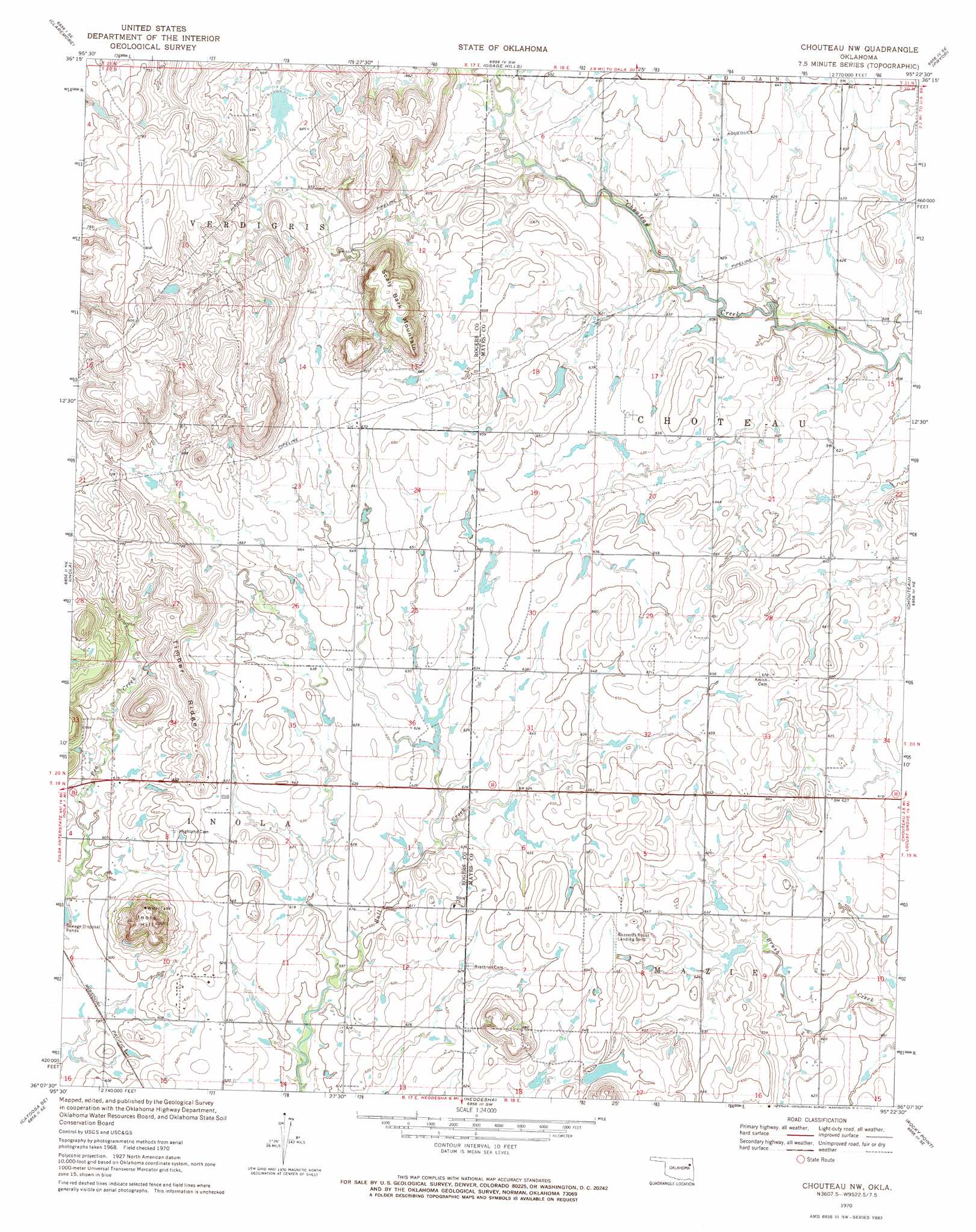
USGS Topo Quad 36095b4 - 1:24,000 scale
| Topo Map Name: | Choteau Nw |
| USGS Topo Quad ID: | 36095b4 |
| Print Size: | ca. 21 1/4" wide x 27" high |
| Southeast Coordinates: | 36.125° N latitude / 95.375° W longitude |
| Map Center Coordinates: | 36.1875° N latitude / 95.4375° W longitude |
| U.S. State: | OK |
| Filename: | o36095b4.jpg |
| Download Map JPG Image: | Choteau Nw topo map 1:24,000 scale |
| Map Type: | Topographic |
| Topo Series: | 7.5´ |
| Map Scale: | 1:24,000 |
| Source of Map Images: | United States Geological Survey (USGS) |
| Alternate Map Versions: |
Chouteau NW OK 1970, updated 1972 Download PDF Buy paper map Chouteau NW OK 2010 Download PDF Buy paper map Chouteau NW OK 2012 Download PDF Buy paper map Chouteau NW OK 2016 Download PDF Buy paper map |
1:24,000 Topo Quads surrounding Choteau Nw
Oologah |
Foyil |
Bushyhead |
Adair |
Strang |
Sageeyah |
Claremore |
Osage Hills |
Pryor |
Salina |
Catoosa |
Inola |
Choteau Nw |
Chouteau |
Locust Grove |
Oneta |
Catoosa Se |
Neodesha |
Rocky Point |
Cedar Crest |
Coweta |
Red Bird |
Wagoner West |
Wagoner East |
Hulbert |
> Back to 36095a1 at 1:100,000 scale
> Back to 36094a1 at 1:250,000 scale
> Back to U.S. Topo Maps home
Choteau Nw topo map: Gazetteer
Choteau Nw: Airports
Buzzards Roost Airport elevation 200m 656′Choteau Nw: Ridges
Timber Ridge elevation 226m 741′Choteau Nw: Summits
Inola Hill elevation 254m 833′Scaly Bark Mountain elevation 253m 830′
Choteau Nw digital topo map on disk
Buy this Choteau Nw topo map showing relief, roads, GPS coordinates and other geographical features, as a high-resolution digital map file on DVD: