Sleeping Bear Creek Nw Topo Map Oklahoma
To zoom in, hover over the map of Sleeping Bear Creek Nw
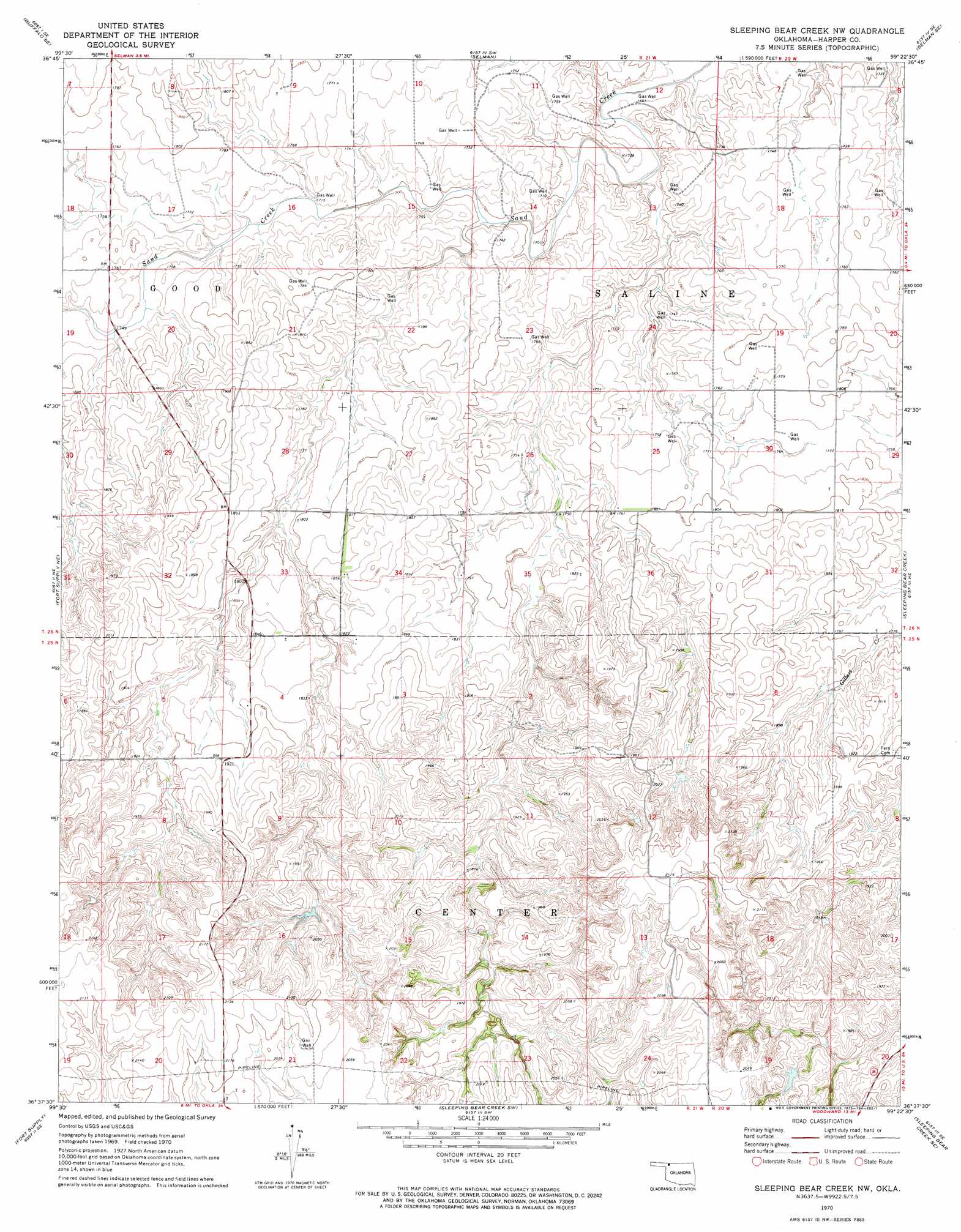
USGS Topo Quad 36099f4 - 1:24,000 scale
| Topo Map Name: | Sleeping Bear Creek Nw |
| USGS Topo Quad ID: | 36099f4 |
| Print Size: | ca. 21 1/4" wide x 27" high |
| Southeast Coordinates: | 36.625° N latitude / 99.375° W longitude |
| Map Center Coordinates: | 36.6875° N latitude / 99.4375° W longitude |
| U.S. State: | OK |
| Filename: | o36099f4.jpg |
| Download Map JPG Image: | Sleeping Bear Creek Nw topo map 1:24,000 scale |
| Map Type: | Topographic |
| Topo Series: | 7.5´ |
| Map Scale: | 1:24,000 |
| Source of Map Images: | United States Geological Survey (USGS) |
| Alternate Map Versions: |
Sleeping Bear Creek NW OK 1970, updated 1973 Download PDF Buy paper map Sleeping Bear Creek NW OK 2010 Download PDF Buy paper map Sleeping Bear Creek NW OK 2012 Download PDF Buy paper map Sleeping Bear Creek NW OK 2016 Download PDF Buy paper map |
1:24,000 Topo Quads surrounding Sleeping Bear Creek Nw
Buffalo Nw |
Buffalo Ne |
Selman Nw |
Lookout |
Freedom Nw |
Buffalo |
Buffalo Se |
Selman |
Selman Se |
Edith |
Fort Supply Nw |
Fort Supply Ne |
Sleeping Bear Creek Nw |
Sleeping Bear Creek |
Alabaster Caverns |
May East |
Fort Supply |
Sleeping Bear Creek Sw |
Sleeping Bear Creek Se |
Fairvalley Sw |
Fargo Nw |
Fargo |
Woodward |
Woodward Ne |
Mooreland |
> Back to 36099e1 at 1:100,000 scale
> Back to 36098a1 at 1:250,000 scale
> Back to U.S. Topo Maps home
Sleeping Bear Creek Nw topo map: Gazetteer
Sleeping Bear Creek Nw: Dams
Deweese Gp17 Dam elevation 598m 1961′Kinney 5 Dam elevation 623m 2043′
Kinney 6 Dam elevation 605m 1984′
Selman Gp1 Dam elevation 532m 1745′
Smith Gp6 Dam elevation 589m 1932′
Sleeping Bear Creek Nw: Reservoirs
Deweese Gp17 Reservoir elevation 598m 1961′Kinney 5 Reservoir elevation 623m 2043′
Kinney 6 Reservoir elevation 605m 1984′
Selman Gp1 Reservoir elevation 532m 1745′
Smith Gp6 Reservoir elevation 589m 1932′
Sleeping Bear Creek Nw digital topo map on disk
Buy this Sleeping Bear Creek Nw topo map showing relief, roads, GPS coordinates and other geographical features, as a high-resolution digital map file on DVD: