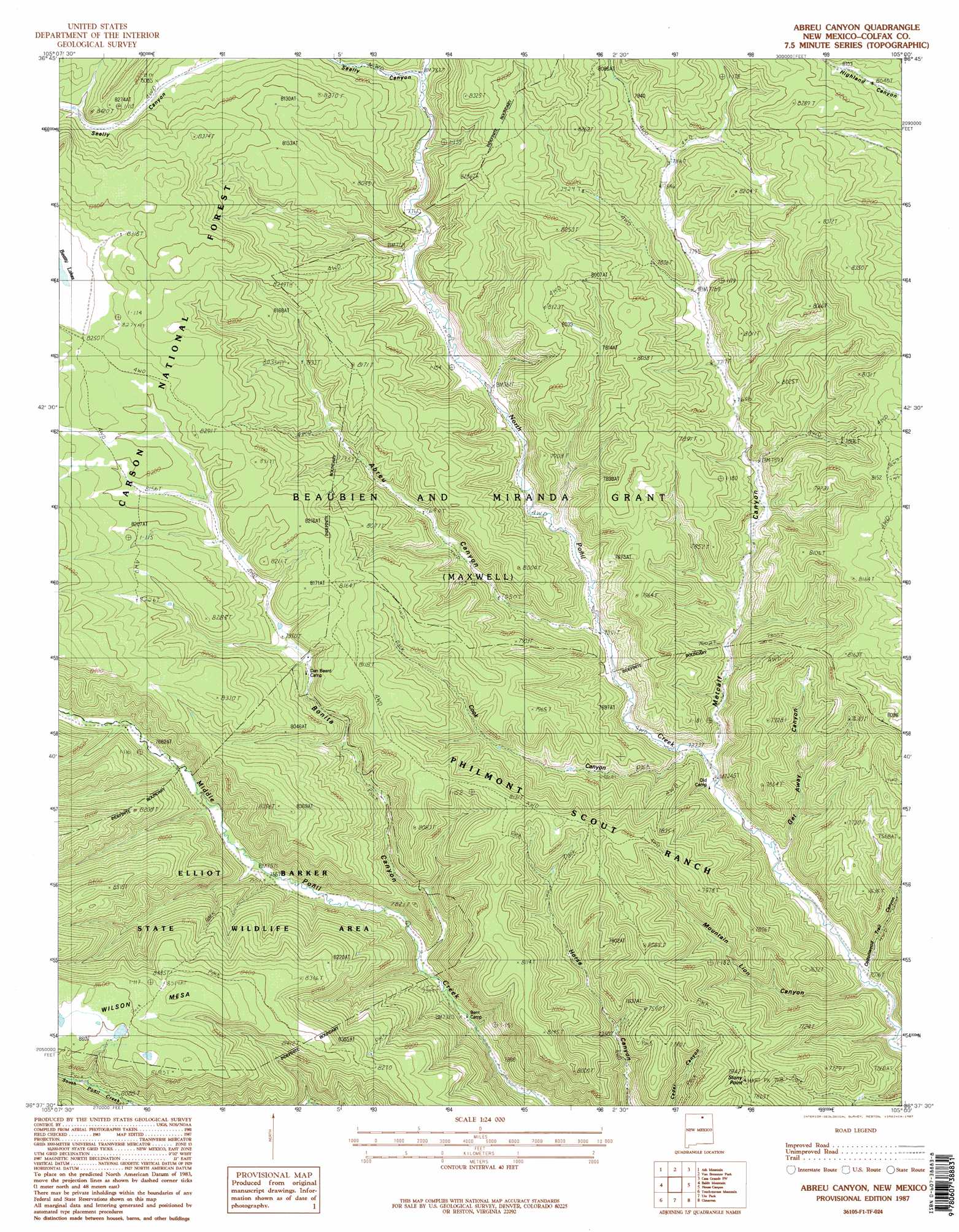
Abreu Canyon Topo Map New Mexico
To zoom in, hover over the map of Abreu Canyon
USGS Topo Quad 36105f1 - 1:24,000 scale
| Topo Map Name: | Abreu Canyon |
| USGS Topo Quad ID: | 36105f1 |
| Print Size: | ca. 21 1/4" wide x 27" high |
| Southeast Coordinates: | 36.625° N latitude / 105° W longitude |
| Map Center Coordinates: | 36.6875° N latitude / 105.0625° W longitude |
| U.S. State: | NM |
| Filename: | o36105f1.jpg |
| Download Map JPG Image: | Abreu Canyon topo map 1:24,000 scale |
| Map Type: | Topographic |
| Topo Series: | 7.5´ |
| Map Scale: | 1:24,000 |
| Source of Map Images: | United States Geological Survey (USGS) |
| Alternate Map Versions: |
Abreu Canyon NM 1987, updated 1987 Download PDF Buy paper map Abreu Canyon NM 1995, updated 1997 Download PDF Buy paper map Abreu Canyon NM 2011 Download PDF Buy paper map Abreu Canyon NM 2013 Download PDF Buy paper map |
| FStopo: | US Forest Service topo Abreu Canyon is available: Download FStopo PDF Download FStopo TIF |
1:24,000 Topo Quads surrounding Abreu Canyon
Big Costilla Peak |
The Wall |
Vermejo Park |
Casa Grande |
Caliente Canyon North |
Comanche Point |
Ash Mountain |
Van Bremmer Park |
Casa Grande Sw |
Caliente Canyon South |
Red River Pass |
Baldy Mountain |
Abreu Canyon |
House Canyon |
Dawson |
Eagle Nest |
Touch-Me-Not Mountain |
Ute Park |
Cimarron |
Cimarron Se |
Palo Flechado Pass |
Garcia Peak |
Tooth Of Time |
Coyote Mesa |
Miami Ne |
> Back to 36105e1 at 1:100,000 scale
> Back to 36104a1 at 1:250,000 scale
> Back to U.S. Topo Maps home
Abreu Canyon topo map: Gazetteer
Abreu Canyon: Parks
Elliot Barker State Wildlife Area elevation 2494m 8182′Abreu Canyon: Post Offices
Stern Post Office elevation 2295m 7529′Abreu Canyon: Summits
Stony Point elevation 2428m 7965′Wilson Mesa elevation 2627m 8618′
Abreu Canyon: Valleys
Abreu Canyon elevation 2256m 7401′Bonita Canyon elevation 2275m 7463′
Cook Canyon elevation 2221m 7286′
Cottonwood Trail Canyon elevation 2157m 7076′
Get Away Canyon elevation 2176m 7139′
Metcalf Canyon elevation 2213m 7260′
Mountain Lion Canyon elevation 2187m 7175′
Seally Canyon elevation 2385m 7824′
Abreu Canyon digital topo map on disk
Buy this Abreu Canyon topo map showing relief, roads, GPS coordinates and other geographical features, as a high-resolution digital map file on DVD: