Red Cornfield Mesa Topo Map Arizona
To zoom in, hover over the map of Red Cornfield Mesa
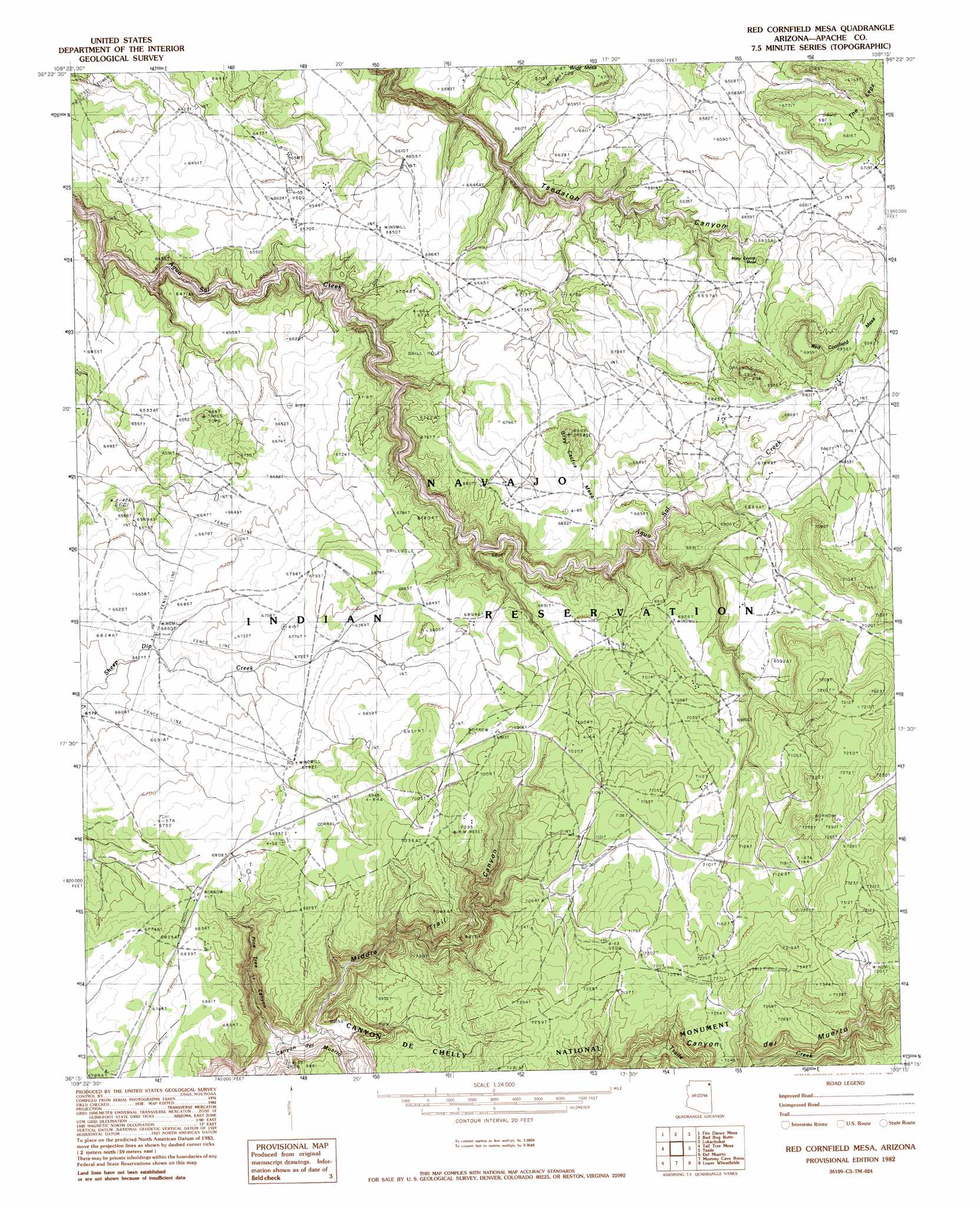
USGS Topo Quad 36109c3 - 1:24,000 scale
| Topo Map Name: | Red Cornfield Mesa |
| USGS Topo Quad ID: | 36109c3 |
| Print Size: | ca. 21 1/4" wide x 27" high |
| Southeast Coordinates: | 36.25° N latitude / 109.25° W longitude |
| Map Center Coordinates: | 36.3125° N latitude / 109.3125° W longitude |
| U.S. State: | AZ |
| Filename: | o36109c3.jpg |
| Download Map JPG Image: | Red Cornfield Mesa topo map 1:24,000 scale |
| Map Type: | Topographic |
| Topo Series: | 7.5´ |
| Map Scale: | 1:24,000 |
| Source of Map Images: | United States Geological Survey (USGS) |
| Alternate Map Versions: |
Sonsala Butte 2 SE AZ 1955, updated 1958 Download PDF Buy paper map Red Cornfield Mesa AZ 1982, updated 1982 Download PDF Buy paper map Red Cornfield Mesa AZ 2011 Download PDF Buy paper map Red Cornfield Mesa AZ 2014 Download PDF Buy paper map |
1:24,000 Topo Quads surrounding Red Cornfield Mesa
Little Round Rock |
Round Rock |
Mexican Cry Mesa |
Cove |
Red Valley |
Many Farms Ne |
Fire Dance Mesa |
Bad Bug Butte |
Lukachukai |
Roof Butte |
Many Farms |
Tall Tree Mesa |
Red Cornfield Mesa |
Tsaile |
Tsaile Butte |
Chinle |
Del Merto |
Mummy Cave Ruins |
Lower Wheatfields |
Upper Wheatfields |
Little White House Ruins |
Three Turkey Canyon |
Spider Rock |
White Clay |
Sonsela Buttes |
> Back to 36109a1 at 1:100,000 scale
> Back to 36108a1 at 1:250,000 scale
> Back to U.S. Topo Maps home
Red Cornfield Mesa topo map: Gazetteer
Red Cornfield Mesa: Summits
Gray Cactus Mesa elevation 2119m 6952′Many Coyote Mesa elevation 2049m 6722′
Red Cornfield Mesa elevation 2119m 6952′
The Legs elevation 2075m 6807′
Red Cornfield Mesa: Valleys
Middle Trail Canyon elevation 1891m 6204′Pine Tree Canyon elevation 1885m 6184′
Red Cornfield Mesa digital topo map on disk
Buy this Red Cornfield Mesa topo map showing relief, roads, GPS coordinates and other geographical features, as a high-resolution digital map file on DVD: