Bad Bug Butte Topo Map Arizona
To zoom in, hover over the map of Bad Bug Butte
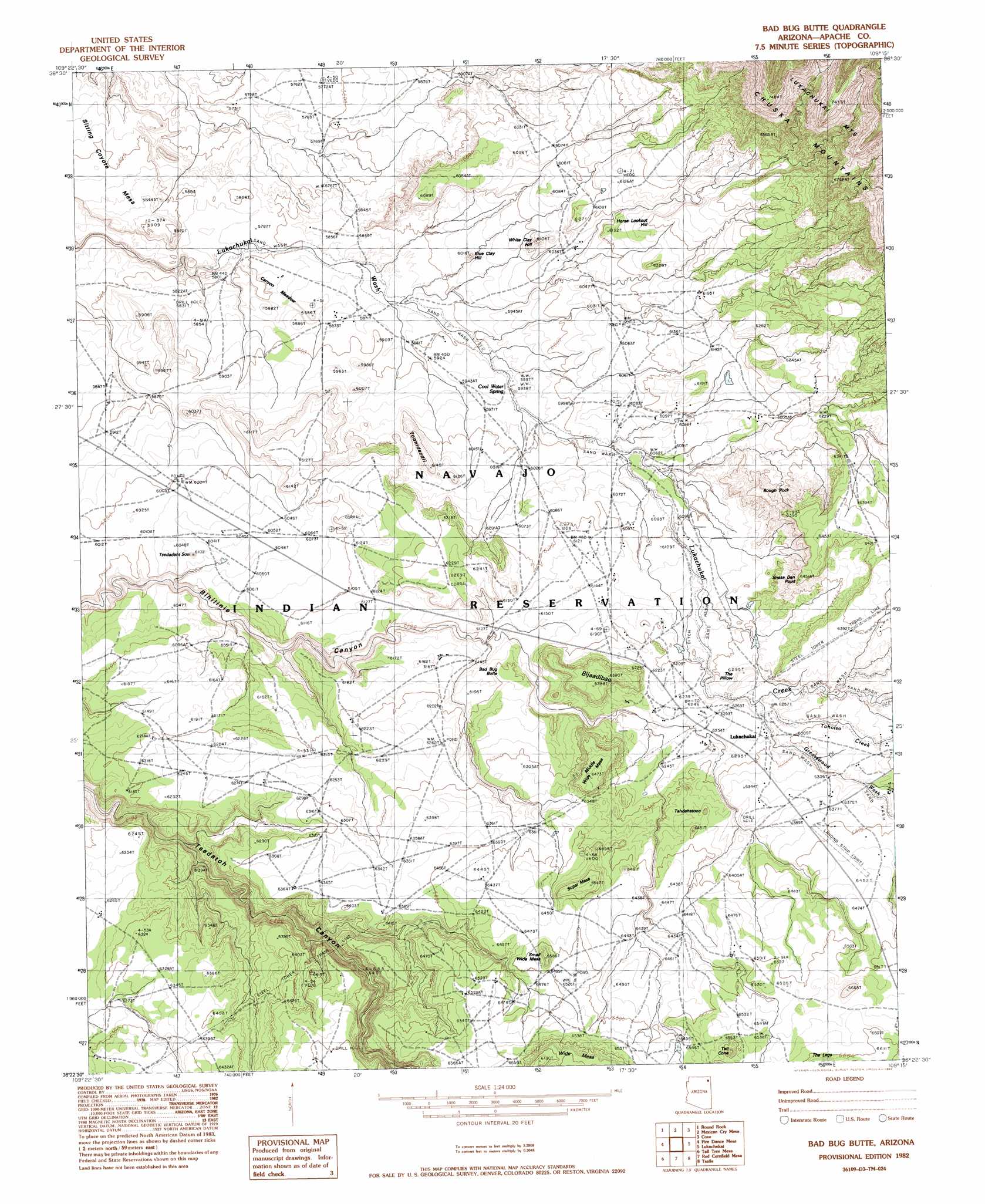
USGS Topo Quad 36109d3 - 1:24,000 scale
| Topo Map Name: | Bad Bug Butte |
| USGS Topo Quad ID: | 36109d3 |
| Print Size: | ca. 21 1/4" wide x 27" high |
| Southeast Coordinates: | 36.375° N latitude / 109.25° W longitude |
| Map Center Coordinates: | 36.4375° N latitude / 109.3125° W longitude |
| U.S. State: | AZ |
| Filename: | o36109d3.jpg |
| Download Map JPG Image: | Bad Bug Butte topo map 1:24,000 scale |
| Map Type: | Topographic |
| Topo Series: | 7.5´ |
| Map Scale: | 1:24,000 |
| Source of Map Images: | United States Geological Survey (USGS) |
| Alternate Map Versions: |
Sonsala Butte 2 NE AZ 1955, updated 1958 Download PDF Buy paper map Bad Bug Butte AZ 1982, updated 1982 Download PDF Buy paper map Bad Bug Butte AZ 2011 Download PDF Buy paper map Bad Bug Butte AZ 2014 Download PDF Buy paper map |
1:24,000 Topo Quads surrounding Bad Bug Butte
Dancing Rocks |
White Area Canyon |
Kinusta Mesa |
Boiling Over Well |
Horse Mesa |
Little Round Rock |
Round Rock |
Mexican Cry Mesa |
Cove |
Red Valley |
Many Farms Ne |
Fire Dance Mesa |
Bad Bug Butte |
Lukachukai |
Roof Butte |
Many Farms |
Tall Tree Mesa |
Red Cornfield Mesa |
Tsaile |
Tsaile Butte |
Chinle |
Del Merto |
Mummy Cave Ruins |
Lower Wheatfields |
Upper Wheatfields |
> Back to 36109a1 at 1:100,000 scale
> Back to 36108a1 at 1:250,000 scale
> Back to U.S. Topo Maps home
Bad Bug Butte topo map: Gazetteer
Bad Bug Butte: Airports
Lukachukai Airport elevation 1957m 6420′Bad Bug Butte: Capes
The Pillow elevation 1893m 6210′Bad Bug Butte: Cliffs
Snake Den Point elevation 1967m 6453′Bad Bug Butte: Flats
Canyon Meadow elevation 1772m 5813′Bad Bug Butte: Pillars
Rough Rock elevation 1889m 6197′Bad Bug Butte: Springs
Cool Water Spring elevation 1811m 5941′Bad Bug Butte: Streams
Greasewood Wash elevation 1913m 6276′Tohotso Creek elevation 1903m 6243′
Bad Bug Butte: Summits
Bad Bug Butte elevation 1888m 6194′Bijaadibae elevation 1947m 6387′
Blue Clay Hill elevation 1811m 5941′
Horse Lookout Hill elevation 1867m 6125′
Middle Wide Mesa elevation 1973m 6473′
Sitting Coyote Mesa elevation 1773m 5816′
Small Wide Mesa elevation 1992m 6535′
Supai Mesa elevation 1969m 6459′
Tahdahatooc elevation 1933m 6341′
Tall Cone elevation 2046m 6712′
Toohidazdii elevation 1825m 5987′
Tsedadahot Sosi elevation 1859m 6099′
White Clay Hill elevation 1841m 6040′
Wide Mesa elevation 2041m 6696′
Bad Bug Butte digital topo map on disk
Buy this Bad Bug Butte topo map showing relief, roads, GPS coordinates and other geographical features, as a high-resolution digital map file on DVD: