Mexican Water Topo Map Arizona
To zoom in, hover over the map of Mexican Water
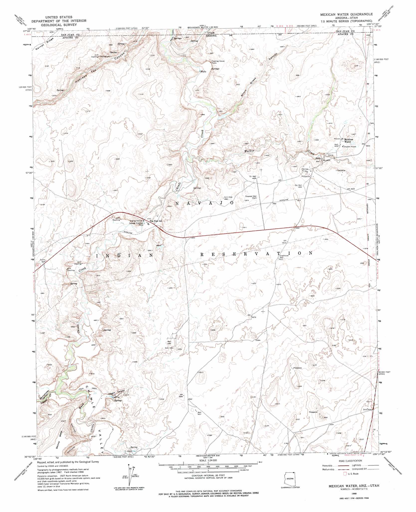
USGS Topo Quad 36109h6 - 1:24,000 scale
| Topo Map Name: | Mexican Water |
| USGS Topo Quad ID: | 36109h6 |
| Print Size: | ca. 21 1/4" wide x 27" high |
| Southeast Coordinates: | 36.875° N latitude / 109.625° W longitude |
| Map Center Coordinates: | 36.9375° N latitude / 109.6875° W longitude |
| U.S. States: | AZ, UT |
| Filename: | o36109h6.jpg |
| Download Map JPG Image: | Mexican Water topo map 1:24,000 scale |
| Map Type: | Topographic |
| Topo Series: | 7.5´ |
| Map Scale: | 1:24,000 |
| Source of Map Images: | United States Geological Survey (USGS) |
| Alternate Map Versions: |
Mexican Water AZ 1968, updated 1971 Download PDF Buy paper map Mexican Water AZ 1968, updated 1978 Download PDF Buy paper map Mexican Water AZ 2011 Download PDF Buy paper map Mexican Water AZ 2011 Download PDF Buy paper map Mexican Water AZ 2014 Download PDF Buy paper map |
1:24,000 Topo Quads surrounding Mexican Water
The Goosenecks |
Mexican Hat |
San Juan Hill |
White Rock Point |
Hogan Mesa |
Mexican Hat Sw |
Mexican Hat Se |
Moses Rock |
Boundary Butte |
Gray Spot Rock |
Rooster Rock |
Garnet Ridge |
Mexican Water |
Walker Creek Reservoir |
Toh Atin Mesa West |
Red Point |
Dennehotso |
Mexican Water Sw |
Hogansaani Spring |
Walker Butte |
Red Point Mesa |
Tall Mesa |
Rock Point |
Dancing Rocks |
White Area Canyon |
> Back to 36109e1 at 1:100,000 scale
> Back to 36108a1 at 1:250,000 scale
> Back to U.S. Topo Maps home
Mexican Water topo map: Gazetteer
Mexican Water: Arroyos
Chinle Wash elevation 1455m 4773′Mexican Water: Populated Places
Mexican Water elevation 1476m 4842′Tes Nez Iah elevation 1448m 4750′
Mexican Water: Streams
Laguña Creek elevation 1455m 4773′Walker Creek elevation 1430m 4691′
Mexican Water: Valleys
Dennehotso Canyon elevation 1455m 4773′Hosteen Tso Canyon elevation 1415m 4642′
Short Grass Canyon elevation 0m 0′
Wagon Canyon elevation 1473m 4832′
Mexican Water: Wells
Greyhouse Well elevation 1504m 4934′Mexican Water digital topo map on disk
Buy this Mexican Water topo map showing relief, roads, GPS coordinates and other geographical features, as a high-resolution digital map file on DVD: