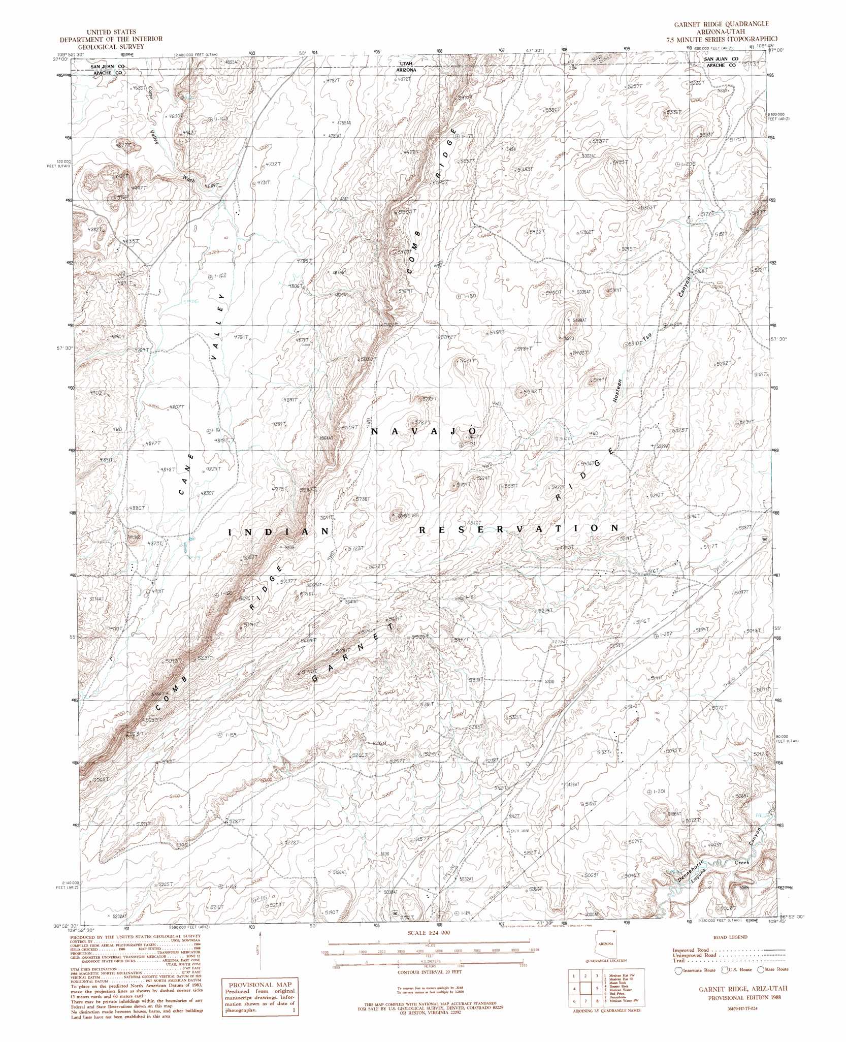
Garnet Ridge Topo Map Arizona
To zoom in, hover over the map of Garnet Ridge
USGS Topo Quad 36109h7 - 1:24,000 scale
| Topo Map Name: | Garnet Ridge |
| USGS Topo Quad ID: | 36109h7 |
| Print Size: | ca. 21 1/4" wide x 27" high |
| Southeast Coordinates: | 36.875° N latitude / 109.75° W longitude |
| Map Center Coordinates: | 36.9375° N latitude / 109.8125° W longitude |
| U.S. States: | AZ, UT |
| Filename: | o36109h7.jpg |
| Download Map JPG Image: | Garnet Ridge topo map 1:24,000 scale |
| Map Type: | Topographic |
| Topo Series: | 7.5´ |
| Map Scale: | 1:24,000 |
| Source of Map Images: | United States Geological Survey (USGS) |
| Alternate Map Versions: |
Setsiltso Springs 2 NE AZ 1952, updated 1954 Download PDF Buy paper map Garnet Ridge AZ 1988, updated 1988 Download PDF Buy paper map Garnet Ridge AZ 2011 Download PDF Buy paper map Garnet Ridge AZ 2011 Download PDF Buy paper map Garnet Ridge AZ 2014 Download PDF Buy paper map |
1:24,000 Topo Quads surrounding Garnet Ridge
Goulding Ne |
The Goosenecks |
Mexican Hat |
San Juan Hill |
White Rock Point |
Monument Pass |
Mexican Hat Sw |
Mexican Hat Se |
Moses Rock |
Boundary Butte |
Mitten Buttes |
Rooster Rock |
Garnet Ridge |
Mexican Water |
Walker Creek Reservoir |
Baby Rocks |
Red Point |
Dennehotso |
Mexican Water Sw |
Hogansaani Spring |
Church Rock |
Red Point Mesa |
Tall Mesa |
Rock Point |
Dancing Rocks |
> Back to 36109e1 at 1:100,000 scale
> Back to 36108a1 at 1:250,000 scale
> Back to U.S. Topo Maps home
Garnet Ridge topo map: Gazetteer
Garnet Ridge: Streams
Cane Valley elevation 1427m 4681′Hosteen Tso Wash elevation 1521m 4990′
Garnet Ridge digital topo map on disk
Buy this Garnet Ridge topo map showing relief, roads, GPS coordinates and other geographical features, as a high-resolution digital map file on DVD: