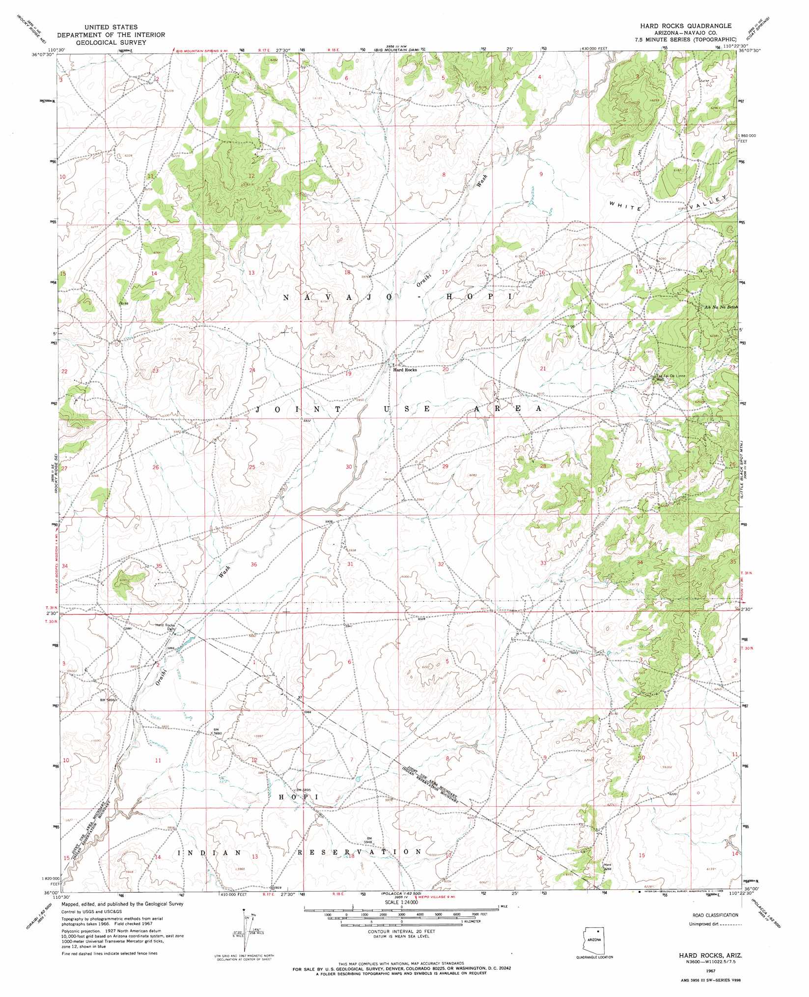
Hard Rocks Topo Map Arizona
To zoom in, hover over the map of Hard Rocks
USGS Topo Quad 36110a4 - 1:24,000 scale
| Topo Map Name: | Hard Rocks |
| USGS Topo Quad ID: | 36110a4 |
| Print Size: | ca. 21 1/4" wide x 27" high |
| Southeast Coordinates: | 36° N latitude / 110.375° W longitude |
| Map Center Coordinates: | 36.0625° N latitude / 110.4375° W longitude |
| U.S. State: | AZ |
| Filename: | o36110a4.jpg |
| Download Map JPG Image: | Hard Rocks topo map 1:24,000 scale |
| Map Type: | Topographic |
| Topo Series: | 7.5´ |
| Map Scale: | 1:24,000 |
| Source of Map Images: | United States Geological Survey (USGS) |
| Alternate Map Versions: |
Hard Rocks AZ 1967, updated 1969 Download PDF Buy paper map Hard Rocks AZ 2011 Download PDF Buy paper map Hard Rocks AZ 2014 Download PDF Buy paper map |
1:24,000 Topo Quads surrounding Hard Rocks
Kydestea Spring |
Red Willow Spring |
Owl Valley |
Red Slide Peak |
Toh Ne Zhonnie Spring |
Rocky Ridge Nw |
Rocky Ridge Ne |
Big Mountain Dam |
Coat Spring |
Pinon Nw |
Rocky Ridge Sw |
Rocky Ridge Se |
Hard Rocks |
Little Black Spot Mountain |
Pinon |
Hotevilla |
Oraibi |
Onion Spring |
Wepo Village |
Echo Canyon |
Mount Beautiful |
Shongopovi |
Polacca |
Sun Altar |
Keams Canyon |
> Back to 36110a1 at 1:100,000 scale
> Back to 36110a1 at 1:250,000 scale
> Back to U.S. Topo Maps home
Hard Rocks topo map: Gazetteer
Hard Rocks: Dams
Hard Rocks Dam elevation 1788m 5866′Hard Rocks: Populated Places
Hard Rocks elevation 1811m 5941′Hard Rocks: Springs
Ah Na Na Betoh elevation 1896m 6220′Hard Rocks: Valleys
White Valley elevation 1836m 6023′Hard Rocks: Wells
Tse Tai De Linne Well elevation 1854m 6082′Hard Rocks digital topo map on disk
Buy this Hard Rocks topo map showing relief, roads, GPS coordinates and other geographical features, as a high-resolution digital map file on DVD: