Vulcans Throne Sw Topo Map Arizona
To zoom in, hover over the map of Vulcans Throne Sw
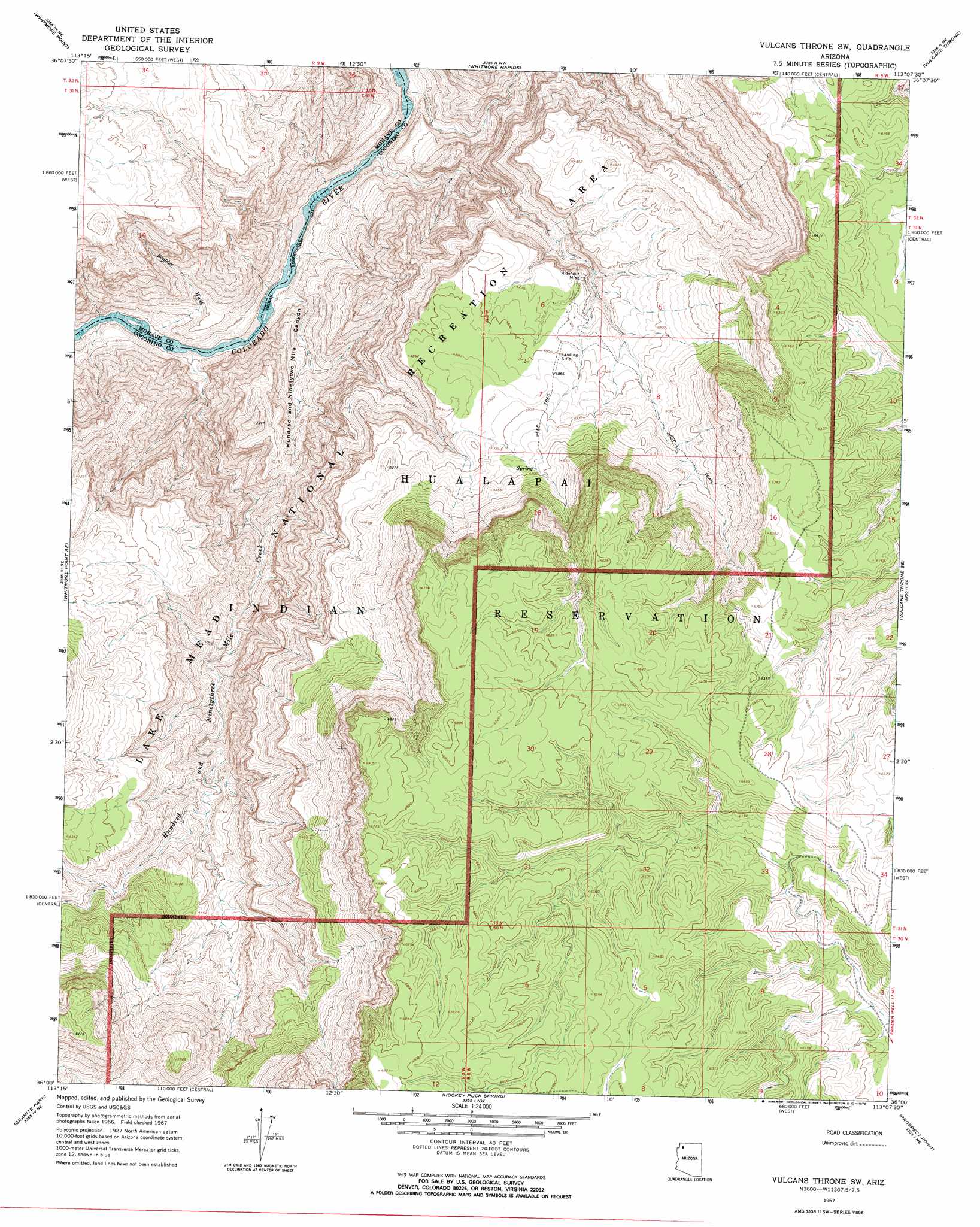
USGS Topo Quad 36113a2 - 1:24,000 scale
| Topo Map Name: | Vulcans Throne Sw |
| USGS Topo Quad ID: | 36113a2 |
| Print Size: | ca. 21 1/4" wide x 27" high |
| Southeast Coordinates: | 36° N latitude / 113.125° W longitude |
| Map Center Coordinates: | 36.0625° N latitude / 113.1875° W longitude |
| U.S. State: | AZ |
| Filename: | o36113a2.jpg |
| Download Map JPG Image: | Vulcans Throne Sw topo map 1:24,000 scale |
| Map Type: | Topographic |
| Topo Series: | 7.5´ |
| Map Scale: | 1:24,000 |
| Source of Map Images: | United States Geological Survey (USGS) |
| Alternate Map Versions: |
Vulcans Throne SW AZ 1967, updated 1970 Download PDF Buy paper map Vulcans Throne SW AZ 2011 Download PDF Buy paper map Vulcans Throne SW AZ 2014 Download PDF Buy paper map |
1:24,000 Topo Quads surrounding Vulcans Throne Sw
Grassy Mountain |
Cold Spring |
Mount Logan |
Mount Trumbull Se |
Fern Glen Canyon |
Yellow John Mountain |
Whitmore Point |
Whitmore Rapids |
Vulcans Throne |
Gateway Rapids |
Whitmore Point Sw |
Whitmore Point Se |
Vulcans Throne Sw |
Vulcans Throne Se |
National Canyon Sw |
Price Point |
Granite Park |
Hockey Puck Spring |
Prospect Point |
National Tank |
Travertine Rapids |
Diamond Peak |
Frazier Wells Sw |
Frazier Wells |
Dike Tank |
> Back to 36113a1 at 1:100,000 scale
> Back to 36112a1 at 1:250,000 scale
> Back to U.S. Topo Maps home
Vulcans Throne Sw topo map: Gazetteer
Vulcans Throne Sw: Airports
183 Mile Heliport elevation 540m 1771′One Hundred Eighty Three Mile Airport elevation 538m 1765′
Vulcans Throne Sw: Mines
Ridenour Mine elevation 1393m 4570′Vulcans Throne Sw: Streams
Hundred and Ninetythree Mile Creek elevation 482m 1581′Vulcans Throne Sw: Valleys
Boulder Wash elevation 486m 1594′Hundred and Ninetytwo Mile Canyon elevation 488m 1601′
Vulcans Throne Sw digital topo map on disk
Buy this Vulcans Throne Sw topo map showing relief, roads, GPS coordinates and other geographical features, as a high-resolution digital map file on DVD: