Yellow John Mountain Topo Map Arizona
To zoom in, hover over the map of Yellow John Mountain
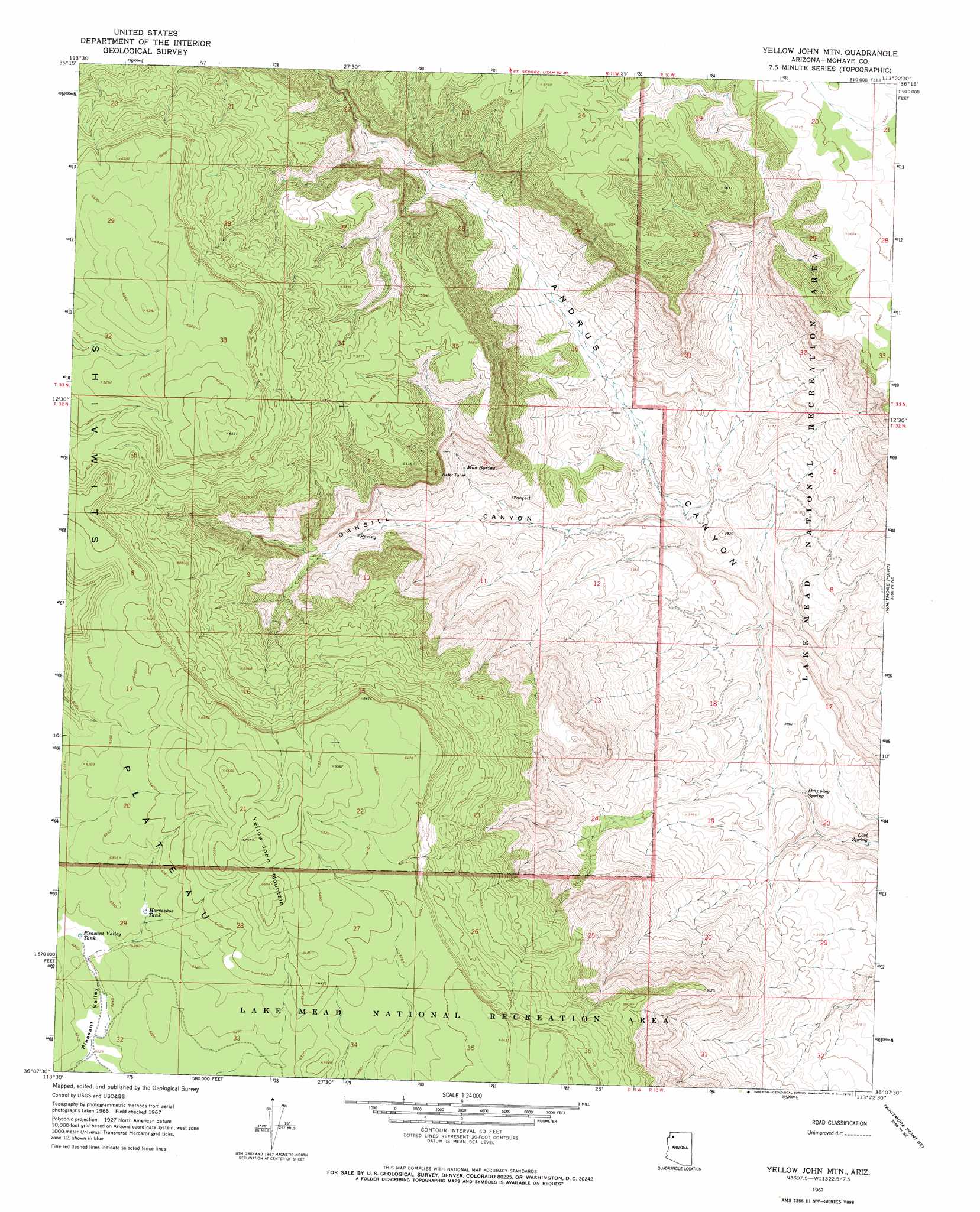
USGS Topo Quad 36113b4 - 1:24,000 scale
| Topo Map Name: | Yellow John Mountain |
| USGS Topo Quad ID: | 36113b4 |
| Print Size: | ca. 21 1/4" wide x 27" high |
| Southeast Coordinates: | 36.125° N latitude / 113.375° W longitude |
| Map Center Coordinates: | 36.1875° N latitude / 113.4375° W longitude |
| U.S. State: | AZ |
| Filename: | o36113b4.jpg |
| Download Map JPG Image: | Yellow John Mountain topo map 1:24,000 scale |
| Map Type: | Topographic |
| Topo Series: | 7.5´ |
| Map Scale: | 1:24,000 |
| Source of Map Images: | United States Geological Survey (USGS) |
| Alternate Map Versions: |
Yellow John Mtn. AZ 1967, updated 1970 Download PDF Buy paper map Yellow John Mountain AZ 2011 Download PDF Buy paper map Yellow John Mountain AZ 2014 Download PDF Buy paper map |
1:24,000 Topo Quads surrounding Yellow John Mountain
Last Chance Canyon |
Poverty Spring |
Poverty Knoll |
Jones Hill |
Mount Trumbull |
Mustang Point |
Wildcat Ranch |
Grassy Mountain |
Cold Spring |
Mount Logan |
Snap Draw |
Castle Peak |
Yellow John Mountain |
Whitmore Point |
Whitmore Rapids |
Tincanebitts Point |
Mount Dellenbaugh |
Whitmore Point Sw |
Whitmore Point Se |
Vulcans Throne Sw |
Devils Slide Rapids |
Amos Point |
Price Point |
Granite Park |
Hockey Puck Spring |
> Back to 36113a1 at 1:100,000 scale
> Back to 36112a1 at 1:250,000 scale
> Back to U.S. Topo Maps home
Yellow John Mountain topo map: Gazetteer
Yellow John Mountain: Reservoirs
Horseshoe Tank elevation 1920m 6299′Playboy Tank elevation 1112m 3648′
Pleasant Valley Tank elevation 1908m 6259′
Yellow John Mountain: Springs
Dansil Spring elevation 1540m 5052′Dripping Spring elevation 1097m 3599′
Lost Spring elevation 945m 3100′
Mud Spring elevation 1313m 4307′
Yellow John Mountain: Summits
Yellow John Mountain elevation 2056m 6745′Yellow John Mountain: Valleys
Dansill Canyon elevation 1063m 3487′Pleasant Valley elevation 1896m 6220′
Yellow John Mountain digital topo map on disk
Buy this Yellow John Mountain topo map showing relief, roads, GPS coordinates and other geographical features, as a high-resolution digital map file on DVD: