Moberly Topo Map Kentucky
To zoom in, hover over the map of Moberly
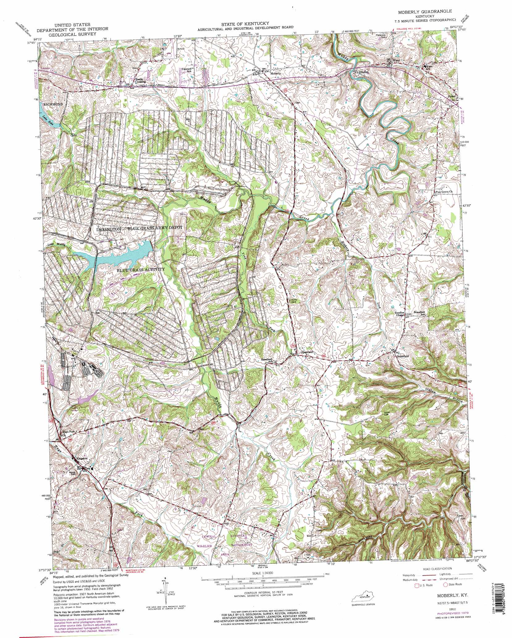
USGS Topo Quad 37084f2 - 1:24,000 scale
| Topo Map Name: | Moberly |
| USGS Topo Quad ID: | 37084f2 |
| Print Size: | ca. 21 1/4" wide x 27" high |
| Southeast Coordinates: | 37.625° N latitude / 84.125° W longitude |
| Map Center Coordinates: | 37.6875° N latitude / 84.1875° W longitude |
| U.S. State: | KY |
| Filename: | o37084f2.jpg |
| Download Map JPG Image: | Moberly topo map 1:24,000 scale |
| Map Type: | Topographic |
| Topo Series: | 7.5´ |
| Map Scale: | 1:24,000 |
| Source of Map Images: | United States Geological Survey (USGS) |
| Alternate Map Versions: |
Moberly KY 1952, updated 1961 Download PDF Buy paper map Moberly KY 1952, updated 1979 Download PDF Buy paper map Moberly KY 1954 Download PDF Buy paper map Moberly KY 2010 Download PDF Buy paper map Moberly KY 2013 Download PDF Buy paper map Moberly KY 2016 Download PDF Buy paper map |
1:24,000 Topo Quads surrounding Moberly
Coletown |
Ford |
Winchester |
Hedges |
Levee |
Valley View |
Richmond North |
Union City |
Palmer |
Clay City |
Kirksville |
Richmond South |
Moberly |
Panola |
Irvine |
Paint Lick |
Berea |
Bighill |
Alcorn |
Leighton |
Brodhead |
Wildie |
Johnetta |
Sandgap |
Mckee |
> Back to 37084e1 at 1:100,000 scale
> Back to 37084a1 at 1:250,000 scale
> Back to U.S. Topo Maps home
Moberly topo map: Gazetteer
Moberly: Airports
SOF Maintenance Site Heliport elevation 305m 1000′Moberly: Parks
Central Kentucky Wildlife Management Area elevation 304m 997′Moberly: Populated Places
Brassfield elevation 288m 944′Crooksville (historical) elevation 276m 905′
Elliston elevation 244m 800′
Kingston elevation 282m 925′
Moberly elevation 268m 879′
Reeds Crossing elevation 287m 941′
Speedwell elevation 283m 928′
Waco elevation 251m 823′
Moberly: Post Offices
Brassfield Post Office (historical) elevation 287m 941′Bybee Post Office (historical) elevation 274m 898′
Colyer Post Office (historical) elevation 289m 948′
Elliston Post Office (historical) elevation 245m 803′
Fredrick Post Office (historical) elevation 293m 961′
Kingston Post Office (historical) elevation 281m 921′
Moberly Post Office (historical) elevation 267m 875′
Shiflet Post Office (historical) elevation 284m 931′
Speedwell Post Office (historical) elevation 287m 941′
Moberly: Streams
Hickory Lick elevation 256m 839′Little Muddy Creek elevation 263m 862′
Pleasant Run elevation 281m 921′
Poplar Branch elevation 228m 748′
Sand Spring Branch elevation 237m 777′
Viny Fork elevation 259m 849′
Moberly digital topo map on disk
Buy this Moberly topo map showing relief, roads, GPS coordinates and other geographical features, as a high-resolution digital map file on DVD: