Phillipsburg Topo Map Missouri
To zoom in, hover over the map of Phillipsburg
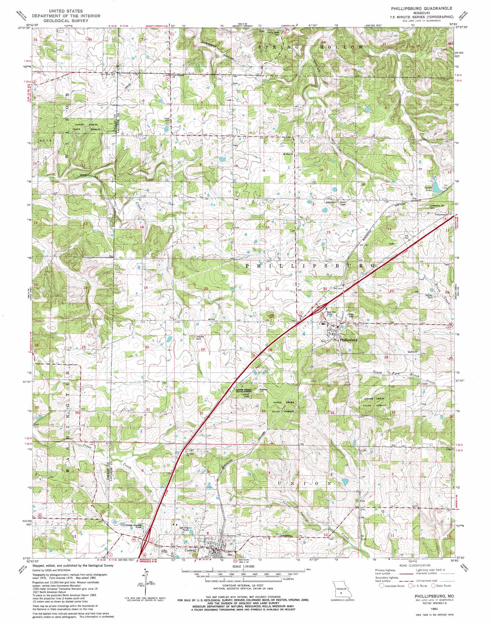
USGS Topo Quad 37092e7 - 1:24,000 scale
| Topo Map Name: | Phillipsburg |
| USGS Topo Quad ID: | 37092e7 |
| Print Size: | ca. 21 1/4" wide x 27" high |
| Southeast Coordinates: | 37.5° N latitude / 92.75° W longitude |
| Map Center Coordinates: | 37.5625° N latitude / 92.8125° W longitude |
| U.S. State: | MO |
| Filename: | o37092e7.jpg |
| Download Map JPG Image: | Phillipsburg topo map 1:24,000 scale |
| Map Type: | Topographic |
| Topo Series: | 7.5´ |
| Map Scale: | 1:24,000 |
| Source of Map Images: | United States Geological Survey (USGS) |
| Alternate Map Versions: |
Phillipsburg MO 1982, updated 1983 Download PDF Buy paper map Phillipsburg MO 2011 Download PDF Buy paper map Phillipsburg MO 2015 Download PDF Buy paper map |
1:24,000 Topo Quads surrounding Phillipsburg
Tunas |
Leadmine |
Eldridge West |
Eldridge East |
Stoutland |
Buffalo |
Windyville |
Bennett Springs |
Lebanon |
Oakland |
Charity |
Long Lake |
Phillipsburg |
Brush Creek |
Russ |
Elkland |
Beach |
Niangua |
Rader |
Grovespring |
Strafford |
Marshfield |
High Prarie |
Duncan |
Hartville |
> Back to 37092e1 at 1:100,000 scale
> Back to 37092a1 at 1:250,000 scale
> Back to U.S. Topo Maps home
Phillipsburg topo map: Gazetteer
Phillipsburg: Dams
Porto Farms Lake Dam elevation 388m 1272′Phillipsburg: Populated Places
Brittain elevation 412m 1351′Conway elevation 429m 1407′
Huben (historical) elevation 418m 1371′
Phillipsburg elevation 430m 1410′
Phillipsburg: Reservoirs
Jacobs Lake elevation 412m 1351′Phillipsburg digital topo map on disk
Buy this Phillipsburg topo map showing relief, roads, GPS coordinates and other geographical features, as a high-resolution digital map file on DVD: