Milford Topo Map Missouri
To zoom in, hover over the map of Milford
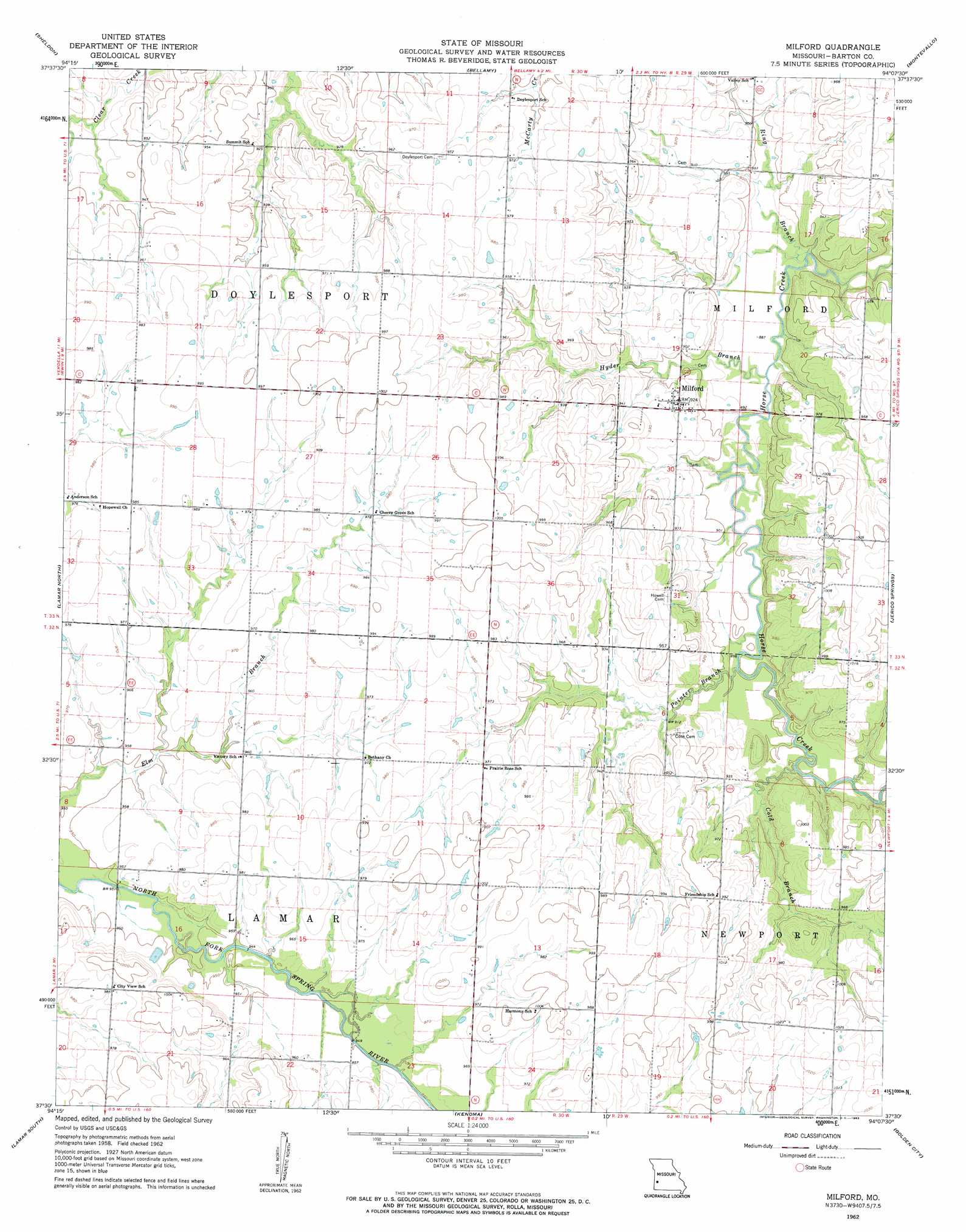
USGS Topo Quad 37094e2 - 1:24,000 scale
| Topo Map Name: | Milford |
| USGS Topo Quad ID: | 37094e2 |
| Print Size: | ca. 21 1/4" wide x 27" high |
| Southeast Coordinates: | 37.5° N latitude / 94.125° W longitude |
| Map Center Coordinates: | 37.5625° N latitude / 94.1875° W longitude |
| U.S. State: | MO |
| Filename: | o37094e2.jpg |
| Download Map JPG Image: | Milford topo map 1:24,000 scale |
| Map Type: | Topographic |
| Topo Series: | 7.5´ |
| Map Scale: | 1:24,000 |
| Source of Map Images: | United States Geological Survey (USGS) |
| Alternate Map Versions: |
Milford MO 1962, updated 1963 Download PDF Buy paper map Milford MO 2011 Download PDF Buy paper map Milford MO 2015 Download PDF Buy paper map |
1:24,000 Topo Quads surrounding Milford
Moundville |
Nevada |
Dederick |
Eldorado Springs South |
Filley |
Bronaugh |
Sheldon |
Bellamy |
Montevallo |
Wagoner |
Iantha |
Lamar North |
Milford |
Jerico Springs |
Cedarville |
Nashville |
Lamar South |
Kenoma |
Golden City |
Lockwood |
Neck City |
Jasper |
Maple Grove |
Dudenville |
Kings Point |
> Back to 37094e1 at 1:100,000 scale
> Back to 37094a1 at 1:250,000 scale
> Back to U.S. Topo Maps home
Milford topo map: Gazetteer
Milford: Dams
Cass Dam elevation 295m 967′Charles Wood Dam elevation 291m 954′
Embery Lake Dam elevation 292m 958′
Wood Lake Dam elevation 291m 954′
Milford: Populated Places
Milford elevation 281m 921′Milford: Reservoirs
Cass Lake elevation 295m 967′Emberry Lake elevation 292m 958′
Wood Lake elevation 291m 954′
Milford: Streams
Cold Branch elevation 271m 889′Hyder Branch elevation 268m 879′
Painter Branch elevation 270m 885′
Ring Branch elevation 266m 872′
Milford digital topo map on disk
Buy this Milford topo map showing relief, roads, GPS coordinates and other geographical features, as a high-resolution digital map file on DVD: