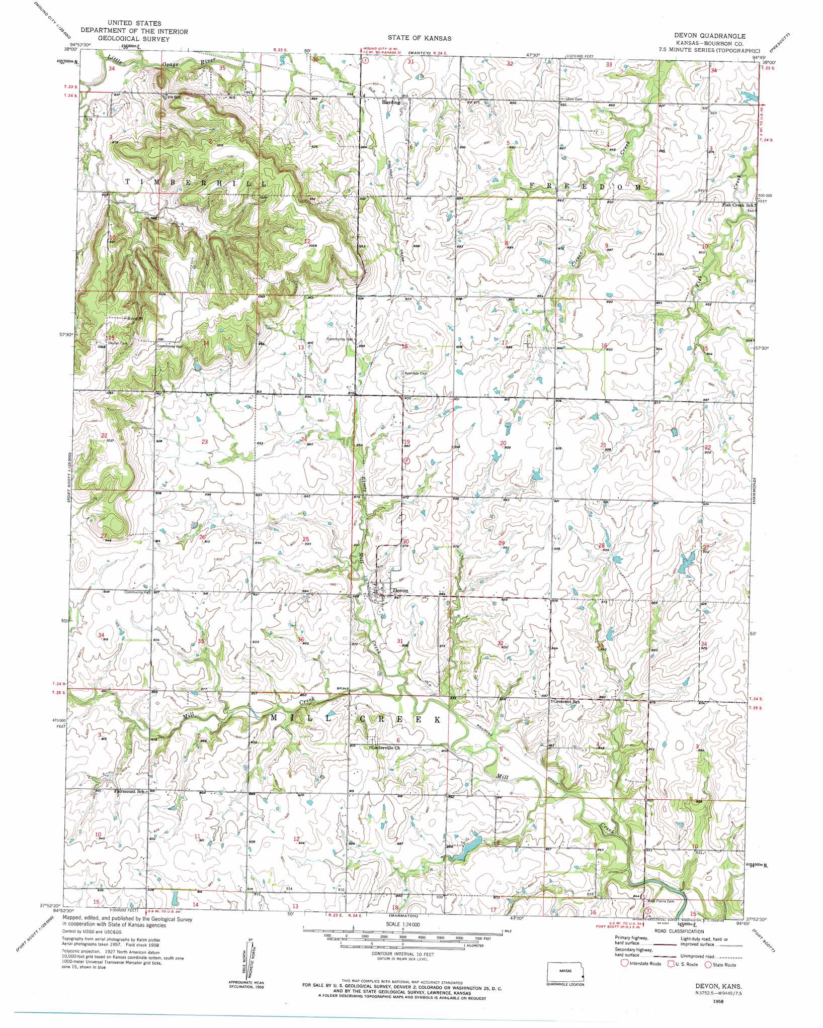
Devon Topo Map Kansas
To zoom in, hover over the map of Devon
USGS Topo Quad 37094h7 - 1:24,000 scale
| Topo Map Name: | Devon |
| USGS Topo Quad ID: | 37094h7 |
| Print Size: | ca. 21 1/4" wide x 27" high |
| Southeast Coordinates: | 37.875° N latitude / 94.75° W longitude |
| Map Center Coordinates: | 37.9375° N latitude / 94.8125° W longitude |
| U.S. State: | KS |
| Filename: | o37094h7.jpg |
| Download Map JPG Image: | Devon topo map 1:24,000 scale |
| Map Type: | Topographic |
| Topo Series: | 7.5´ |
| Map Scale: | 1:24,000 |
| Source of Map Images: | United States Geological Survey (USGS) |
| Alternate Map Versions: |
Devon KS 1958, updated 1959 Download PDF Buy paper map Devon KS 2009 Download PDF Buy paper map Devon KS 2012 Download PDF Buy paper map Devon KS 2015 Download PDF Buy paper map |
1:24,000 Topo Quads surrounding Devon
Centerville |
Mound City Nw |
Mound City |
Pleasanton |
Worland |
Blue Mound |
Mapleton |
Mantey |
Prescott |
Hume |
Bronson |
Xenia |
Devon |
Hammond |
Richards |
Moran Se |
Uniontown |
Marmaton |
Fort Scott |
Deerfield |
Porterville |
Hepler |
Hiattville |
Cato |
Garland |
> Back to 37094e1 at 1:100,000 scale
> Back to 37094a1 at 1:250,000 scale
> Back to U.S. Topo Maps home
Devon topo map: Gazetteer
Devon: Populated Places
Devon elevation 263m 862′Harding elevation 260m 853′
Devon: Streams
Honey Creek elevation 244m 800′Little Mill Creek elevation 253m 830′
Devon digital topo map on disk
Buy this Devon topo map showing relief, roads, GPS coordinates and other geographical features, as a high-resolution digital map file on DVD: