Severy North Topo Map Kansas
To zoom in, hover over the map of Severy North
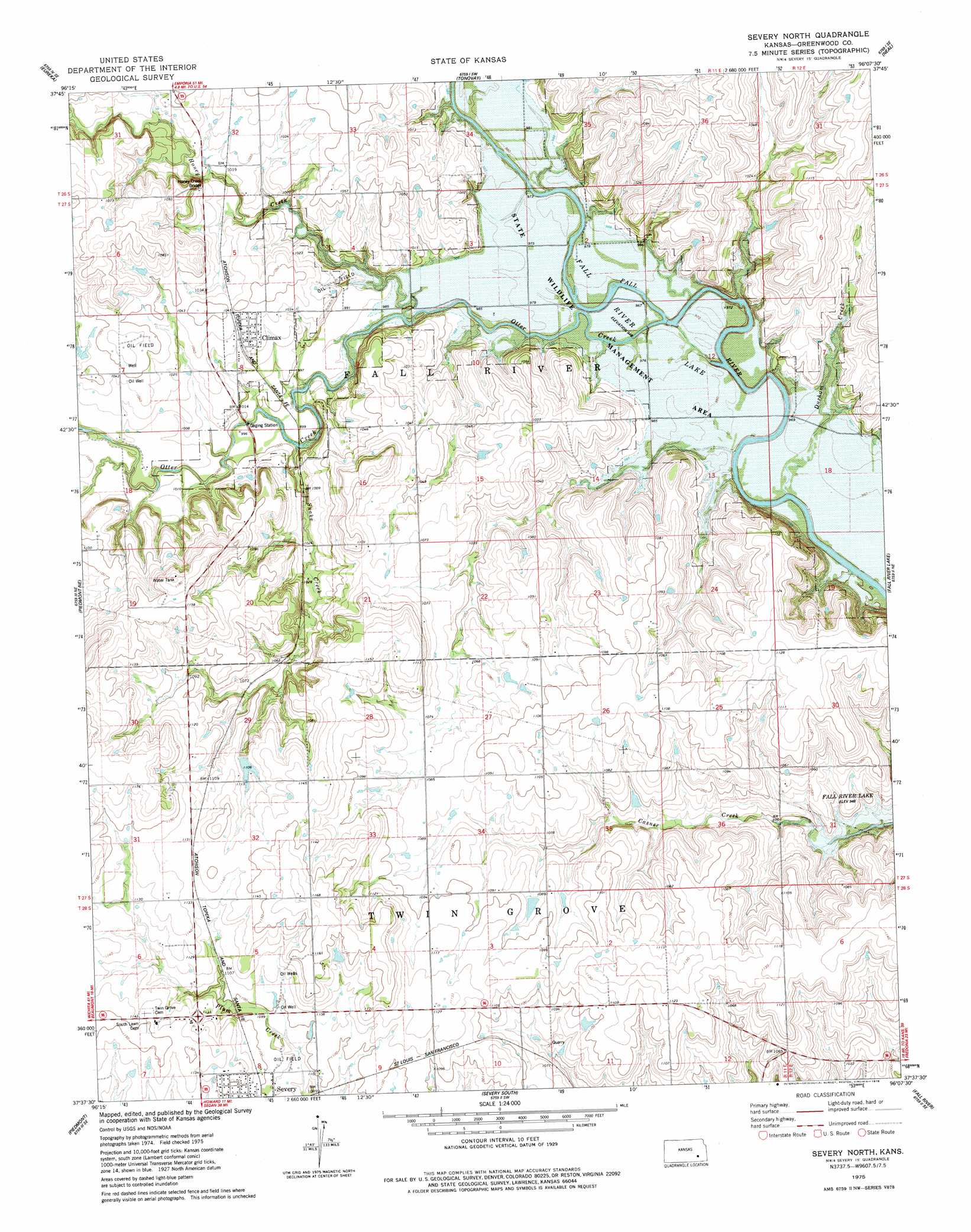
USGS Topo Quad 37096f2 - 1:24,000 scale
| Topo Map Name: | Severy North |
| USGS Topo Quad ID: | 37096f2 |
| Print Size: | ca. 21 1/4" wide x 27" high |
| Southeast Coordinates: | 37.625° N latitude / 96.125° W longitude |
| Map Center Coordinates: | 37.6875° N latitude / 96.1875° W longitude |
| U.S. State: | KS |
| Filename: | o37096f2.jpg |
| Download Map JPG Image: | Severy North topo map 1:24,000 scale |
| Map Type: | Topographic |
| Topo Series: | 7.5´ |
| Map Scale: | 1:24,000 |
| Source of Map Images: | United States Geological Survey (USGS) |
| Alternate Map Versions: |
Severy North KS 1975, updated 1978 Download PDF Buy paper map Severy North KS 2010 Download PDF Buy paper map Severy North KS 2012 Download PDF Buy paper map Severy North KS 2015 Download PDF Buy paper map |
1:24,000 Topo Quads surrounding Severy North
Lapland |
Eureka Ne |
Hamilton |
Virgil |
Quincy |
Reece |
Eureka |
Tonovay |
Neal |
Toronto |
Piedmont Nw |
Piedmont Ne |
Severy North |
Fall River Lake |
Coyville |
Piedmont Sw |
Piedmont |
Severy South |
Fall River |
New Albany |
Howard Nw |
Howard |
Longton Nw |
Longton |
Buxton |
> Back to 37096e1 at 1:100,000 scale
> Back to 37096a1 at 1:250,000 scale
> Back to U.S. Topo Maps home
Severy North topo map: Gazetteer
Severy North: Bridges
Honey Creek Bridge elevation 306m 1003′Severy North: Populated Places
Climax elevation 317m 1040′Severy North: Streams
Durham Creek elevation 290m 951′Honey Creek elevation 301m 987′
Otter Creek elevation 291m 954′
Snake Creek elevation 301m 987′
Severy North digital topo map on disk
Buy this Severy North topo map showing relief, roads, GPS coordinates and other geographical features, as a high-resolution digital map file on DVD: