Severy South Topo Map Kansas
To zoom in, hover over the map of Severy South
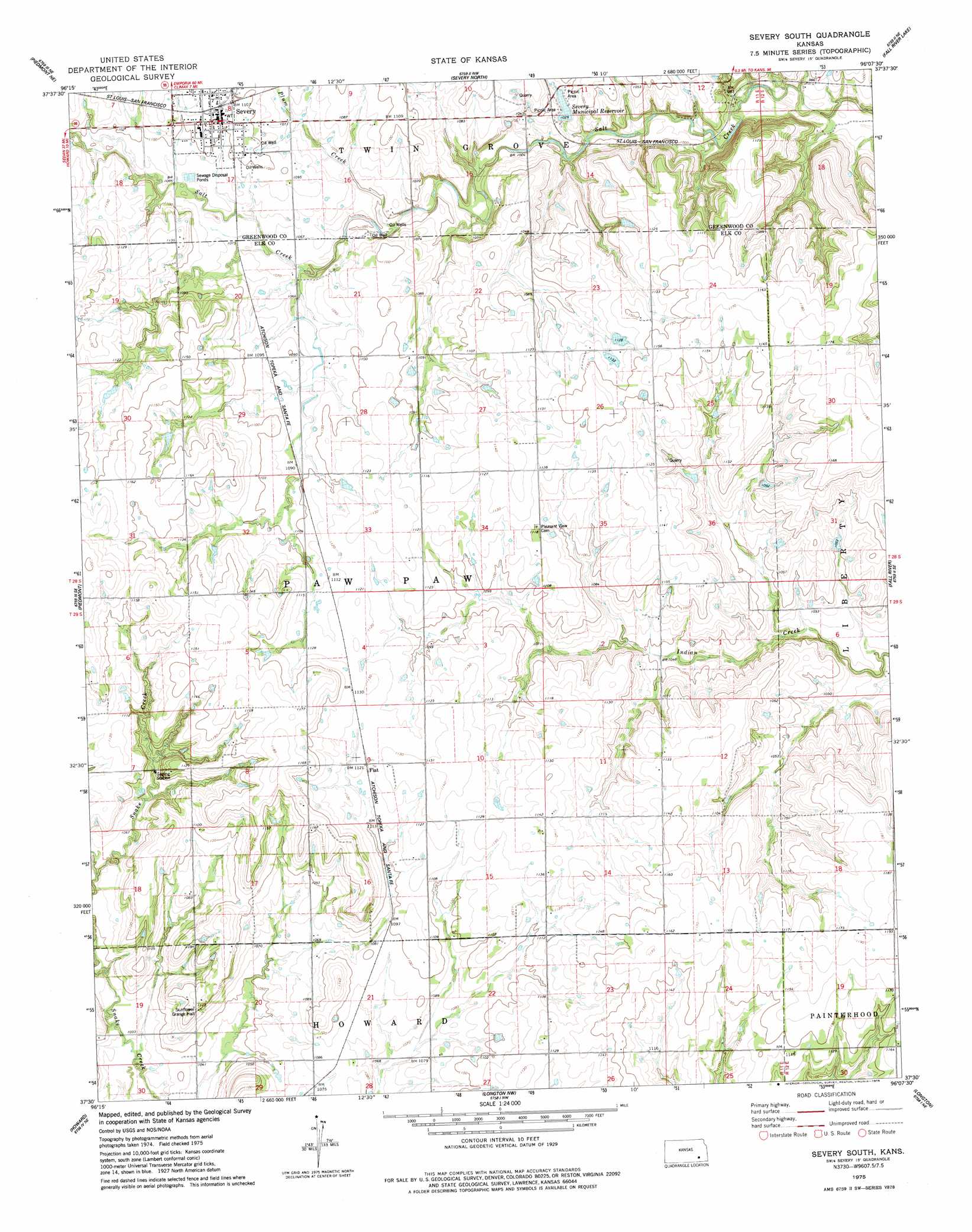
USGS Topo Quad 37096e2 - 1:24,000 scale
| Topo Map Name: | Severy South |
| USGS Topo Quad ID: | 37096e2 |
| Print Size: | ca. 21 1/4" wide x 27" high |
| Southeast Coordinates: | 37.5° N latitude / 96.125° W longitude |
| Map Center Coordinates: | 37.5625° N latitude / 96.1875° W longitude |
| U.S. State: | KS |
| Filename: | o37096e2.jpg |
| Download Map JPG Image: | Severy South topo map 1:24,000 scale |
| Map Type: | Topographic |
| Topo Series: | 7.5´ |
| Map Scale: | 1:24,000 |
| Source of Map Images: | United States Geological Survey (USGS) |
| Alternate Map Versions: |
Severy South KS 2009 Download PDF Buy paper map Severy South KS 2012 Download PDF Buy paper map Severy South KS 2015 Download PDF Buy paper map |
1:24,000 Topo Quads surrounding Severy South
Reece |
Eureka |
Tonovay |
Neal |
Toronto |
Piedmont Nw |
Piedmont Ne |
Severy North |
Fall River Lake |
Coyville |
Piedmont Sw |
Piedmont |
Severy South |
Fall River |
New Albany |
Howard Nw |
Howard |
Longton Nw |
Longton |
Buxton |
Grenola |
Moline |
Elk Falls |
Oak Valley |
Elk City |
> Back to 37096e1 at 1:100,000 scale
> Back to 37096a1 at 1:250,000 scale
> Back to U.S. Topo Maps home
Severy South topo map: Gazetteer
Severy South: Dams
Severy City Dam elevation 312m 1023′Severy South: Populated Places
Fiat elevation 342m 1122′Severy elevation 339m 1112′
Severy South: Reservoirs
Severy Municipal Reservoir elevation 312m 1023′Severy South: Streams
Plum Creek elevation 315m 1033′Severy South digital topo map on disk
Buy this Severy South topo map showing relief, roads, GPS coordinates and other geographical features, as a high-resolution digital map file on DVD: