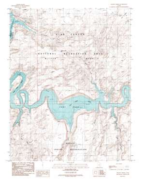
Wilson Creek Topo Map Utah
To zoom in, hover over the map of Wilson Creek
USGS Topo Quad 37110b7 - 1:24,000 scale
| Topo Map Name: | Wilson Creek |
| USGS Topo Quad ID: | 37110b7 |
| Print Size: | ca. 21 1/4" wide x 27" high |
| Southeast Coordinates: | 37.125° N latitude / 110.75° W longitude |
| Map Center Coordinates: | 37.1875° N latitude / 110.8125° W longitude |
| U.S. State: | UT |
| Filename: | o37110b7.jpg |
| Download Map JPG Image: | Wilson Creek topo map 1:24,000 scale |
| Map Type: | Topographic |
| Topo Series: | 7.5´ |
| Map Scale: | 1:24,000 |
| Source of Map Images: | United States Geological Survey (USGS) |
| Alternate Map Versions: |
Wilson Creek UT 1987, updated 1988 Download PDF Buy paper map Wilson Creek UT 1987, updated 1988 Download PDF Buy paper map Wilson Creek UT 2011 Download PDF Buy paper map Wilson Creek UT 2014 Download PDF Buy paper map |
1:24,000 Topo Quads surrounding Wilson Creek
> Back to 37110a1 at 1:100,000 scale
> Back to 37110a1 at 1:250,000 scale
> Back to U.S. Topo Maps home
Wilson Creek topo map: Gazetteer
Wilson Creek: Arches
Old Settler Natural Bridge elevation 1267m 4156′Wilson Creek: Bays
Cha Bay elevation 1129m 3704′Wilson Creek: Gaps
Aladdins Lamp Pass elevation 1343m 4406′Wilson Creek: Ranges
Glass Mountains elevation 1284m 4212′Wilson Creek: Streams
Cha Creek elevation 1144m 3753′Cottonwood Creek elevation 1141m 3743′
Desha Creek elevation 1204m 3950′
Junction Creek elevation 1166m 3825′
Nasja Creek elevation 1212m 3976′
Wilson Creek elevation 1162m 3812′
Wilson Creek: Valleys
Bald Rock Canyon elevation 1198m 3930′Cha Canyon elevation 1157m 3795′
Desha Canyon elevation 1129m 3704′
Junction Canyon elevation 1158m 3799′
Shoot the Chute Canyon elevation 1168m 3832′
Trail Canyon elevation 1139m 3736′
Wilson Creek digital topo map on disk
Buy this Wilson Creek topo map showing relief, roads, GPS coordinates and other geographical features, as a high-resolution digital map file on DVD:


