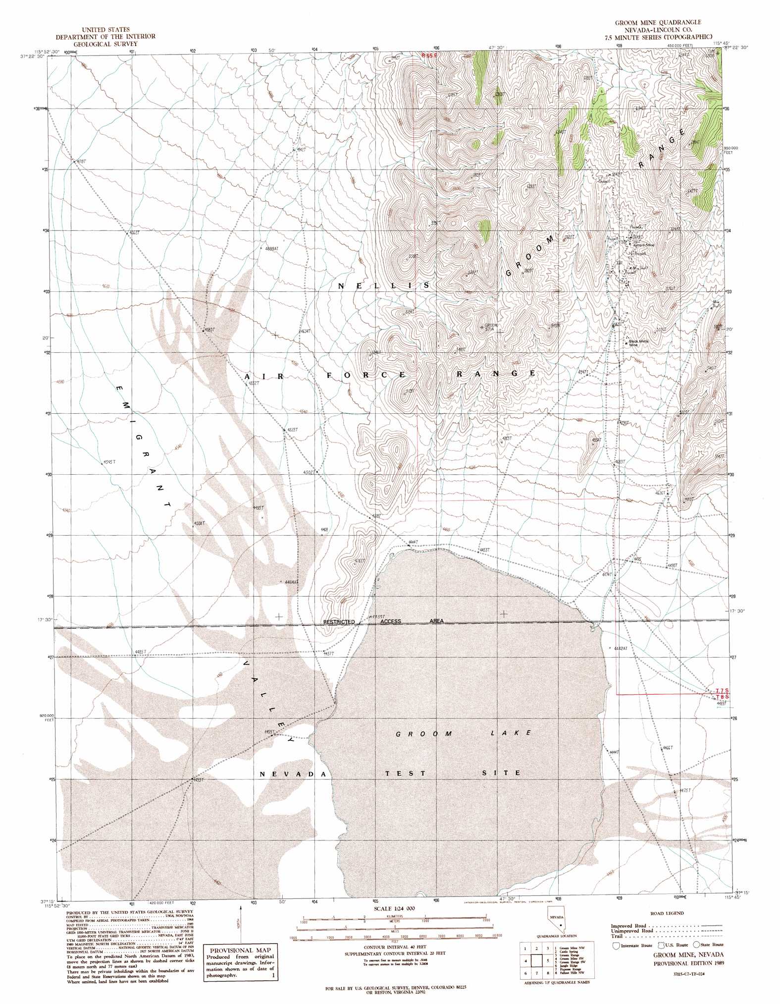
Groom Mine Topo Map Nevada
To zoom in, hover over the map of Groom Mine
USGS Topo Quad 37115c7 - 1:24,000 scale
| Topo Map Name: | Groom Mine |
| USGS Topo Quad ID: | 37115c7 |
| Print Size: | ca. 21 1/4" wide x 27" high |
| Southeast Coordinates: | 37.25° N latitude / 115.75° W longitude |
| Map Center Coordinates: | 37.3125° N latitude / 115.8125° W longitude |
| U.S. State: | NV |
| Filename: | o37115c7.jpg |
| Download Map JPG Image: | Groom Mine topo map 1:24,000 scale |
| Map Type: | Topographic |
| Topo Series: | 7.5´ |
| Map Scale: | 1:24,000 |
| Source of Map Images: | United States Geological Survey (USGS) |
| Alternate Map Versions: |
Groom Mine NV 1989, updated 1989 Download PDF Buy paper map |
1:24,000 Topo Quads surrounding Groom Mine
Belted Peak |
White Blotch Springs |
White Blotch Springs Se |
Tempiute Mountain South |
Tempiute Mountain Se |
Wheelbarrow Peak |
Groom Mine Nw |
Cattle Spring |
Groom Range |
Groom Range Ne |
Oak Spring Butte |
Groom Mine Sw |
Groom Mine |
Groom Range Sw |
Groom Range Se |
Oak Spring |
Jangle Ridge |
Papoose Range |
Fallout Hills Nw |
Fallout Hills Ne |
Yucca Flat |
Paiute Ridge |
Papoose Lake |
Fallout Hills |
Southeastern Mine |
> Back to 37115a1 at 1:100,000 scale
> Back to 37114a1 at 1:250,000 scale
> Back to U.S. Topo Maps home
Groom Mine topo map: Gazetteer
Groom Mine: Basins
Emigrant Valley elevation 1346m 4416′Groom Mine: Lakes
Groom Lake elevation 1344m 4409′Groom Mine: Mines
Black Metal Mine elevation 1552m 5091′Groom Mine elevation 1738m 5702′
Groom Mine: Springs
Disappointment Spring elevation 1514m 4967′Miner Spring elevation 1516m 4973′
Groom Mine digital topo map on disk
Buy this Groom Mine topo map showing relief, roads, GPS coordinates and other geographical features, as a high-resolution digital map file on DVD: