Murphy Gap Nw Topo Map Nevada
To zoom in, hover over the map of Murphy Gap Nw
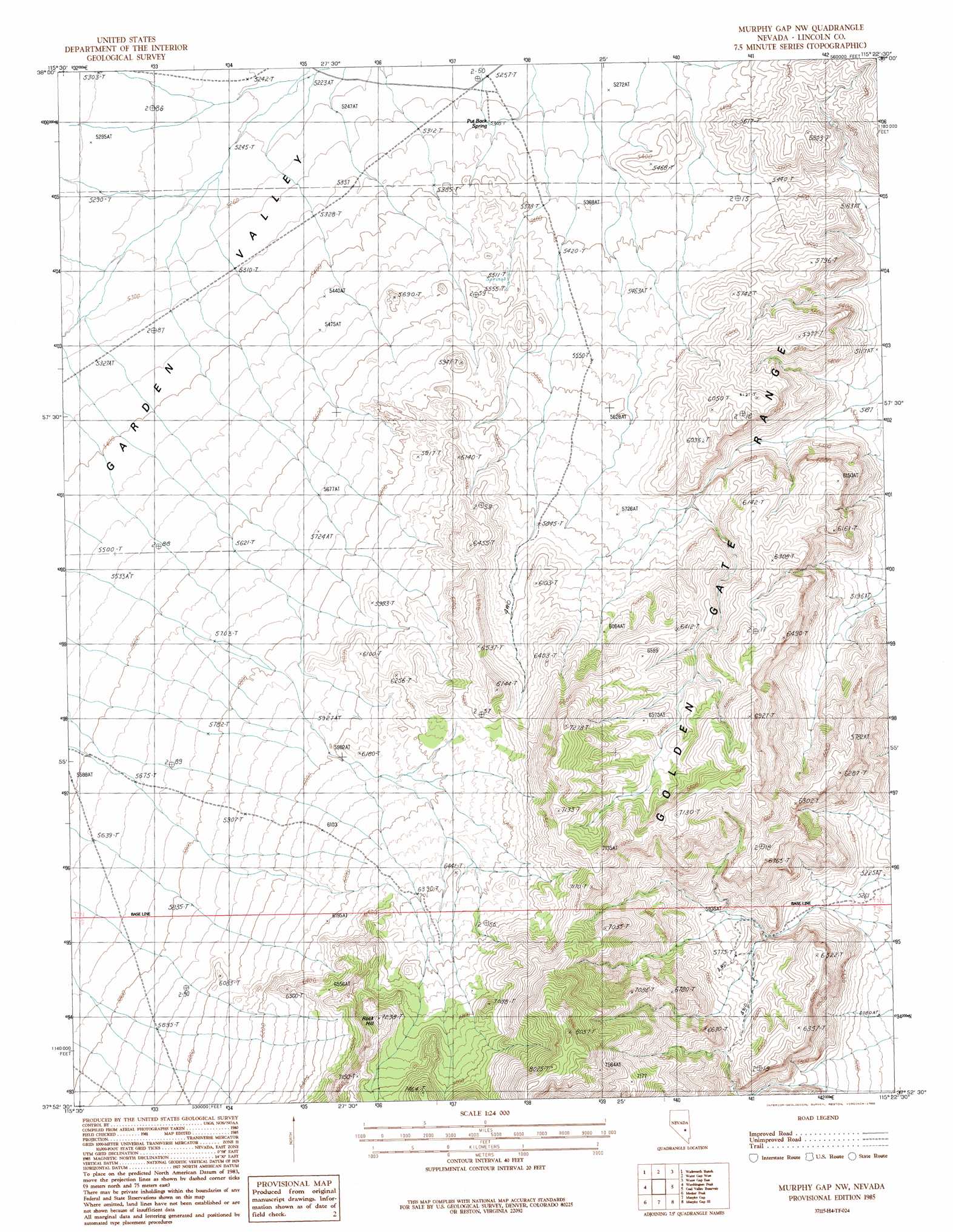
USGS Topo Quad 37115h4 - 1:24,000 scale
| Topo Map Name: | Murphy Gap Nw |
| USGS Topo Quad ID: | 37115h4 |
| Print Size: | ca. 21 1/4" wide x 27" high |
| Southeast Coordinates: | 37.875° N latitude / 115.375° W longitude |
| Map Center Coordinates: | 37.9375° N latitude / 115.4375° W longitude |
| U.S. State: | NV |
| Filename: | o37115h4.jpg |
| Download Map JPG Image: | Murphy Gap Nw topo map 1:24,000 scale |
| Map Type: | Topographic |
| Topo Series: | 7.5´ |
| Map Scale: | 1:24,000 |
| Source of Map Images: | United States Geological Survey (USGS) |
| Alternate Map Versions: |
Murphy Gap NW NV 1985, updated 1986 Download PDF Buy paper map Murphy Gap NW NV 2012 Download PDF Buy paper map Murphy Gap NW NV 2014 Download PDF Buy paper map |
1:24,000 Topo Quads surrounding Murphy Gap Nw
Nyala |
Adaven |
Water Gap Nw |
Water Gap Ne |
Timber Mountain Pass Nw |
Badger Gulch |
Wadsworth Ranch |
Water Gap West |
Water Gap East |
Timber Mountain Pass West |
Mccutchen Spring |
Worthington Peak |
Murphy Gap Nw |
Coal Valley Reservoir |
Oreana Spring |
Worthington Peak Sw |
Meeker Peak |
Murphy Gap |
Murphy Gap Se |
Seaman Wash |
Timpiute Mountain North |
Monte Mountain |
Mount Irish |
Mail Summit |
Fossil Peak |
> Back to 37115e1 at 1:100,000 scale
> Back to 37114a1 at 1:250,000 scale
> Back to U.S. Topo Maps home
Murphy Gap Nw topo map: Gazetteer
Murphy Gap Nw: Gaps
Cottontail Pass elevation 1652m 5419′Murphy Gap Nw: Ranges
Golden Gate Range elevation 1953m 6407′Murphy Gap Nw: Springs
Little Davis Spring elevation 1627m 5337′Put Back Spring elevation 1618m 5308′
Murphy Gap Nw: Streams
Barton Creek elevation 1611m 5285′Murphy Gap Nw: Summits
Rock Hill elevation 2203m 7227′Murphy Gap Nw digital topo map on disk
Buy this Murphy Gap Nw topo map showing relief, roads, GPS coordinates and other geographical features, as a high-resolution digital map file on DVD: