Timber Mountain Pass Nw Topo Map Nevada
To zoom in, hover over the map of Timber Mountain Pass Nw
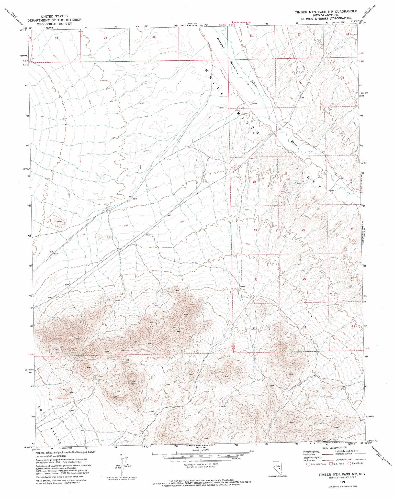
USGS Topo Quad 38115b2 - 1:24,000 scale
| Topo Map Name: | Timber Mountain Pass Nw |
| USGS Topo Quad ID: | 38115b2 |
| Print Size: | ca. 21 1/4" wide x 27" high |
| Southeast Coordinates: | 38.125° N latitude / 115.125° W longitude |
| Map Center Coordinates: | 38.1875° N latitude / 115.1875° W longitude |
| U.S. State: | NV |
| Filename: | o38115b2.jpg |
| Download Map JPG Image: | Timber Mountain Pass Nw topo map 1:24,000 scale |
| Map Type: | Topographic |
| Topo Series: | 7.5´ |
| Map Scale: | 1:24,000 |
| Source of Map Images: | United States Geological Survey (USGS) |
| Alternate Map Versions: |
Timber Mtn Pass NW NV 1971, updated 1973 Download PDF Buy paper map Timber Mountain Pass NW NV 2012 Download PDF Buy paper map Timber Mountain Pass NW NV 2014 Download PDF Buy paper map |
1:24,000 Topo Quads surrounding Timber Mountain Pass Nw
Heath Canyon |
Forest Home Ne |
Sunnyside Nw |
Sunnyside |
Cave Valley Well |
Horse Spring Hills |
Forest Home |
Hot Creek Butte |
Gap Mountain |
Silver King Well |
Water Gap Nw |
Water Gap Ne |
Timber Mountain Pass Nw |
Timber Mountain Pass Ne |
Silver King Mountain |
Water Gap West |
Water Gap East |
Timber Mountain Pass West |
Timber Mountain Pass East |
Silver King Mountain Sw |
Murphy Gap Nw |
Coal Valley Reservoir |
Oreana Spring |
Weepah Spring |
Deadman Spring |
> Back to 38115a1 at 1:100,000 scale
> Back to 38114a1 at 1:250,000 scale
> Back to U.S. Topo Maps home
Timber Mountain Pass Nw topo map: Gazetteer
Timber Mountain Pass Nw: Flats
Murphy Meadows elevation 1552m 5091′Timber Mountain Pass Nw: Reservoirs
Murphy Gap Reservoir elevation 1578m 5177′Timber Mountain Pass Nw: Wells
Griswold Upper Well elevation 1556m 5104′Uhalde Well elevation 1554m 5098′
Timber Mountain Pass Nw digital topo map on disk
Buy this Timber Mountain Pass Nw topo map showing relief, roads, GPS coordinates and other geographical features, as a high-resolution digital map file on DVD: