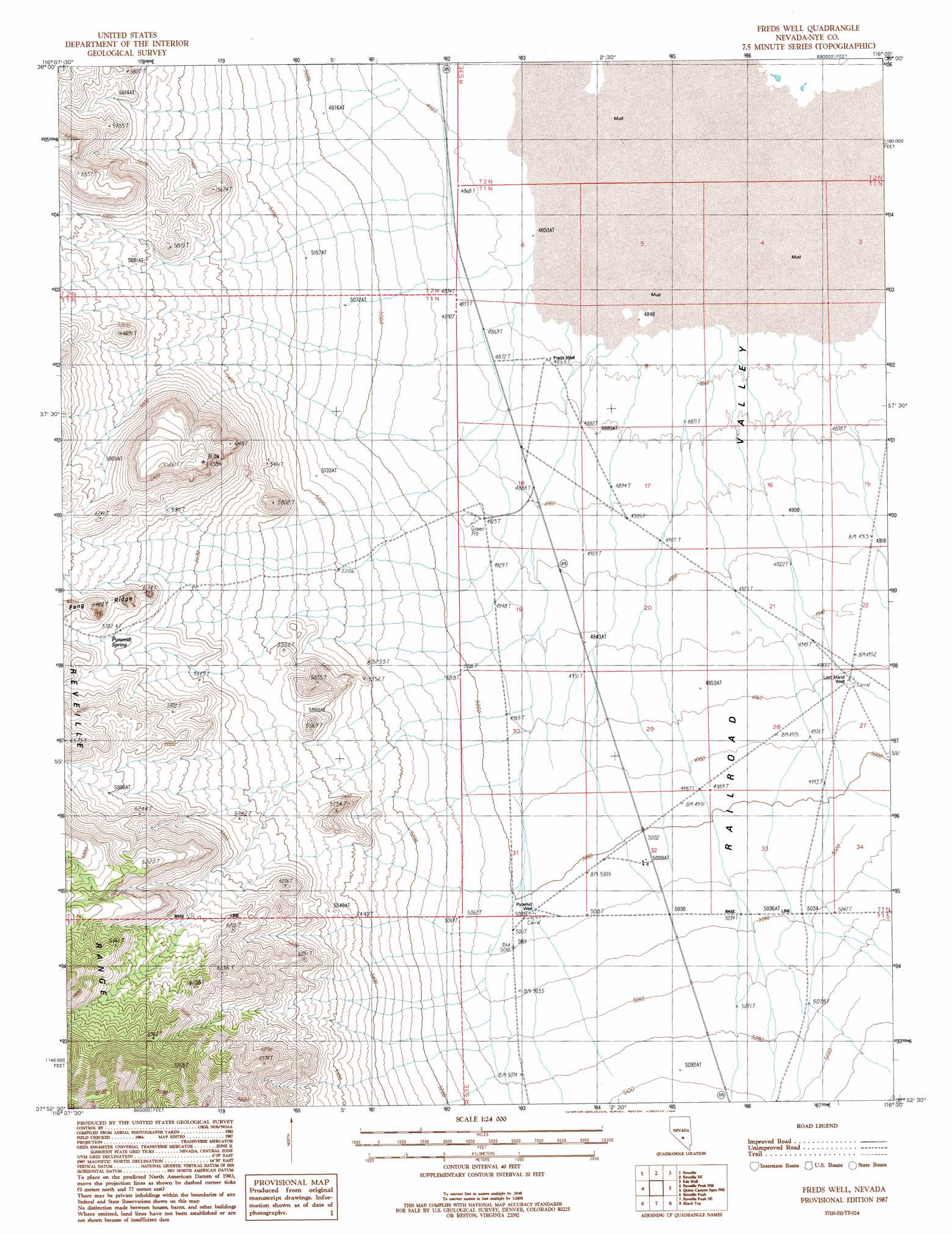
Freds Well Topo Map Nevada
To zoom in, hover over the map of Freds Well
USGS Topo Quad 37116h1 - 1:24,000 scale
| Topo Map Name: | Freds Well |
| USGS Topo Quad ID: | 37116h1 |
| Print Size: | ca. 21 1/4" wide x 27" high |
| Southeast Coordinates: | 37.875° N latitude / 116° W longitude |
| Map Center Coordinates: | 37.9375° N latitude / 116.0625° W longitude |
| U.S. State: | NV |
| Filename: | o37116h1.jpg |
| Download Map JPG Image: | Freds Well topo map 1:24,000 scale |
| Map Type: | Topographic |
| Topo Series: | 7.5´ |
| Map Scale: | 1:24,000 |
| Source of Map Images: | United States Geological Survey (USGS) |
| Alternate Map Versions: |
Freds Well NV 1987, updated 1988 Download PDF Buy paper map |
1:24,000 Topo Quads surrounding Freds Well
Warm Springs |
Twin Springs Slough |
Echo Canyon |
Goat Ranch Well |
Big Creek Ranch |
Warm Springs Se |
Reveille |
Reveille Se |
Eds Well |
Goat Ranch Springs |
Kawich Peak Ne |
Reveille Peak Nw |
Freds Well |
Quinn Canyon Springs Nw |
Quinn Canyon Springs |
Georges Well |
Reveille Peak |
Reveille Peak Se |
Black Top |
Honest John Well |
Cedar Pass |
Rhyolite Knob |
Monotony Valley |
White Blotch Springs Nw |
White Blotch Springs Ne |
> Back to 37116e1 at 1:100,000 scale
> Back to 37116a1 at 1:250,000 scale
> Back to U.S. Topo Maps home
Freds Well topo map: Gazetteer
Freds Well: Springs
Pyramid Spring elevation 1772m 5813′Freds Well: Wells
Eastside Well elevation 1479m 4852′Freds Well elevation 1483m 4865′
Last Stand Well elevation 1514m 4967′
Pyramid Well elevation 1527m 5009′
Freds Well digital topo map on disk
Buy this Freds Well topo map showing relief, roads, GPS coordinates and other geographical features, as a high-resolution digital map file on DVD: