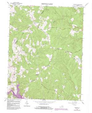
Belmont Topo Map Virginia
To zoom in, hover over the map of Belmont
USGS Topo Quad 38077b7 - 1:24,000 scale
| Topo Map Name: | Belmont |
| USGS Topo Quad ID: | 38077b7 |
| Print Size: | ca. 21 1/4" wide x 27" high |
| Southeast Coordinates: | 38.125° N latitude / 77.75° W longitude |
| Map Center Coordinates: | 38.1875° N latitude / 77.8125° W longitude |
| U.S. State: | VA |
| Filename: | o38077b7.jpg |
| Download Map JPG Image: | Belmont topo map 1:24,000 scale |
| Map Type: | Topographic |
| Topo Series: | 7.5´ |
| Map Scale: | 1:24,000 |
| Source of Map Images: | United States Geological Survey (USGS) |
| Alternate Map Versions: |
Belmont VA 1942, updated 1961 Download PDF Buy paper map Belmont VA 1966, updated 1967 Download PDF Buy paper map Belmont VA 1966, updated 1974 Download PDF Buy paper map Belmont VA 1966, updated 1978 Download PDF Buy paper map Belmont VA 1966, updated 1984 Download PDF Buy paper map Belmont VA 2010 Download PDF Buy paper map Belmont VA 2013 Download PDF Buy paper map Belmont VA 2016 Download PDF Buy paper map |
1:24,000 Topo Quads surrounding Belmont
> Back to 38077a1 at 1:100,000 scale
> Back to 38076a1 at 1:250,000 scale
> Back to U.S. Topo Maps home
Belmont topo map: Gazetteer
Belmont: Bays
Childs Cove elevation 76m 249′Belmont: Bridges
Dillards Bridge elevation 76m 249′Stubbs Bridge elevation 77m 252′
Belmont: Capes
Perkinson Point elevation 79m 259′Belmont: Dams
Rams Lake Dam elevation 109m 357′Belmont: Parks
Livingston Park elevation 134m 439′Belmont: Populated Places
Bells Crossroad elevation 125m 410′Belmont elevation 106m 347′
Childs Cove elevation 86m 282′
Granite Springs elevation 131m 429′
Jones elevation 132m 433′
Logan elevation 118m 387′
Mastins Corner elevation 129m 423′
Panier elevation 122m 400′
Paytes elevation 161m 528′
Porters elevation 139m 456′
Prince Dominion elevation 101m 331′
Stubbs elevation 129m 423′
White Owl Landing elevation 111m 364′
Belmont: Reservoirs
Rams Lake elevation 109m 357′Belmont: Streams
Adams Branch elevation 76m 249′Knights Branch elevation 77m 252′
McCracken Creek elevation 99m 324′
Music Branch elevation 77m 252′
Plentiful Creek elevation 76m 249′
Shanty Bridge Creek elevation 93m 305′
Belmont digital topo map on disk
Buy this Belmont topo map showing relief, roads, GPS coordinates and other geographical features, as a high-resolution digital map file on DVD:
Atlantic Coast (NY, NJ, PA, DE, MD, VA, NC)
Buy digital topo maps: Atlantic Coast (NY, NJ, PA, DE, MD, VA, NC)


