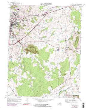
Culpeper East Topo Map Virginia
To zoom in, hover over the map of Culpeper East
USGS Topo Quad 38077d8 - 1:24,000 scale
| Topo Map Name: | Culpeper East |
| USGS Topo Quad ID: | 38077d8 |
| Print Size: | ca. 21 1/4" wide x 27" high |
| Southeast Coordinates: | 38.375° N latitude / 77.875° W longitude |
| Map Center Coordinates: | 38.4375° N latitude / 77.9375° W longitude |
| U.S. State: | VA |
| Filename: | o38077d8.jpg |
| Download Map JPG Image: | Culpeper East topo map 1:24,000 scale |
| Map Type: | Topographic |
| Topo Series: | 7.5´ |
| Map Scale: | 1:24,000 |
| Source of Map Images: | United States Geological Survey (USGS) |
| Alternate Map Versions: |
Culpeper VA 1943, updated 1961 Download PDF Buy paper map Culpeper VA 1968, updated 1970 Download PDF Buy paper map Culpeper East VA 1973, updated 1974 Download PDF Buy paper map Culpeper East VA 1973, updated 1978 Download PDF Buy paper map Culpeper East VA 1973, updated 1978 Download PDF Buy paper map Culpeper East VA 1973, updated 1981 Download PDF Buy paper map Culpeper East VA 1994, updated 1999 Download PDF Buy paper map Culpeper East VA 2011 Download PDF Buy paper map Culpeper East VA 2013 Download PDF Buy paper map Culpeper East VA 2016 Download PDF Buy paper map |
1:24,000 Topo Quads surrounding Culpeper East
> Back to 38077a1 at 1:100,000 scale
> Back to 38076a1 at 1:250,000 scale
> Back to U.S. Topo Maps home
Culpeper East topo map: Gazetteer
Culpeper East: Capes
Stony Point elevation 116m 380′Culpeper East: Parks
Culpeper Historic District elevation 127m 416′Yowell Meadow Park elevation 103m 337′
Culpeper East: Populated Places
Batna elevation 86m 282′Belle Parc elevation 123m 403′
Braggs Corner elevation 116m 380′
Culpeper elevation 126m 413′
Greens Corner elevation 113m 370′
High Point elevation 139m 456′
Meadows of Culpeper elevation 140m 459′
Stevensburg elevation 110m 360′
Winfrey elevation 122m 400′
Culpeper East: Post Offices
Culpeper Post Office elevation 126m 413′Culpeper East: Ridges
The Ridge elevation 141m 462′Culpeper East: Streams
Balds Run elevation 107m 351′Dry Run elevation 89m 291′
Hidens Branch elevation 106m 347′
Jonas Run elevation 78m 255′
Meadowbrook Run elevation 95m 311′
Potato Run elevation 68m 223′
Sumerduck Run elevation 66m 216′
Culpeper East: Summits
Coles Hill elevation 138m 452′Mount Pony elevation 229m 751′
Culpeper East digital topo map on disk
Buy this Culpeper East topo map showing relief, roads, GPS coordinates and other geographical features, as a high-resolution digital map file on DVD:
Atlantic Coast (NY, NJ, PA, DE, MD, VA, NC)
Buy digital topo maps: Atlantic Coast (NY, NJ, PA, DE, MD, VA, NC)


