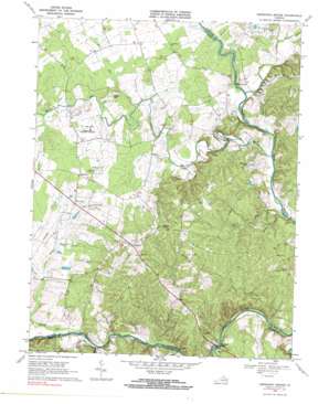
Germanna Bridge Topo Map Virginia
To zoom in, hover over the map of Germanna Bridge
USGS Topo Quad 38077d7 - 1:24,000 scale
| Topo Map Name: | Germanna Bridge |
| USGS Topo Quad ID: | 38077d7 |
| Print Size: | ca. 21 1/4" wide x 27" high |
| Southeast Coordinates: | 38.375° N latitude / 77.75° W longitude |
| Map Center Coordinates: | 38.4375° N latitude / 77.8125° W longitude |
| U.S. State: | VA |
| Filename: | o38077d7.jpg |
| Download Map JPG Image: | Germanna Bridge topo map 1:24,000 scale |
| Map Type: | Topographic |
| Topo Series: | 7.5´ |
| Map Scale: | 1:24,000 |
| Source of Map Images: | United States Geological Survey (USGS) |
| Alternate Map Versions: |
Germanna Bridge VA 1943, updated 1957 Download PDF Buy paper map Germanna Bridge VA 1943, updated 1964 Download PDF Buy paper map Germanna Bridge VA 1968, updated 1970 Download PDF Buy paper map Germanna Bridge VA 1968, updated 1984 Download PDF Buy paper map Germanna Bridge VA 2010 Download PDF Buy paper map Germanna Bridge VA 2013 Download PDF Buy paper map Germanna Bridge VA 2016 Download PDF Buy paper map |
1:24,000 Topo Quads surrounding Germanna Bridge
> Back to 38077a1 at 1:100,000 scale
> Back to 38076a1 at 1:250,000 scale
> Back to U.S. Topo Maps home
Germanna Bridge topo map: Gazetteer
Germanna Bridge: Airports
The Greenhouse Airport elevation 90m 295′Germanna Bridge: Bends
Horseshoe Bend elevation 65m 213′Germanna Bridge: Bridges
Germanna Bridge elevation 59m 193′Kellys Ford Bridge elevation 70m 229′
Germanna Bridge: Crossings
Germanna Ford elevation 59m 193′Kellys Ford elevation 59m 193′
Germanna Bridge: Dams
Hawkins Dam elevation 85m 278′Germanna Bridge: Populated Places
Carrico elevation 75m 246′Kellys Ford elevation 64m 209′
Lagrange elevation 90m 295′
Lignum elevation 124m 406′
Mount Holly elevation 103m 337′
Whitetown elevation 90m 295′
Germanna Bridge: Reservoirs
Hawkins Lake elevation 85m 278′Germanna Bridge: Springs
Berry Hill Mineral Springs elevation 83m 272′Germanna Bridge: Streams
Brook Run elevation 71m 232′Fields Run elevation 67m 219′
Flat Run elevation 70m 229′
Harpers Run elevation 64m 209′
Hoopers Run elevation 57m 187′
Lick Branch elevation 59m 193′
Marsh Run elevation 63m 206′
Mill Run elevation 53m 173′
Mine Run elevation 76m 249′
Mountain Run elevation 64m 209′
Mountain Run elevation 53m 173′
Germanna Bridge: Summits
Berry Hill elevation 102m 334′Germanna Bridge digital topo map on disk
Buy this Germanna Bridge topo map showing relief, roads, GPS coordinates and other geographical features, as a high-resolution digital map file on DVD:
Atlantic Coast (NY, NJ, PA, DE, MD, VA, NC)
Buy digital topo maps: Atlantic Coast (NY, NJ, PA, DE, MD, VA, NC)


